Pittsburg Topo Map Texas
To zoom in, hover over the map of Pittsburg
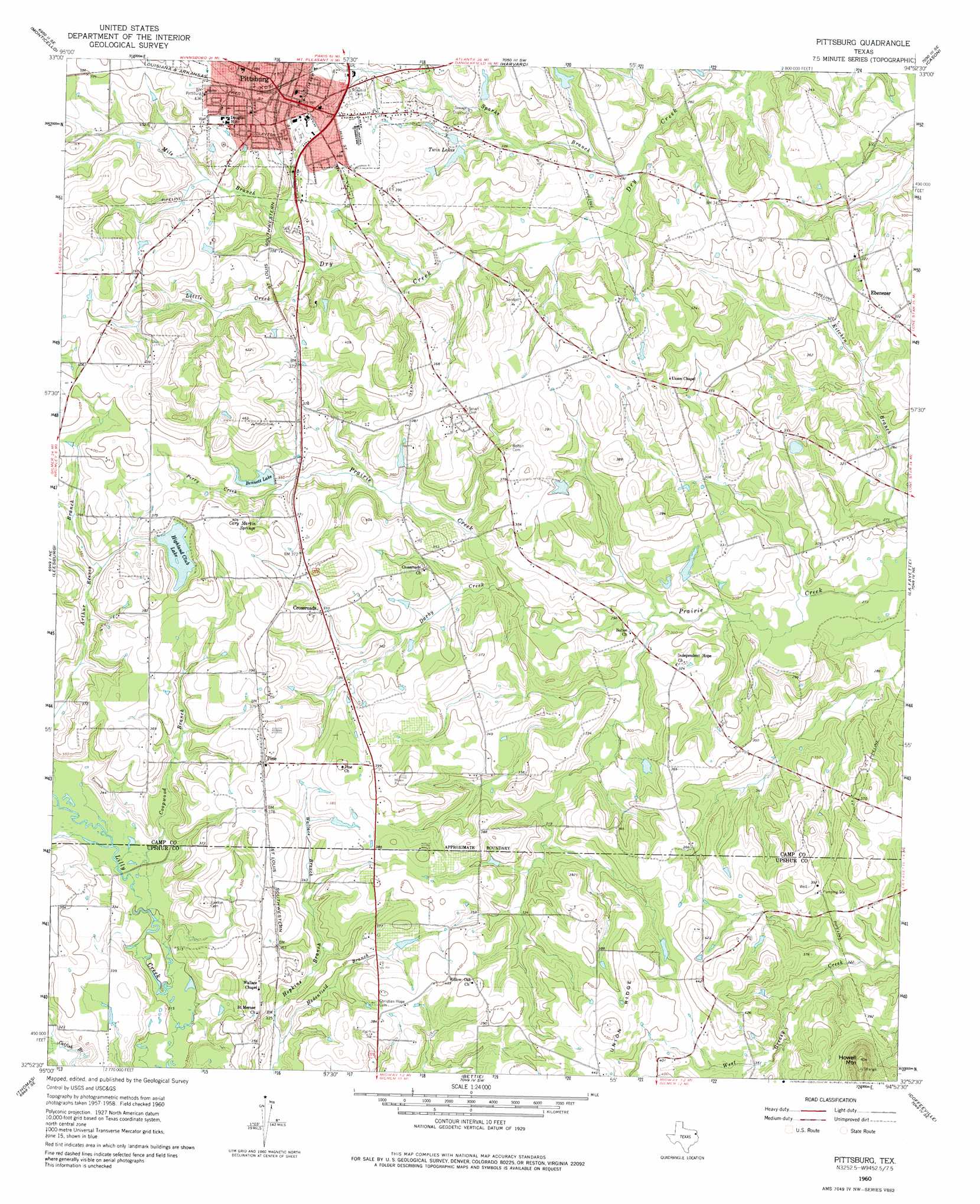
USGS Topo Quad 32094h8 - 1:24,000 scale
| Topo Map Name: | Pittsburg |
| USGS Topo Quad ID: | 32094h8 |
| Print Size: | ca. 21 1/4" wide x 27" high |
| Southeast Coordinates: | 32.875° N latitude / 94.875° W longitude |
| Map Center Coordinates: | 32.9375° N latitude / 94.9375° W longitude |
| U.S. State: | TX |
| Filename: | o32094h8.jpg |
| Download Map JPG Image: | Pittsburg topo map 1:24,000 scale |
| Map Type: | Topographic |
| Topo Series: | 7.5´ |
| Map Scale: | 1:24,000 |
| Source of Map Images: | United States Geological Survey (USGS) |
| Alternate Map Versions: |
Pittsburg TX 1960, updated 1962 Download PDF Buy paper map Pittsburg TX 1960, updated 1975 Download PDF Buy paper map Pittsburg TX 2010 Download PDF Buy paper map Pittsburg TX 2013 Download PDF Buy paper map Pittsburg TX 2016 Download PDF Buy paper map |
1:24,000 Topo Quads surrounding Pittsburg
Mount Vernon |
Winfield |
Mount Pleasant |
Cookville |
Naples |
New Hope |
Monticello |
Harvard |
Cason |
Daingerfield |
Newsome |
Leesburg |
Pittsburg |
Lafayette |
Lone Star |
Rhonesboro |
Thomas |
Bettie |
Coffeeville |
Ore City |
Shady Grove |
Pritchett |
Gilmer |
Glenwood |
Ashland |
> Back to 32094e1 at 1:100,000 scale
> Back to 32094a1 at 1:250,000 scale
> Back to U.S. Topo Maps home
Pittsburg topo map: Gazetteer
Pittsburg: Dams
Bennett Dam elevation 110m 360′Highland Club Dam elevation 115m 377′
Pittsburg: Populated Places
Crossroads elevation 113m 370′Ebenezer elevation 104m 341′
Pine elevation 121m 396′
Pittsburg elevation 120m 393′
Pittsburg: Reservoirs
Bennett Lake elevation 110m 360′Highland Club Lake elevation 112m 367′
Twin Lakes elevation 101m 331′
Pittsburg: Springs
Cary Martin Springs elevation 115m 377′Pittsburg: Streams
Darby Creek elevation 91m 298′Darby Creek elevation 91m 298′
Hadenfield Branch elevation 97m 318′
Little Creek elevation 97m 318′
Mile Branch elevation 103m 337′
Perry Creek elevation 103m 337′
Sparks Branch elevation 88m 288′
Wallace Branch elevation 101m 331′
Pittsburg: Summits
Howell Mountain elevation 185m 606′Pittsburg digital topo map on disk
Buy this Pittsburg topo map showing relief, roads, GPS coordinates and other geographical features, as a high-resolution digital map file on DVD: