Troup East Topo Map Texas
To zoom in, hover over the map of Troup East
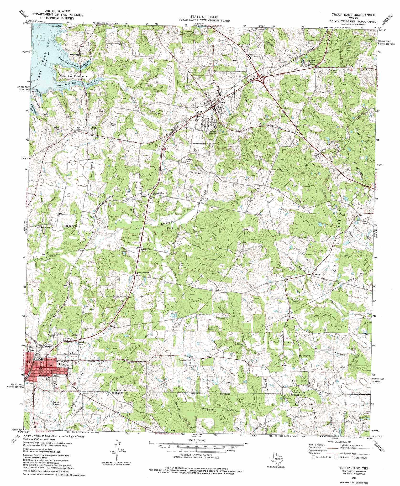
USGS Topo Quad 32095b1 - 1:24,000 scale
| Topo Map Name: | Troup East |
| USGS Topo Quad ID: | 32095b1 |
| Print Size: | ca. 21 1/4" wide x 27" high |
| Southeast Coordinates: | 32.125° N latitude / 95° W longitude |
| Map Center Coordinates: | 32.1875° N latitude / 95.0625° W longitude |
| U.S. State: | TX |
| Filename: | o32095b1.jpg |
| Download Map JPG Image: | Troup East topo map 1:24,000 scale |
| Map Type: | Topographic |
| Topo Series: | 7.5´ |
| Map Scale: | 1:24,000 |
| Source of Map Images: | United States Geological Survey (USGS) |
| Alternate Map Versions: |
Troup East TX 1973, updated 1976 Download PDF Buy paper map Troup East TX 2010 Download PDF Buy paper map Troup East TX 2012 Download PDF Buy paper map Troup East TX 2016 Download PDF Buy paper map |
1:24,000 Topo Quads surrounding Troup East
Tyler North |
Winona |
Starrville |
Kilgore Nw |
Kilgore Ne |
Tyler South |
Bascom |
Hope Pond |
Kilgore Sw |
Kilgore Se |
Bullard |
Troup West |
Troup East |
Price |
Henderson |
Mount Selman |
Tecula |
Griffin |
Gum Springs |
Berryhill Creek |
Jacksonville West |
Jacksonville East |
New Summerfield |
New Salem |
Laneville |
> Back to 32095a1 at 1:100,000 scale
> Back to 32094a1 at 1:250,000 scale
> Back to U.S. Topo Maps home
Troup East topo map: Gazetteer
Troup East: Bays
North Bridge Cove elevation 115m 377′Omen Road Bay elevation 115m 377′
Shark Bay elevation 115m 377′
South Bridge Cove elevation 115m 377′
Swan Bay elevation 115m 377′
Swinney Road Bay elevation 115m 377′
Troup East: Capes
Grand View Point elevation 121m 396′Twin Bay Peninsula elevation 126m 413′
Troup East: Oilfields
Good Omen Oil Field elevation 113m 370′Troup East: Populated Places
Arp elevation 151m 495′Omen elevation 146m 479′
Salem elevation 122m 400′
Sinclair City elevation 132m 433′
Troup elevation 139m 456′
Troup East digital topo map on disk
Buy this Troup East topo map showing relief, roads, GPS coordinates and other geographical features, as a high-resolution digital map file on DVD: