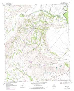
Bristol Topo Map Texas
To zoom in, hover over the map of Bristol
USGS Topo Quad 32096d5 - 1:24,000 scale
| Topo Map Name: | Bristol |
| USGS Topo Quad ID: | 32096d5 |
| Print Size: | ca. 21 1/4" wide x 27" high |
| Southeast Coordinates: | 32.375° N latitude / 96.5° W longitude |
| Map Center Coordinates: | 32.4375° N latitude / 96.5625° W longitude |
| U.S. State: | TX |
| Filename: | o32096d5.jpg |
| Download Map JPG Image: | Bristol topo map 1:24,000 scale |
| Map Type: | Topographic |
| Topo Series: | 7.5´ |
| Map Scale: | 1:24,000 |
| Source of Map Images: | United States Geological Survey (USGS) |
| Alternate Map Versions: |
Bristol TX 1962, updated 1966 Download PDF Buy paper map Bristol TX 1962, updated 1979 Download PDF Buy paper map Bristol TX 1962, updated 1979 Download PDF Buy paper map Bristol TX 2010 Download PDF Buy paper map Bristol TX 2012 Download PDF Buy paper map Bristol TX 2016 Download PDF Buy paper map |
1:24,000 Topo Quads surrounding Bristol
> Back to 32096a1 at 1:100,000 scale
> Back to 32096a1 at 1:250,000 scale
> Back to U.S. Topo Maps home
Bristol topo map: Gazetteer
Bristol: Airports
Eisenbeck Ranch Airport elevation 107m 351′Bristol: Dams
Cherry Lake Dam elevation 141m 462′Hefner Lake Number 1 Dam elevation 130m 426′
Hefner Lake Number 2 Dam elevation 127m 416′
Johnson Lake Dam elevation 146m 479′
Soil Conservation Service Site 2 Dam elevation 127m 416′
Soil Conservation Service Site 3 Dam elevation 119m 390′
Soil Conservation Service Site 4 Dam elevation 124m 406′
Soil Conservation Service Site 5 Dam elevation 117m 383′
Soil Conservation Service Site 6 Dam elevation 114m 374′
Soil Conservation Service Site 7 Dam elevation 115m 377′
Soil Conservation Service Site 8 Dam elevation 114m 374′
Soil Conservation Service Site 8a Dam elevation 109m 357′
Bristol: Populated Places
Alsdorf elevation 122m 400′Bristol elevation 154m 505′
Crisp elevation 144m 472′
Bristol: Reservoirs
Cherry Lake elevation 141m 462′Hefner Lake Number 1 elevation 130m 426′
Hefner Lake Number 2 elevation 127m 416′
Johnson Lake elevation 146m 479′
Soil Conservation Service Site 2 Reservoir elevation 127m 416′
Soil Conservation Service Site 3 Reservoir elevation 119m 390′
Soil Conservation Service Site 4 Reservoir elevation 124m 406′
Soil Conservation Service Site 5 Reservoir elevation 117m 383′
Soil Conservation Service Site 6 Reservoir elevation 114m 374′
Soil Conservation Service Site 7 Reservoir elevation 115m 377′
Soil Conservation Service Site 8 Reservoir elevation 114m 374′
Soil Conservation Service Site 8a Reservoir elevation 109m 357′
Bristol: Streams
Bear Creek elevation 104m 341′Bolivar Branch elevation 116m 380′
East Fork Trinity River elevation 98m 321′
Grove Creek elevation 107m 351′
Hare Prong elevation 104m 341′
Old Tenmile Creek elevation 101m 331′
Persimmon Branch elevation 102m 334′
Red Oak Creek elevation 96m 314′
Bristol digital topo map on disk
Buy this Bristol topo map showing relief, roads, GPS coordinates and other geographical features, as a high-resolution digital map file on DVD:


