Waxahachie Topo Map Texas
To zoom in, hover over the map of Waxahachie
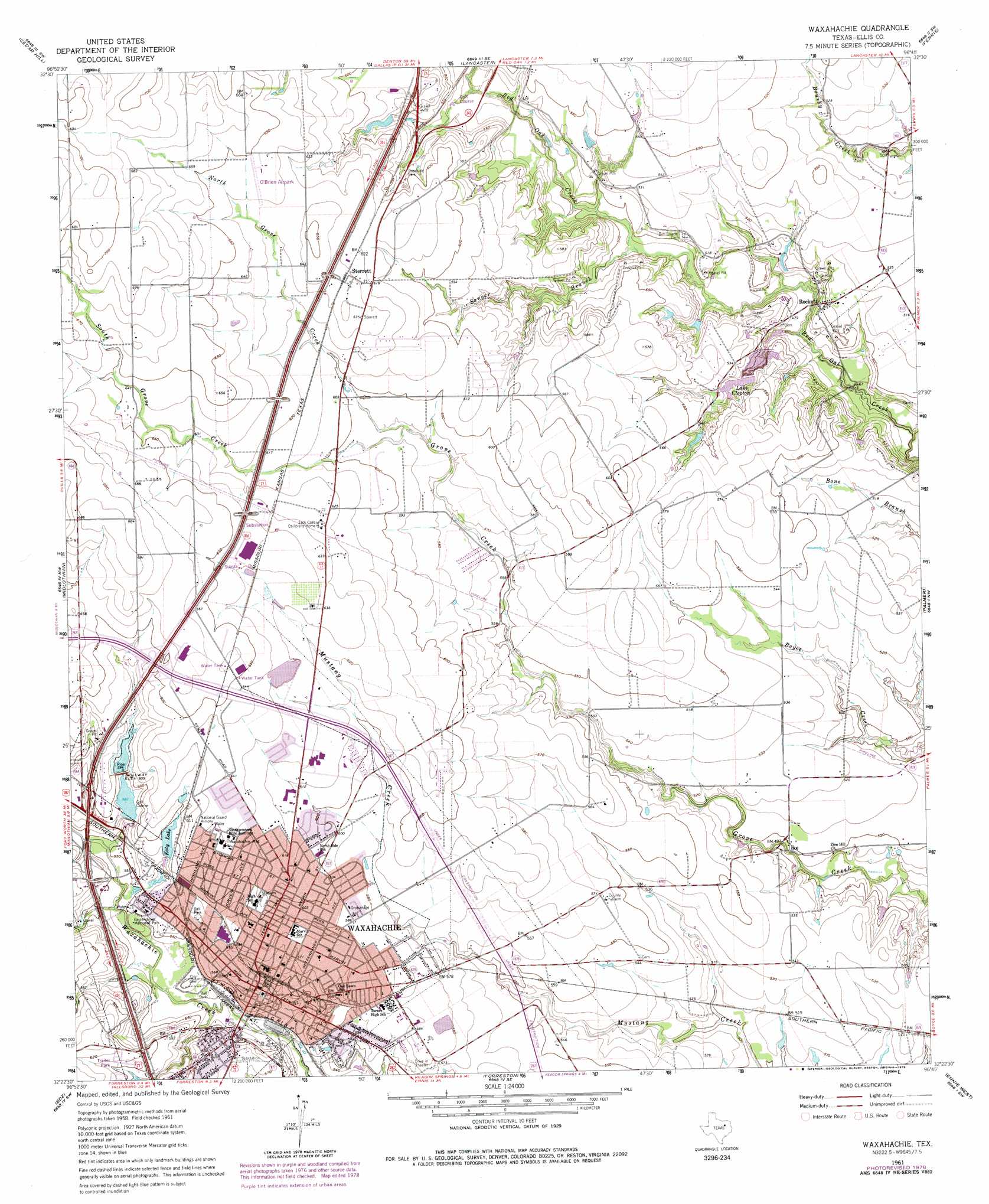
USGS Topo Quad 32096d7 - 1:24,000 scale
| Topo Map Name: | Waxahachie |
| USGS Topo Quad ID: | 32096d7 |
| Print Size: | ca. 21 1/4" wide x 27" high |
| Southeast Coordinates: | 32.375° N latitude / 96.75° W longitude |
| Map Center Coordinates: | 32.4375° N latitude / 96.8125° W longitude |
| U.S. State: | TX |
| Filename: | o32096d7.jpg |
| Download Map JPG Image: | Waxahachie topo map 1:24,000 scale |
| Map Type: | Topographic |
| Topo Series: | 7.5´ |
| Map Scale: | 1:24,000 |
| Source of Map Images: | United States Geological Survey (USGS) |
| Alternate Map Versions: |
Waxahachie TX 1961, updated 1963 Download PDF Buy paper map Waxahachie TX 1961, updated 1973 Download PDF Buy paper map Waxahachie TX 1961, updated 1979 Download PDF Buy paper map Waxahachie TX 2010 Download PDF Buy paper map Waxahachie TX 2012 Download PDF Buy paper map Waxahachie TX 2016 Download PDF Buy paper map |
1:24,000 Topo Quads surrounding Waxahachie
Arlington |
Duncanville |
Oak Cliff |
Hutchins |
Seagoville |
Britton |
Cedar Hill |
Lancaster |
Ferris |
India |
Venus |
Midlothian |
Waxahachie |
Palmer |
Bristol |
Maypearl |
Boz |
Forreston |
Ennis West |
Ennis East |
Files Valley |
Italy |
Avalon |
Cryer Creek |
Emhouse |
> Back to 32096a1 at 1:100,000 scale
> Back to 32096a1 at 1:250,000 scale
> Back to U.S. Topo Maps home
Waxahachie topo map: Gazetteer
Waxahachie: Airports
Hurn Airport elevation 168m 551′O'Brien Airpark elevation 196m 643′
Waxahachie: Dams
Katy Lake Dam elevation 177m 580′Lake Clopton Dam elevation 158m 518′
Soil Conservation Service Site 14 Dam elevation 185m 606′
Waxahachie Country Club Dam elevation 182m 597′
Waxahachie: Parks
Billy Goodloe Stadium elevation 170m 557′Chapman Park elevation 185m 606′
Getzendaner Memorial Park elevation 166m 544′
Lumpkin Stadium elevation 185m 606′
Richards Park elevation 162m 531′
Sheaffer Full Life Center - Southwest Assemblies of God University elevation 192m 629′
Southwest Assemblies of God University Baseball Fields elevation 192m 629′
Southwest Assemblies of God University Football Field elevation 193m 633′
Waxahachie: Populated Places
Ike elevation 153m 501′Pecan Hill elevation 165m 541′
Rockett elevation 150m 492′
Sterrett elevation 191m 626′
Waxahachie elevation 170m 557′
Waxahachie: Reservoirs
Katy Lake elevation 181m 593′Lake Clopton elevation 157m 515′
Soil Conservation Service Site 14 Reservoir elevation 185m 606′
Waxahachie: Streams
North Grove Creek elevation 179m 587′Sanger Branch elevation 148m 485′
South Grove Creek elevation 179m 587′
Waxahachie digital topo map on disk
Buy this Waxahachie topo map showing relief, roads, GPS coordinates and other geographical features, as a high-resolution digital map file on DVD: