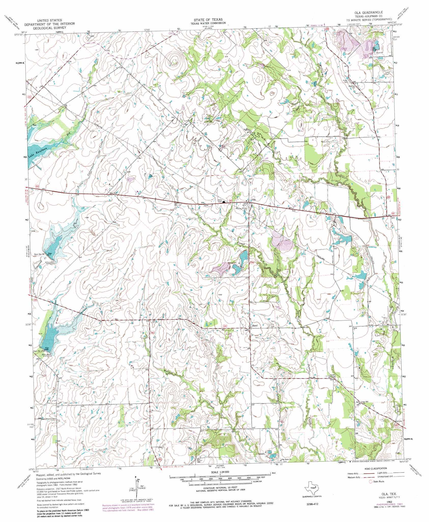
Ola Topo Map Texas
To zoom in, hover over the map of Ola
USGS Topo Quad 32096e2 - 1:24,000 scale
| Topo Map Name: | Ola |
| USGS Topo Quad ID: | 32096e2 |
| Print Size: | ca. 21 1/4" wide x 27" high |
| Southeast Coordinates: | 32.5° N latitude / 96.125° W longitude |
| Map Center Coordinates: | 32.5625° N latitude / 96.1875° W longitude |
| U.S. State: | TX |
| Filename: | o32096e2.jpg |
| Download Map JPG Image: | Ola topo map 1:24,000 scale |
| Map Type: | Topographic |
| Topo Series: | 7.5´ |
| Map Scale: | 1:24,000 |
| Source of Map Images: | United States Geological Survey (USGS) |
| Alternate Map Versions: |
Ola TX 1962, updated 1965 Download PDF Buy paper map Ola TX 1962, updated 1982 Download PDF Buy paper map Ola TX 2010 Download PDF Buy paper map Ola TX 2012 Download PDF Buy paper map Ola TX 2016 Download PDF Buy paper map |
1:24,000 Topo Quads surrounding Ola
Forney North |
Terrell North |
Poetry |
Ables Springs |
Iron Bridge Dam |
Forney South |
Terrell South |
Elmo |
Wills Point |
Edgewood |
Scurry |
Kaufman |
Ola |
Cedarvale |
Myrtle Springs |
Rosser |
Grays Prairie |
Kemp |
Prairieville |
Phalba |
Rosser Sw |
Styx |
Tool |
Mabank |
Stockard |
> Back to 32096e1 at 1:100,000 scale
> Back to 32096a1 at 1:250,000 scale
> Back to U.S. Topo Maps home
Ola topo map: Gazetteer
Ola: Airports
Hall Airport elevation 134m 439′Ola: Dams
Circle K Dam Number 1 elevation 131m 429′Circle K Dam Number 2 elevation 129m 423′
Dam Number 76 elevation 128m 419′
Dam Number 77 elevation 124m 406′
Soil Conservation Service Site 76 Dam elevation 127m 416′
Soil Conservation Service Site 77a Dam elevation 121m 396′
West Lake Dam elevation 132m 433′
Ola: Oilfields
Fair Oil Field elevation 120m 393′Ola: Populated Places
Ola elevation 146m 479′Rand elevation 140m 459′
Ola: Reservoirs
Circle K Lake Number 1 elevation 131m 429′Circle K Lake Number 2 elevation 129m 423′
Soil Conservation Service Site 76 Reservoir elevation 127m 416′
Soil Conservation Service Site 77a Reservoir elevation 121m 396′
West Lake elevation 132m 433′
Ola digital topo map on disk
Buy this Ola topo map showing relief, roads, GPS coordinates and other geographical features, as a high-resolution digital map file on DVD: