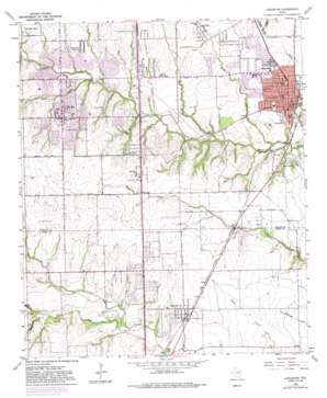
Lancaster Topo Map Texas
To zoom in, hover over the map of Lancaster
USGS Topo Quad 32096e7 - 1:24,000 scale
| Topo Map Name: | Lancaster |
| USGS Topo Quad ID: | 32096e7 |
| Print Size: | ca. 21 1/4" wide x 27" high |
| Southeast Coordinates: | 32.5° N latitude / 96.75° W longitude |
| Map Center Coordinates: | 32.5625° N latitude / 96.8125° W longitude |
| U.S. State: | TX |
| Filename: | o32096e7.jpg |
| Download Map JPG Image: | Lancaster topo map 1:24,000 scale |
| Map Type: | Topographic |
| Topo Series: | 7.5´ |
| Map Scale: | 1:24,000 |
| Source of Map Images: | United States Geological Survey (USGS) |
| Alternate Map Versions: |
Lancaster TX 1959, updated 1960 Download PDF Buy paper map Lancaster TX 1959, updated 1969 Download PDF Buy paper map Lancaster TX 1959, updated 1974 Download PDF Buy paper map Lancaster TX 1959, updated 1982 Download PDF Buy paper map Lancaster TX 1959, updated 1987 Download PDF Buy paper map Lancaster TX 2010 Download PDF Buy paper map Lancaster TX 2012 Download PDF Buy paper map Lancaster TX 2016 Download PDF Buy paper map |
1:24,000 Topo Quads surrounding Lancaster
> Back to 32096e1 at 1:100,000 scale
> Back to 32096a1 at 1:250,000 scale
> Back to U.S. Topo Maps home
Lancaster topo map: Gazetteer
Lancaster: Airports
Carroll Air Park elevation 213m 698′Lancaster: Crossings
Interchange 412 elevation 187m 613′Interchange 413 elevation 187m 613′
Interchange 414 elevation 183m 600′
Interchange 415 elevation 178m 583′
Lancaster: Parks
Eagle Stadium elevation 219m 718′Grimes Park elevation 188m 616′
Lion Club Park elevation 149m 488′
Mosley Park elevation 179m 587′
Tiger Field elevation 160m 524′
Zeigler Park elevation 202m 662′
Lancaster: Populated Places
DeSoto elevation 203m 666′Elva elevation 186m 610′
Glenn Heights elevation 206m 675′
Lancaster elevation 159m 521′
Oak Leaf elevation 184m 603′
Red Oak elevation 185m 606′
Lancaster: Post Offices
Desoto Post Office elevation 206m 675′Red Oak Post Office elevation 190m 623′
Lancaster: Streams
Deep Branch elevation 137m 449′Halls Branch elevation 142m 465′
Heath Creek elevation 166m 544′
Little Creek elevation 164m 538′
Mill Branch elevation 144m 472′
Spring Creek elevation 159m 521′
Willow Brook elevation 173m 567′
Lancaster digital topo map on disk
Buy this Lancaster topo map showing relief, roads, GPS coordinates and other geographical features, as a high-resolution digital map file on DVD:


