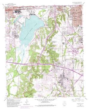
Duncanville Topo Map Texas
To zoom in, hover over the map of Duncanville
USGS Topo Quad 32096f8 - 1:24,000 scale
| Topo Map Name: | Duncanville |
| USGS Topo Quad ID: | 32096f8 |
| Print Size: | ca. 21 1/4" wide x 27" high |
| Southeast Coordinates: | 32.625° N latitude / 96.875° W longitude |
| Map Center Coordinates: | 32.6875° N latitude / 96.9375° W longitude |
| U.S. State: | TX |
| Filename: | o32096f8.jpg |
| Download Map JPG Image: | Duncanville topo map 1:24,000 scale |
| Map Type: | Topographic |
| Topo Series: | 7.5´ |
| Map Scale: | 1:24,000 |
| Source of Map Images: | United States Geological Survey (USGS) |
| Alternate Map Versions: |
Duncanville TX 1959, updated 1961 Download PDF Buy paper map Duncanville TX 1959, updated 1966 Download PDF Buy paper map Duncanville TX 1959, updated 1970 Download PDF Buy paper map Duncanville TX 1959, updated 1974 Download PDF Buy paper map Duncanville TX 1959, updated 1982 Download PDF Buy paper map Duncanville TX 1959, updated 1982 Download PDF Buy paper map Duncanville TX 1995, updated 2001 Download PDF Buy paper map Duncanville TX 2010 Download PDF Buy paper map Duncanville TX 2012 Download PDF Buy paper map Duncanville TX 2016 Download PDF Buy paper map |
1:24,000 Topo Quads surrounding Duncanville
> Back to 32096e1 at 1:100,000 scale
> Back to 32096a1 at 1:250,000 scale
> Back to U.S. Topo Maps home
Duncanville topo map: Gazetteer
Duncanville: Airports
Charlton Methodist Hospital Heliport elevation 198m 649′Charlton-Careflite Heliport elevation 213m 698′
Duncanville: Crossings
Interchange 457 elevation 145m 475′Interchange 458 elevation 145m 475′
Interchange 460 elevation 214m 702′
Interchange 461 elevation 224m 734′
Interchange 462A elevation 229m 751′
Interchange 462B elevation 223m 731′
Interchange 463 elevation 216m 708′
Interchange 464A and 464B elevation 211m 692′
Duncanville: Dams
Mountain Creek Dam elevation 139m 456′Duncanville: Parks
Alexander Park elevation 213m 698′Arcadia Heights Park elevation 162m 531′
Arcadia Park elevation 143m 469′
Armstrong Park elevation 219m 718′
Beverly Hills Park elevation 180m 590′
Colgate Park elevation 139m 456′
Crockett Park elevation 154m 505′
Duncanville Independent School District High School Baseball Field elevation 230m 754′
Escarpment Nature Preserve elevation 185m 606′
Hendrix Park elevation 152m 498′
Kennedy Middle School Football Stadium elevation 156m 511′
Lakeside City Park elevation 217m 711′
Limestone Park elevation 207m 679′
Marcus Harrington Park elevation 189m 620′
Martin Weiss Park elevation 183m 600′
Mountain Creek Lake Park elevation 140m 459′
Mountain Valley Park elevation 134m 439′
Mountain View Park elevation 207m 679′
Oriole Park elevation 213m 698′
Panther Stadium - Duncanville Independent School District High School elevation 230m 754′
Pecan Grove Park elevation 171m 561′
Penn Springs Historical Park elevation 203m 666′
Quail Run Park elevation 220m 721′
Rotary Park elevation 215m 705′
Sam Houston Athletic Field elevation 138m 452′
South Side City Park elevation 199m 652′
Sprague Stadium elevation 191m 626′
Sugarberry Park elevation 216m 708′
Sycamore Park elevation 153m 501′
Valley Park elevation 157m 515′
War Memorial Park elevation 222m 728′
Westhaven Park elevation 182m 597′
Westmoreland Park elevation 195m 639′
Duncanville: Populated Places
Arcadia Park elevation 160m 524′Cockrell Hill elevation 195m 639′
Cole elevation 213m 698′
Duncanville elevation 221m 725′
Grand Prairie elevation 157m 515′
Kenwood elevation 196m 643′
Lakeland Heights elevation 153m 501′
Lakeview elevation 153m 501′
Ledbetter Hills elevation 206m 675′
Red Bird Addition elevation 228m 748′
River Oaks elevation 207m 679′
Westwood Park elevation 194m 636′
Woodland Hills elevation 196m 643′
Duncanville: Post Offices
Duncanville Post Office elevation 216m 708′Duncanville: Reservoirs
Joe Pool Lake elevation 141m 462′Mountain Creek Lake elevation 133m 436′
Duncanville: Streams
Artesian Creek elevation 140m 459′Bentle Branch elevation 186m 610′
Cottonwood Creek elevation 139m 456′
Fish Creek elevation 139m 456′
Hornet Branch elevation 187m 613′
John Penn Branch elevation 155m 508′
Kirby Creek elevation 140m 459′
O'Guinn Creek elevation 140m 459′
Walnut Creek elevation 155m 508′
Duncanville: Summits
Chalk Hill elevation 202m 662′Duncanville: Trails
Mountain Creek Lake Park Trail elevation 140m 459′Duncanville: Woods
Whispering Cedars elevation 199m 652′Duncanville digital topo map on disk
Buy this Duncanville topo map showing relief, roads, GPS coordinates and other geographical features, as a high-resolution digital map file on DVD:


