Itasca Topo Map Texas
To zoom in, hover over the map of Itasca
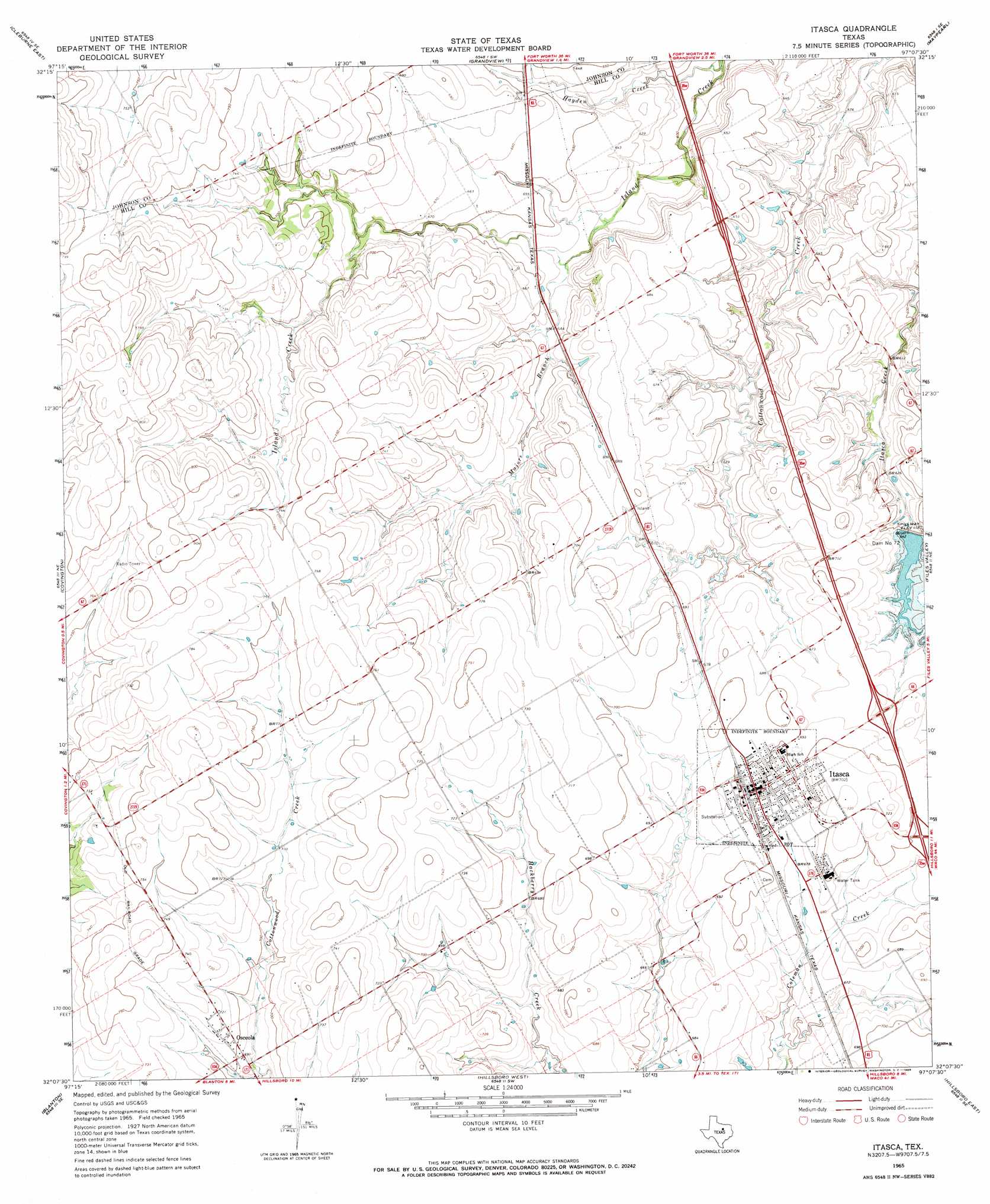
USGS Topo Quad 32097b2 - 1:24,000 scale
| Topo Map Name: | Itasca |
| USGS Topo Quad ID: | 32097b2 |
| Print Size: | ca. 21 1/4" wide x 27" high |
| Southeast Coordinates: | 32.125° N latitude / 97.125° W longitude |
| Map Center Coordinates: | 32.1875° N latitude / 97.1875° W longitude |
| U.S. State: | TX |
| Filename: | o32097b2.jpg |
| Download Map JPG Image: | Itasca topo map 1:24,000 scale |
| Map Type: | Topographic |
| Topo Series: | 7.5´ |
| Map Scale: | 1:24,000 |
| Source of Map Images: | United States Geological Survey (USGS) |
| Alternate Map Versions: |
Itasca TX 1965, updated 1968 Download PDF Buy paper map Itasca TX 2010 Download PDF Buy paper map Itasca TX 2012 Download PDF Buy paper map Itasca TX 2016 Download PDF Buy paper map |
1:24,000 Topo Quads surrounding Itasca
Joshua |
Keene |
Alvarado |
Venus |
Midlothian |
Cleburne West |
Cleburne East |
Grandview |
Maypearl |
Boz |
Blum |
Covington |
Itasca |
Files Valley |
Italy |
Lakeside Village |
Blanton |
Hillsboro West |
Hillsboro East |
Mertens |
Allen Bend |
Whitney |
Peoria |
Abbott |
Malone |
> Back to 32097a1 at 1:100,000 scale
> Back to 32096a1 at 1:250,000 scale
> Back to U.S. Topo Maps home
Itasca topo map: Gazetteer
Itasca: Dams
Dam Number 72 elevation 196m 643′Soil Conservation Service Grade Stabilization Structure 11-2 elevation 215m 705′
Soil Conservation Service Grade Stabilization Structure 14-1 elevation 213m 698′
Soil Conservation Service Grade Stabilization Structure 14-2 elevation 210m 688′
Soil Conservation Service Site 65a Dam elevation 202m 662′
Soil Conservation Service Site 67a Dam elevation 207m 679′
Soil Conservation Service Site 67b Dam elevation 201m 659′
Soil Conservation Service Site 68 Dam elevation 199m 652′
Soil Conservation Service Site 72 Dam elevation 192m 629′
Itasca: Populated Places
Itasca elevation 214m 702′Osceola elevation 216m 708′
Itasca: Reservoirs
Grade Stabilization Structure 11 Reservoir elevation 215m 705′Grade Stabilization Structure 14-1 Reservoir elevation 213m 698′
Grade Stabilization Structure 14-2 Reservoir elevation 210m 688′
Soil Conservation Service Site 65a Reservoir elevation 202m 662′
Soil Conservation Service Site 67a Reservoir elevation 207m 679′
Soil Conservation Service Site 67b Reservoir elevation 201m 659′
Soil Conservation Service Site 68 Reservoir elevation 199m 652′
Soil Conservation Service Site 72 Reservoir elevation 192m 629′
Itasca: Streams
Hayden Creek elevation 175m 574′Majors Branch elevation 190m 623′
Itasca digital topo map on disk
Buy this Itasca topo map showing relief, roads, GPS coordinates and other geographical features, as a high-resolution digital map file on DVD: