Primrose Topo Map Texas
To zoom in, hover over the map of Primrose
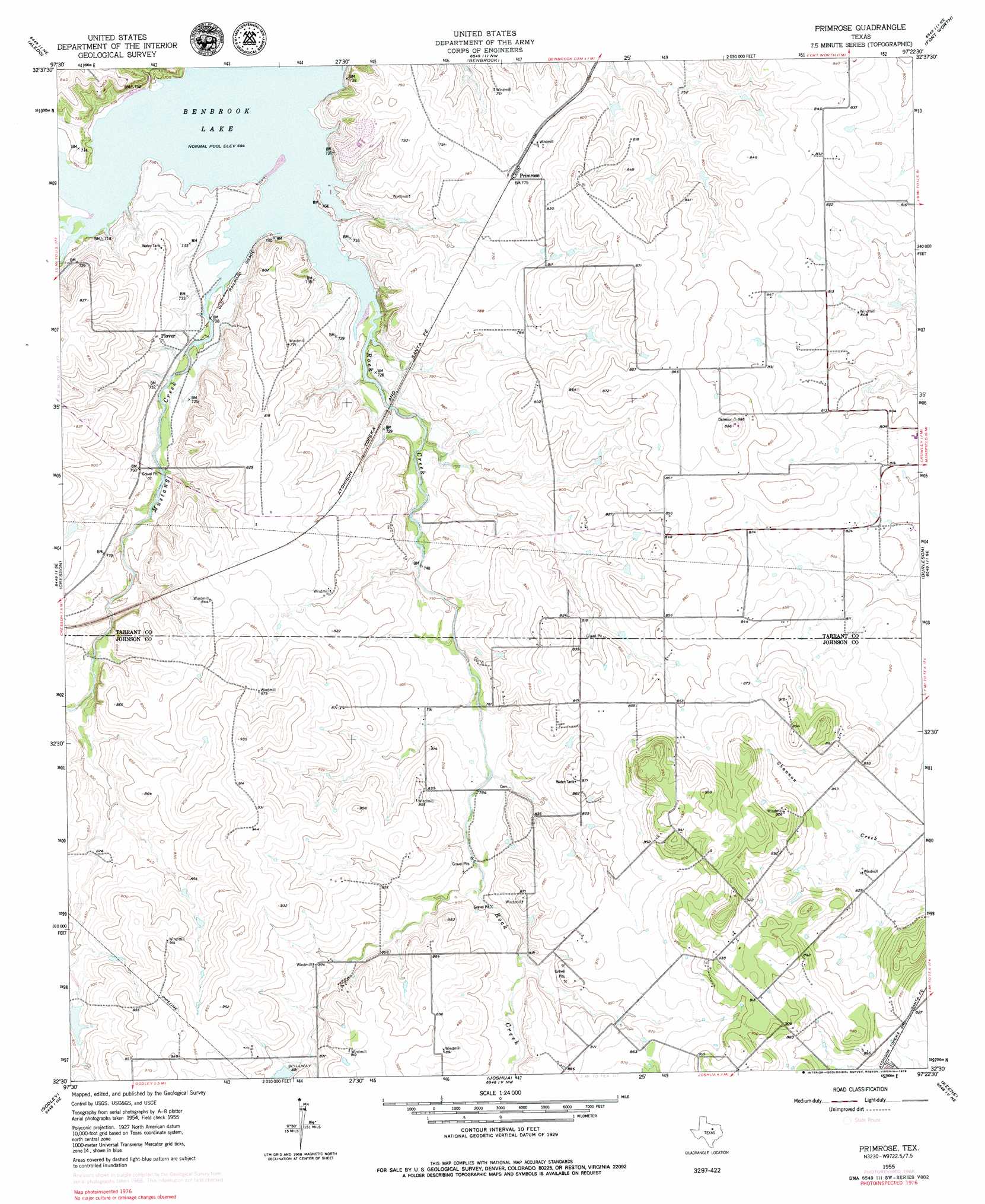
USGS Topo Quad 32097e4 - 1:24,000 scale
| Topo Map Name: | Primrose |
| USGS Topo Quad ID: | 32097e4 |
| Print Size: | ca. 21 1/4" wide x 27" high |
| Southeast Coordinates: | 32.5° N latitude / 97.375° W longitude |
| Map Center Coordinates: | 32.5625° N latitude / 97.4375° W longitude |
| U.S. State: | TX |
| Filename: | o32097e4.jpg |
| Download Map JPG Image: | Primrose topo map 1:24,000 scale |
| Map Type: | Topographic |
| Topo Series: | 7.5´ |
| Map Scale: | 1:24,000 |
| Source of Map Images: | United States Geological Survey (USGS) |
| Alternate Map Versions: |
Primrose TX 1955, updated 1956 Download PDF Buy paper map Primrose TX 1955, updated 1969 Download PDF Buy paper map Primrose TX 2010 Download PDF Buy paper map Primrose TX 2012 Download PDF Buy paper map Primrose TX 2016 Download PDF Buy paper map |
1:24,000 Topo Quads surrounding Primrose
Lake Weatherford |
Springtown Se |
Lake Worth |
Haltom City |
Hurst |
Anneta |
Aledo |
Benbrook |
Fort Worth |
Kennedale |
Chapin |
Cresson |
Primrose |
Burleson |
Mansfield |
Acton |
Godley |
Joshua |
Keene |
Alvarado |
Nemo |
Bono |
Cleburne West |
Cleburne East |
Grandview |
> Back to 32097e1 at 1:100,000 scale
> Back to 32096a1 at 1:250,000 scale
> Back to U.S. Topo Maps home
Primrose topo map: Gazetteer
Primrose: Airports
Plover Heliport elevation 245m 803′Primrose: Parks
Eagle Stadium elevation 248m 813′Mustang Park elevation 225m 738′
Panther Stadium elevation 257m 843′
Rocky Creek Park elevation 219m 718′
Primrose: Populated Places
Plover elevation 226m 741′Primrose elevation 236m 774′
Saint Francis Village elevation 237m 777′
Primrose: Streams
Bear Creek elevation 212m 695′Mustang Creek elevation 212m 695′
Rock Creek elevation 212m 695′
Primrose digital topo map on disk
Buy this Primrose topo map showing relief, roads, GPS coordinates and other geographical features, as a high-resolution digital map file on DVD: