Chapin Topo Map Texas
To zoom in, hover over the map of Chapin
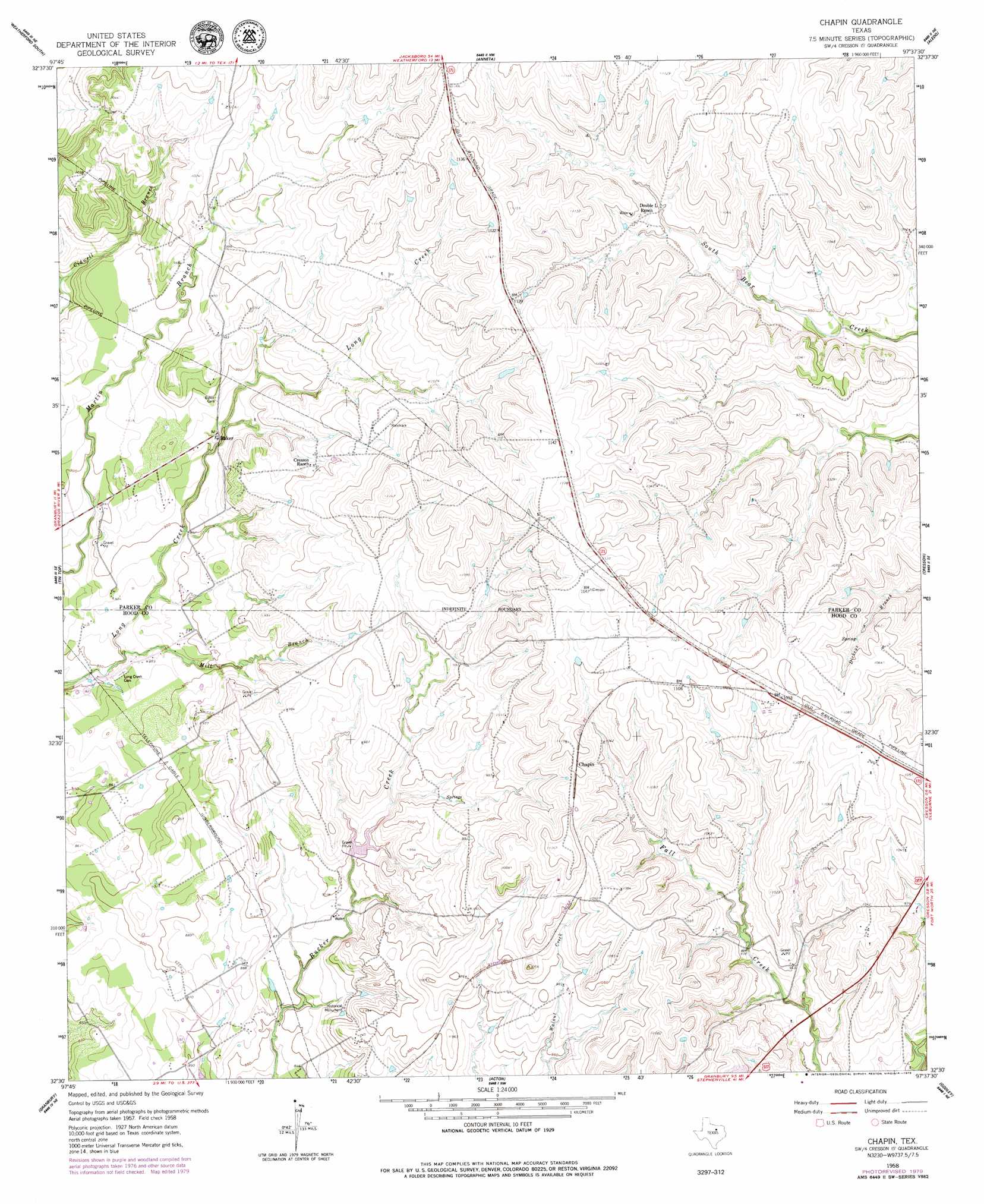
USGS Topo Quad 32097e6 - 1:24,000 scale
| Topo Map Name: | Chapin |
| USGS Topo Quad ID: | 32097e6 |
| Print Size: | ca. 21 1/4" wide x 27" high |
| Southeast Coordinates: | 32.5° N latitude / 97.625° W longitude |
| Map Center Coordinates: | 32.5625° N latitude / 97.6875° W longitude |
| U.S. State: | TX |
| Filename: | o32097e6.jpg |
| Download Map JPG Image: | Chapin topo map 1:24,000 scale |
| Map Type: | Topographic |
| Topo Series: | 7.5´ |
| Map Scale: | 1:24,000 |
| Source of Map Images: | United States Geological Survey (USGS) |
| Alternate Map Versions: |
Chapin TX 1958, updated 1960 Download PDF Buy paper map Chapin TX 1958, updated 1960 Download PDF Buy paper map Chapin TX 1958, updated 1979 Download PDF Buy paper map Chapin TX 2010 Download PDF Buy paper map Chapin TX 2013 Download PDF Buy paper map Chapin TX 2016 Download PDF Buy paper map |
1:24,000 Topo Quads surrounding Chapin
Garner |
Weatherford North |
Lake Weatherford |
Springtown Se |
Lake Worth |
Brock |
Weatherford South |
Anneta |
Aledo |
Benbrook |
Dennis |
Tin Top |
Chapin |
Cresson |
Primrose |
Tolar |
Granbury |
Acton |
Godley |
Joshua |
Paluxy |
Hill City |
Nemo |
Bono |
Cleburne West |
> Back to 32097e1 at 1:100,000 scale
> Back to 32096a1 at 1:250,000 scale
> Back to U.S. Topo Maps home
Chapin topo map: Gazetteer
Chapin: Dams
Smelley Lake Dam elevation 294m 964′Soil Conservation Service Site 1 Dam elevation 268m 879′
Chapin: Populated Places
Baker elevation 281m 921′Chapin elevation 336m 1102′
Chapin: Reservoirs
Smelley Lake elevation 294m 964′Soil Conservation Service Site 1 Reservoir elevation 268m 879′
Chapin: Springs
Parkinson Springs elevation 265m 869′Chapin: Streams
Mill Branch elevation 258m 846′Chapin digital topo map on disk
Buy this Chapin topo map showing relief, roads, GPS coordinates and other geographical features, as a high-resolution digital map file on DVD: