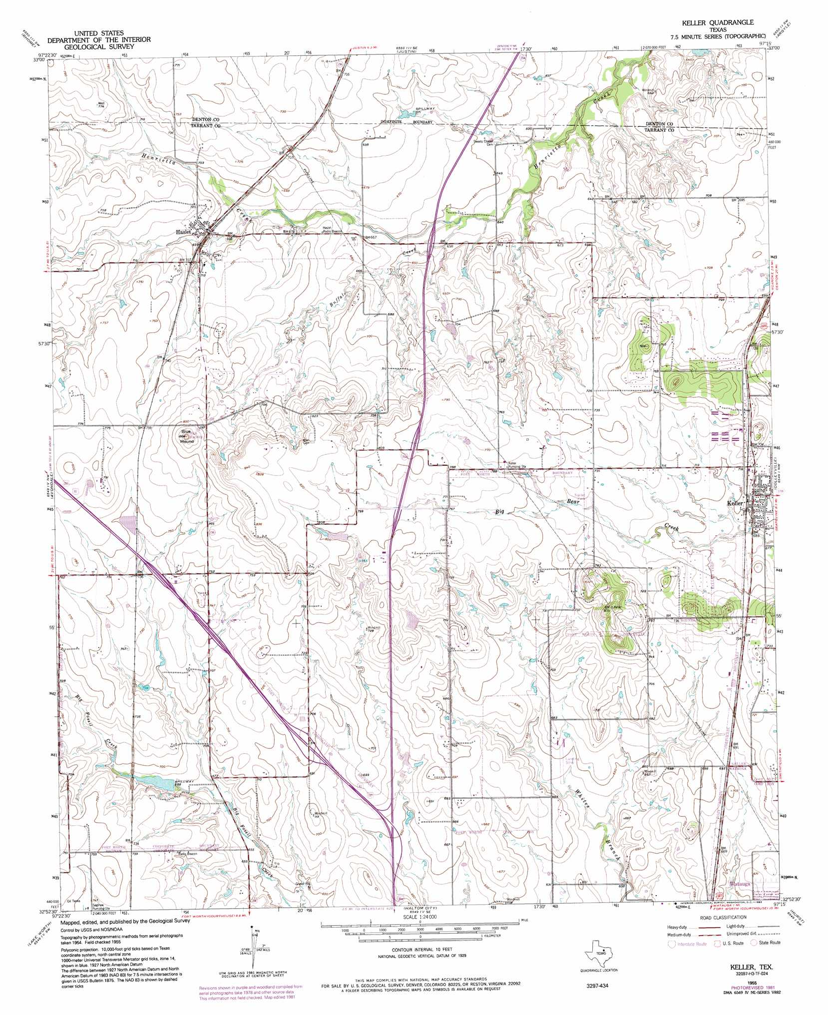
Keller Topo Map Texas
To zoom in, hover over the map of Keller
USGS Topo Quad 32097h3 - 1:24,000 scale
| Topo Map Name: | Keller |
| USGS Topo Quad ID: | 32097h3 |
| Print Size: | ca. 21 1/4" wide x 27" high |
| Southeast Coordinates: | 32.875° N latitude / 97.25° W longitude |
| Map Center Coordinates: | 32.9375° N latitude / 97.3125° W longitude |
| U.S. State: | TX |
| Filename: | o32097h3.jpg |
| Download Map JPG Image: | Keller topo map 1:24,000 scale |
| Map Type: | Topographic |
| Topo Series: | 7.5´ |
| Map Scale: | 1:24,000 |
| Source of Map Images: | United States Geological Survey (USGS) |
| Alternate Map Versions: |
Keller TX 1955, updated 1956 Download PDF Buy paper map Keller TX 1955, updated 1969 Download PDF Buy paper map Keller TX 1955, updated 1974 Download PDF Buy paper map Keller TX 1955, updated 1981 Download PDF Buy paper map Keller TX 1955, updated 1992 Download PDF Buy paper map Keller TX 2010 Download PDF Buy paper map Keller TX 2012 Download PDF Buy paper map Keller TX 2016 Download PDF Buy paper map |
1:24,000 Topo Quads surrounding Keller
Decatur |
Bluett |
Ponder |
Denton West |
Denton East |
Boyd |
Rhome |
Justin |
Argyle |
Lewisville West |
Azle |
Avondale |
Keller |
Colleyville |
Grapevine |
Springtown Se |
Lake Worth |
Haltom City |
Hurst |
Euless |
Aledo |
Benbrook |
Fort Worth |
Kennedale |
Arlington |
> Back to 32097e1 at 1:100,000 scale
> Back to 32096a1 at 1:250,000 scale
> Back to U.S. Topo Maps home
Keller topo map: Gazetteer
Keller: Airports
Circle C Ranch Airport elevation 195m 639′Fort Worth Alliance Airport elevation 213m 698′
Hillcrest Airport elevation 216m 708′
Ultralight International elevation 250m 820′
Keller: Dams
Loughridge Lake Dam elevation 208m 682′Keller: Parks
Callahan Field elevation 200m 656′Fossil Hill Middle School Football Field elevation 201m 659′
Keller: Populated Places
Alta Vista Mobile Home Park elevation 221m 725′Haslet elevation 214m 702′
Keller elevation 216m 708′
Meadow Glen Mobile Home Park elevation 230m 754′
Pine Tree Estates Number 2 elevation 217m 711′
Keller: Reservoirs
Loughridge Lake elevation 208m 682′Keller: Streams
Buffalo Creek elevation 195m 639′Keller: Summits
Blue Mound elevation 264m 866′Keller: Trails
Capp Smith Park Trail elevation 196m 643′Keller digital topo map on disk
Buy this Keller topo map showing relief, roads, GPS coordinates and other geographical features, as a high-resolution digital map file on DVD: