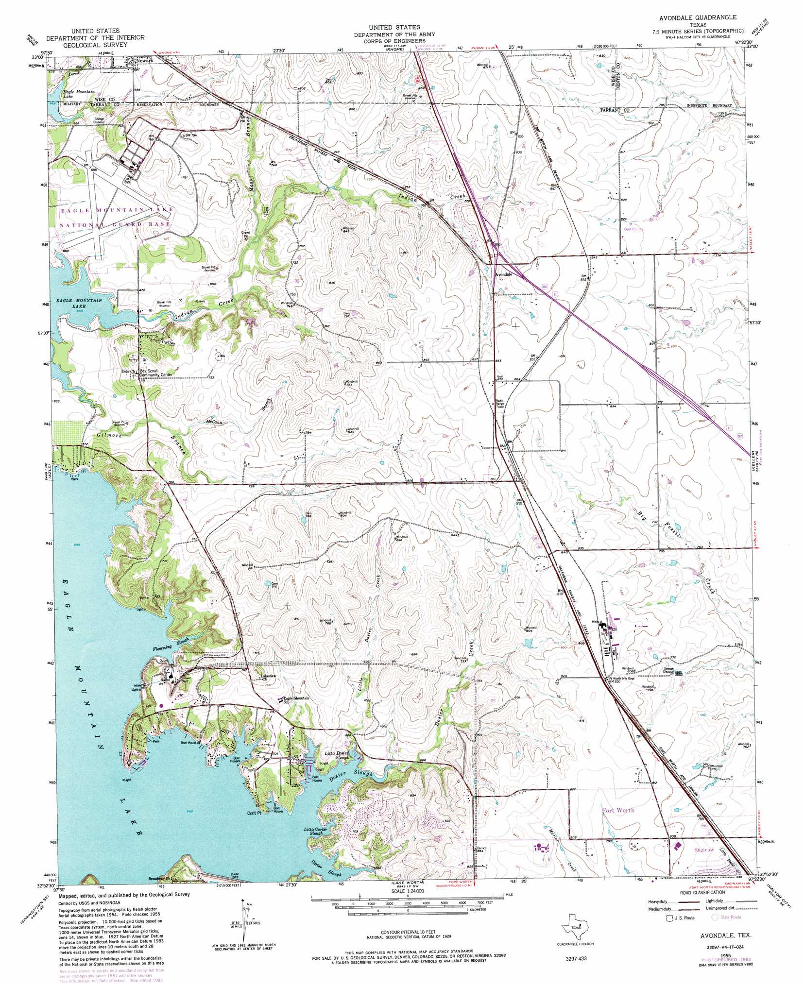
Avondale Topo Map Texas
To zoom in, hover over the map of Avondale
USGS Topo Quad 32097h4 - 1:24,000 scale
| Topo Map Name: | Avondale |
| USGS Topo Quad ID: | 32097h4 |
| Print Size: | ca. 21 1/4" wide x 27" high |
| Southeast Coordinates: | 32.875° N latitude / 97.375° W longitude |
| Map Center Coordinates: | 32.9375° N latitude / 97.4375° W longitude |
| U.S. State: | TX |
| Filename: | o32097h4.jpg |
| Download Map JPG Image: | Avondale topo map 1:24,000 scale |
| Map Type: | Topographic |
| Topo Series: | 7.5´ |
| Map Scale: | 1:24,000 |
| Source of Map Images: | United States Geological Survey (USGS) |
| Alternate Map Versions: |
Avondale TX 1955, updated 1956 Download PDF Buy paper map Avondale TX 1955, updated 1969 Download PDF Buy paper map Avondale TX 1955, updated 1974 Download PDF Buy paper map Avondale TX 1955, updated 1982 Download PDF Buy paper map Avondale TX 1955, updated 1988 Download PDF Buy paper map Avondale TX 2010 Download PDF Buy paper map Avondale TX 2012 Download PDF Buy paper map Avondale TX 2016 Download PDF Buy paper map |
1:24,000 Topo Quads surrounding Avondale
Bridgeport East |
Decatur |
Bluett |
Ponder |
Denton West |
Cottondale |
Boyd |
Rhome |
Justin |
Argyle |
Springtown |
Azle |
Avondale |
Keller |
Colleyville |
Lake Weatherford |
Springtown Se |
Lake Worth |
Haltom City |
Hurst |
Anneta |
Aledo |
Benbrook |
Fort Worth |
Kennedale |
> Back to 32097e1 at 1:100,000 scale
> Back to 32096a1 at 1:250,000 scale
> Back to U.S. Topo Maps home
Avondale topo map: Gazetteer
Avondale: Airports
Hicks Airfield elevation 255m 836′Kenneth Copeland Airport elevation 207m 679′
Avondale: Bays
Carter Slough elevation 198m 649′Dosier Slough elevation 198m 649′
Flemming Slough elevation 198m 649′
Little Carter Slough elevation 198m 649′
Little Dosier Slough elevation 198m 649′
Avondale: Capes
Craft Point elevation 198m 649′Avondale: Parks
Pioneer Stadium elevation 250m 820′William Houston Park elevation 242m 793′
Avondale: Populated Places
Avondale elevation 246m 807′Eagle Mountain elevation 204m 669′
Lakeview elevation 214m 702′
Pecan Acres elevation 217m 711′
Avondale: Reservoirs
Eagle Mountain Lake elevation 199m 652′Avondale: Streams
Derrett Creek elevation 198m 649′Dosier Creek elevation 199m 652′
Gilmore Branch elevation 198m 649′
Indian Creek elevation 198m 649′
Little Dosier Creek elevation 198m 649′
McCann Branch elevation 206m 675′
Moss Branch elevation 204m 669′
Avondale digital topo map on disk
Buy this Avondale topo map showing relief, roads, GPS coordinates and other geographical features, as a high-resolution digital map file on DVD: