Johnsville Topo Map Texas
To zoom in, hover over the map of Johnsville
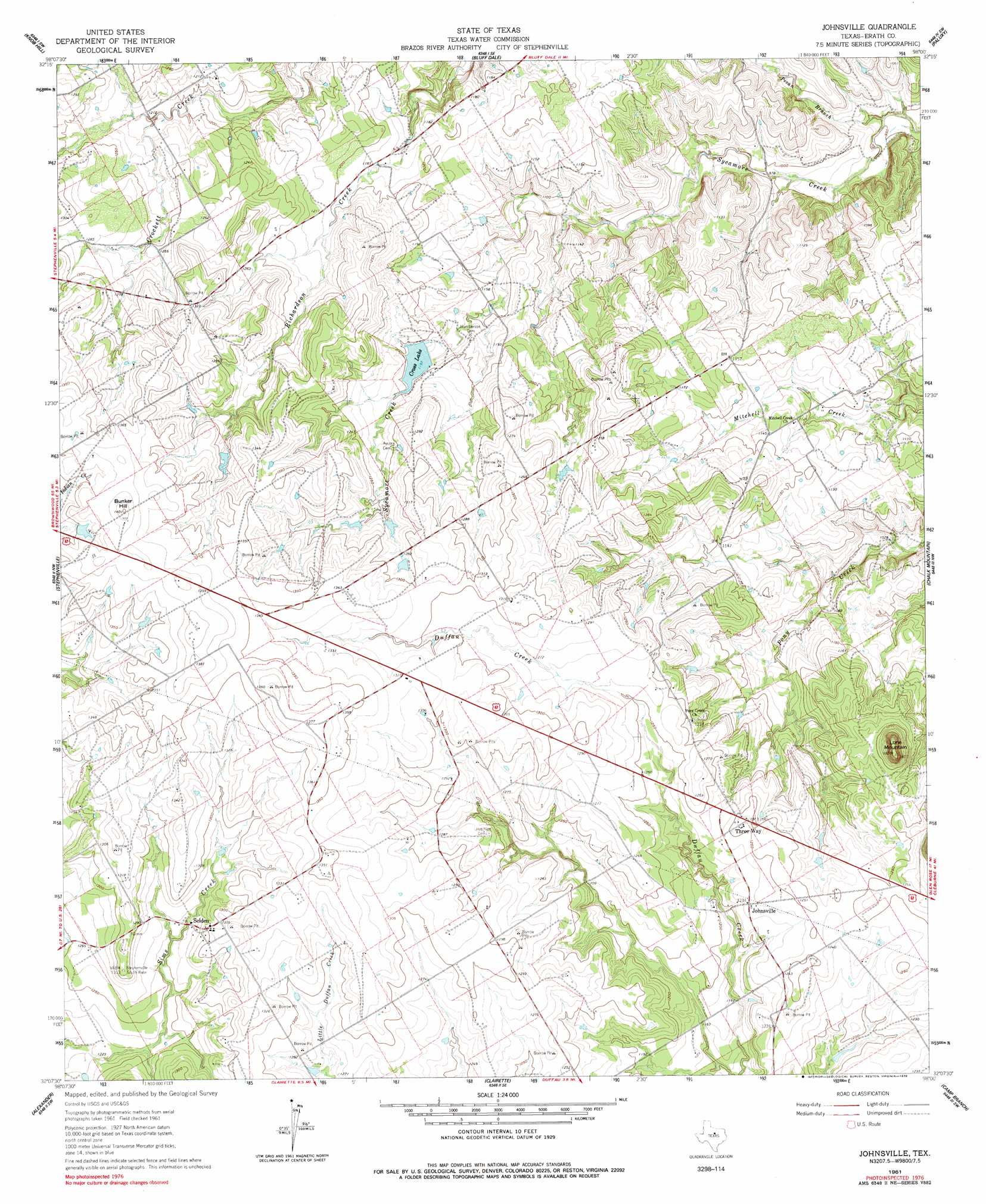
USGS Topo Quad 32098b1 - 1:24,000 scale
| Topo Map Name: | Johnsville |
| USGS Topo Quad ID: | 32098b1 |
| Print Size: | ca. 21 1/4" wide x 27" high |
| Southeast Coordinates: | 32.125° N latitude / 98° W longitude |
| Map Center Coordinates: | 32.1875° N latitude / 98.0625° W longitude |
| U.S. State: | TX |
| Filename: | o32098b1.jpg |
| Download Map JPG Image: | Johnsville topo map 1:24,000 scale |
| Map Type: | Topographic |
| Topo Series: | 7.5´ |
| Map Scale: | 1:24,000 |
| Source of Map Images: | United States Geological Survey (USGS) |
| Alternate Map Versions: |
Johnsville TX 1961, updated 1962 Download PDF Buy paper map Johnsville TX 1961, updated 1978 Download PDF Buy paper map Johnsville TX 2010 Download PDF Buy paper map Johnsville TX 2012 Download PDF Buy paper map Johnsville TX 2016 Download PDF Buy paper map |
1:24,000 Topo Quads surrounding Johnsville
Turkey Creek |
Morgan Mill |
Bluff Dale Ne |
Tolar |
Granbury |
Huckabay |
Knob Hill |
Bluff Dale |
Paluxy |
Hill City |
Bunyan |
Stephenville |
Johnsville |
Chalk Mountain |
Glen Rose West |
Dublin |
Alexander |
Clairette |
Camp Branch |
Walnut Springs West |
Edna Hill |
Carlton |
Hico |
Spring Creek Gap |
Iredell |
> Back to 32098a1 at 1:100,000 scale
> Back to 32098a1 at 1:250,000 scale
> Back to U.S. Topo Maps home
Johnsville topo map: Gazetteer
Johnsville: Dams
Gross Dam elevation 364m 1194′Pass Lake Dam elevation 388m 1272′
Warren Lake Number 1 Dam elevation 413m 1354′
Warren Lake Number 2 Dam elevation 396m 1299′
Johnsville: Populated Places
Johnsville elevation 376m 1233′Selden elevation 386m 1266′
Three Way elevation 375m 1230′
Johnsville: Reservoirs
Cross Lake elevation 364m 1194′Gross Lake elevation 364m 1194′
Pass Lake elevation 388m 1272′
Warren Lake Number 1 elevation 413m 1354′
Warren Lake Number 2 elevation 396m 1299′
Johnsville: Streams
Pecan Branch elevation 286m 938′Johnsville: Summits
Bunker Hill elevation 427m 1400′Lone Mountain elevation 429m 1407′
Johnsville digital topo map on disk
Buy this Johnsville topo map showing relief, roads, GPS coordinates and other geographical features, as a high-resolution digital map file on DVD: