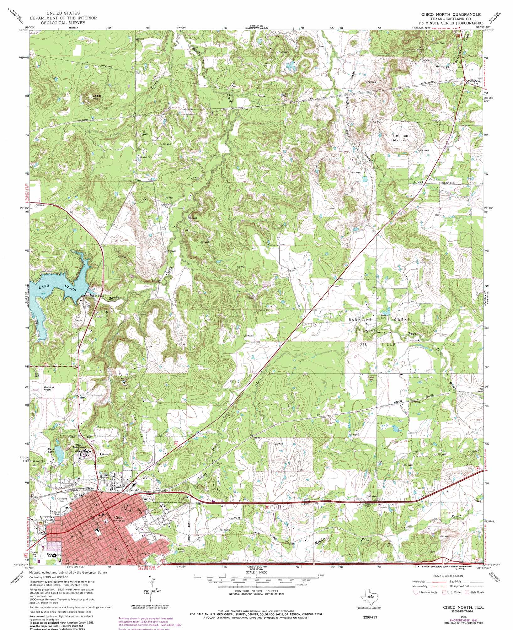
Cisco North Topo Map Texas
To zoom in, hover over the map of Cisco North
USGS Topo Quad 32098d8 - 1:24,000 scale
| Topo Map Name: | Cisco North |
| USGS Topo Quad ID: | 32098d8 |
| Print Size: | ca. 21 1/4" wide x 27" high |
| Southeast Coordinates: | 32.375° N latitude / 98.875° W longitude |
| Map Center Coordinates: | 32.4375° N latitude / 98.9375° W longitude |
| U.S. State: | TX |
| Filename: | o32098d8.jpg |
| Download Map JPG Image: | Cisco North topo map 1:24,000 scale |
| Map Type: | Topographic |
| Topo Series: | 7.5´ |
| Map Scale: | 1:24,000 |
| Source of Map Images: | United States Geological Survey (USGS) |
| Alternate Map Versions: |
Cisco North TX 1966, updated 1969 Download PDF Buy paper map Cisco North TX 1966, updated 1987 Download PDF Buy paper map Cisco North TX 2010 Download PDF Buy paper map Cisco North TX 2012 Download PDF Buy paper map Cisco North TX 2016 Download PDF Buy paper map |
1:24,000 Topo Quads surrounding Cisco North
Mccathrine Mountain |
Eolian |
Buck Mountain |
Necessity |
Caddo |
Moran |
Indian Knoll |
Harpersville |
Wayland |
La Casa |
Putnam North |
Bernie Lake |
Cisco North |
Eastland |
Ranger |
Putnam South |
Scranton |
Cisco South |
Carbon |
Kokomo |
Cross Plains North |
Sabanno |
Union Center |
Hunting Shirt Creek |
Gorman |
> Back to 32098a1 at 1:100,000 scale
> Back to 32098a1 at 1:250,000 scale
> Back to U.S. Topo Maps home
Cisco North topo map: Gazetteer
Cisco North: Dams
Twin Lake Dam elevation 487m 1597′Williamson Dam elevation 457m 1499′
Cisco North: Oilfields
Bankline Owens Oil Field elevation 459m 1505′Cisco North: Parks
Chesley Stadium elevation 514m 1686′Cisco North: Populated Places
Cisco elevation 498m 1633′Cisco North: Reservoirs
Lake Cisco elevation 459m 1505′Twin Lake elevation 485m 1591′
Cisco North: Summits
Cedar Mountain elevation 494m 1620′Flat Top Mountain elevation 475m 1558′
Cisco North digital topo map on disk
Buy this Cisco North topo map showing relief, roads, GPS coordinates and other geographical features, as a high-resolution digital map file on DVD: