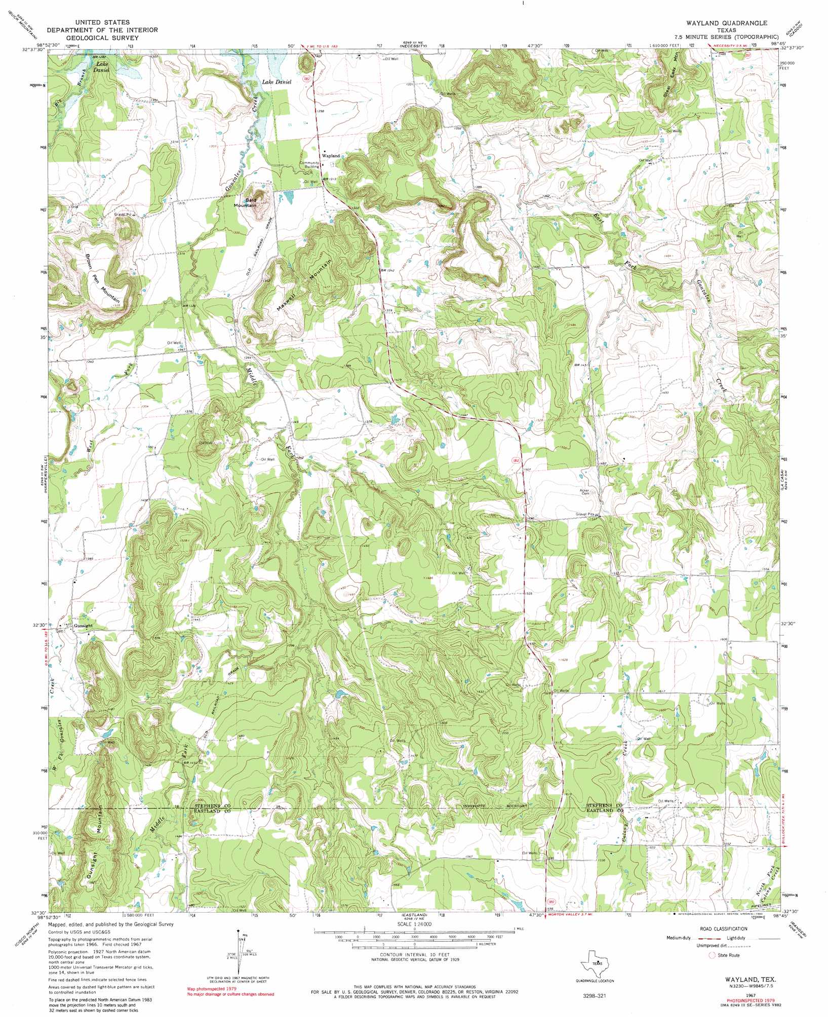
Wayland Topo Map Texas
To zoom in, hover over the map of Wayland
USGS Topo Quad 32098e7 - 1:24,000 scale
| Topo Map Name: | Wayland |
| USGS Topo Quad ID: | 32098e7 |
| Print Size: | ca. 21 1/4" wide x 27" high |
| Southeast Coordinates: | 32.5° N latitude / 98.75° W longitude |
| Map Center Coordinates: | 32.5625° N latitude / 98.8125° W longitude |
| U.S. State: | TX |
| Filename: | o32098e7.jpg |
| Download Map JPG Image: | Wayland topo map 1:24,000 scale |
| Map Type: | Topographic |
| Topo Series: | 7.5´ |
| Map Scale: | 1:24,000 |
| Source of Map Images: | United States Geological Survey (USGS) |
| Alternate Map Versions: |
Wayland TX 1967, updated 1970 Download PDF Buy paper map Wayland TX 1967, updated 1982 Download PDF Buy paper map Wayland TX 2011 Download PDF Buy paper map Wayland TX 2012 Download PDF Buy paper map Wayland TX 2016 Download PDF Buy paper map |
1:24,000 Topo Quads surrounding Wayland
Edwards Branch |
Breckenridge |
Grand Lake |
Ivan South |
Brad |
Eolian |
Buck Mountain |
Necessity |
Caddo |
Caddo Ne |
Indian Knoll |
Harpersville |
Wayland |
La Casa |
Strawn West |
Bernie Lake |
Cisco North |
Eastland |
Ranger |
Bear Mountain |
Scranton |
Cisco South |
Carbon |
Kokomo |
Desdemona |
> Back to 32098e1 at 1:100,000 scale
> Back to 32098a1 at 1:250,000 scale
> Back to U.S. Topo Maps home
Wayland topo map: Gazetteer
Wayland: Dams
Gibon Lake Dam elevation 489m 1604′Wayland: Populated Places
Gunsight elevation 433m 1420′Wayland elevation 399m 1309′
Wayland: Reservoirs
Gibson Lake elevation 489m 1604′Wayland: Streams
Big Branch elevation 390m 1279′Middle Fork Gunsolus Creek elevation 396m 1299′
West Fork Gunsolus Creek elevation 396m 1299′
Wayland: Summits
Bald Mountain elevation 430m 1410′Brown Pen Mountain elevation 465m 1525′
Gunsight Mountain elevation 503m 1650′
Maxwell Mountain elevation 449m 1473′
Steal Easy Mountain elevation 482m 1581′
Wayland digital topo map on disk
Buy this Wayland topo map showing relief, roads, GPS coordinates and other geographical features, as a high-resolution digital map file on DVD: