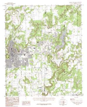
Mineral Wells East Topo Map Texas
To zoom in, hover over the map of Mineral Wells East
USGS Topo Quad 32098g1 - 1:24,000 scale
| Topo Map Name: | Mineral Wells East |
| USGS Topo Quad ID: | 32098g1 |
| Print Size: | ca. 21 1/4" wide x 27" high |
| Southeast Coordinates: | 32.75° N latitude / 98° W longitude |
| Map Center Coordinates: | 32.8125° N latitude / 98.0625° W longitude |
| U.S. State: | TX |
| Filename: | o32098g1.jpg |
| Download Map JPG Image: | Mineral Wells East topo map 1:24,000 scale |
| Map Type: | Topographic |
| Topo Series: | 7.5´ |
| Map Scale: | 1:24,000 |
| Source of Map Images: | United States Geological Survey (USGS) |
| Alternate Map Versions: |
Mineral Wells East TX 1984, updated 1986 Download PDF Buy paper map Mineral Wells East TX 2010 Download PDF Buy paper map Mineral Wells East TX 2012 Download PDF Buy paper map Mineral Wells East TX 2016 Download PDF Buy paper map |
1:24,000 Topo Quads surrounding Mineral Wells East
> Back to 32098e1 at 1:100,000 scale
> Back to 32098a1 at 1:250,000 scale
> Back to U.S. Topo Maps home
Mineral Wells East topo map: Gazetteer
Mineral Wells East: Airports
McQuaid Heliport elevation 270m 885′Mineral Wells Airport elevation 286m 938′
Upham Heliport elevation 267m 875′
Mineral Wells East: Dams
Holiday Hills Club Lake Dam elevation 262m 859′Lake Mineral Wells Dam elevation 263m 862′
Millsap Lake Dam elevation 260m 853′
Mineral Wells East: Parks
Bulldog Stadium elevation 252m 826′Lake Mineral Wells State Park elevation 274m 898′
Lake Mineral Wells State Park elevation 272m 892′
Lion Park elevation 282m 925′
Mineral Wells East: Populated Places
Cool elevation 284m 931′Mineral Wells elevation 269m 882′
Sturdivant elevation 301m 987′
Wolters Village elevation 277m 908′
Mineral Wells East: Reservoirs
Holiday Hills Club Lake elevation 262m 859′Lake Mineral Wells elevation 263m 862′
Lake Pinto elevation 273m 895′
Millsap Lake elevation 260m 853′
Mineral Wells East: Streams
Dry Creek elevation 244m 800′Duke Mountain Branch elevation 238m 780′
Patterson Branch elevation 258m 846′
Rippy Branch elevation 265m 869′
Wilson Creek elevation 236m 774′
Mineral Wells East: Summits
Duke Mountain elevation 293m 961′East Mountain elevation 307m 1007′
West Mountain elevation 321m 1053′
Mineral Wells East: Trails
Lake Mineral Wells State Park and Trailway elevation 272m 892′Mineral Wells East digital topo map on disk
Buy this Mineral Wells East topo map showing relief, roads, GPS coordinates and other geographical features, as a high-resolution digital map file on DVD:


