Oplin Topo Map Texas
To zoom in, hover over the map of Oplin
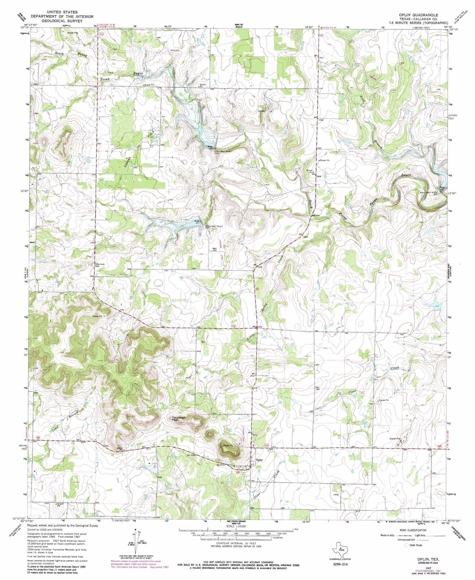
USGS Topo Quad 32099b5 - 1:24,000 scale
| Topo Map Name: | Oplin |
| USGS Topo Quad ID: | 32099b5 |
| Print Size: | ca. 21 1/4" wide x 27" high |
| Southeast Coordinates: | 32.125° N latitude / 99.5° W longitude |
| Map Center Coordinates: | 32.1875° N latitude / 99.5625° W longitude |
| U.S. State: | TX |
| Filename: | o32099b5.jpg |
| Download Map JPG Image: | Oplin topo map 1:24,000 scale |
| Map Type: | Topographic |
| Topo Series: | 7.5´ |
| Map Scale: | 1:24,000 |
| Source of Map Images: | United States Geological Survey (USGS) |
| Alternate Map Versions: |
Oplin TX 1967, updated 1970 Download PDF Buy paper map Oplin TX 1967, updated 1983 Download PDF Buy paper map Oplin TX 1967, updated 1987 Download PDF Buy paper map Oplin TX 2010 Download PDF Buy paper map Oplin TX 2012 Download PDF Buy paper map Oplin TX 2016 Download PDF Buy paper map |
1:24,000 Topo Quads surrounding Oplin
Abilene West |
Abilene East |
Kirby Lake Ne |
Baird |
Jayell |
Buffalo Gap |
Potosi |
Eula |
Cub Hollow |
Admiral |
Tuscola |
Lawn |
Oplin |
Rowden Nw |
Rowden |
Bald Knob |
Goldsboro |
Mcewen Draw |
Crooked Creek |
Webbville |
Crews |
Novice West |
Novice East |
Lake Scarborough |
Coleman Ne |
> Back to 32099a1 at 1:100,000 scale
> Back to 32098a1 at 1:250,000 scale
> Back to U.S. Topo Maps home
Oplin topo map: Gazetteer
Oplin: Dams
Soil Conservation Service Site 1 Dam elevation 589m 1932′Soil Conservation Service Site 11a Dam elevation 556m 1824′
Soil Conservation Service Site 2 Dam elevation 581m 1906′
Straley Lake Dam elevation 580m 1902′
Oplin: Oilfields
Dumont Oil Field elevation 607m 1991′Oplin: Populated Places
Oplin elevation 606m 1988′Oplin: Reservoirs
Soil Conservation Service Site 11a Reservoir elevation 556m 1824′Soil Conservation Service Site 2 Reservoir elevation 581m 1906′
Soil Conservation Service Site 32 Reservoir elevation 589m 1932′
Straley Lake elevation 580m 1902′
Oplin: Streams
Little Rocky Creek elevation 554m 1817′Oplin: Summits
Tecumseh Peak elevation 649m 2129′Oplin digital topo map on disk
Buy this Oplin topo map showing relief, roads, GPS coordinates and other geographical features, as a high-resolution digital map file on DVD: