Cub Hollow Topo Map Texas
To zoom in, hover over the map of Cub Hollow
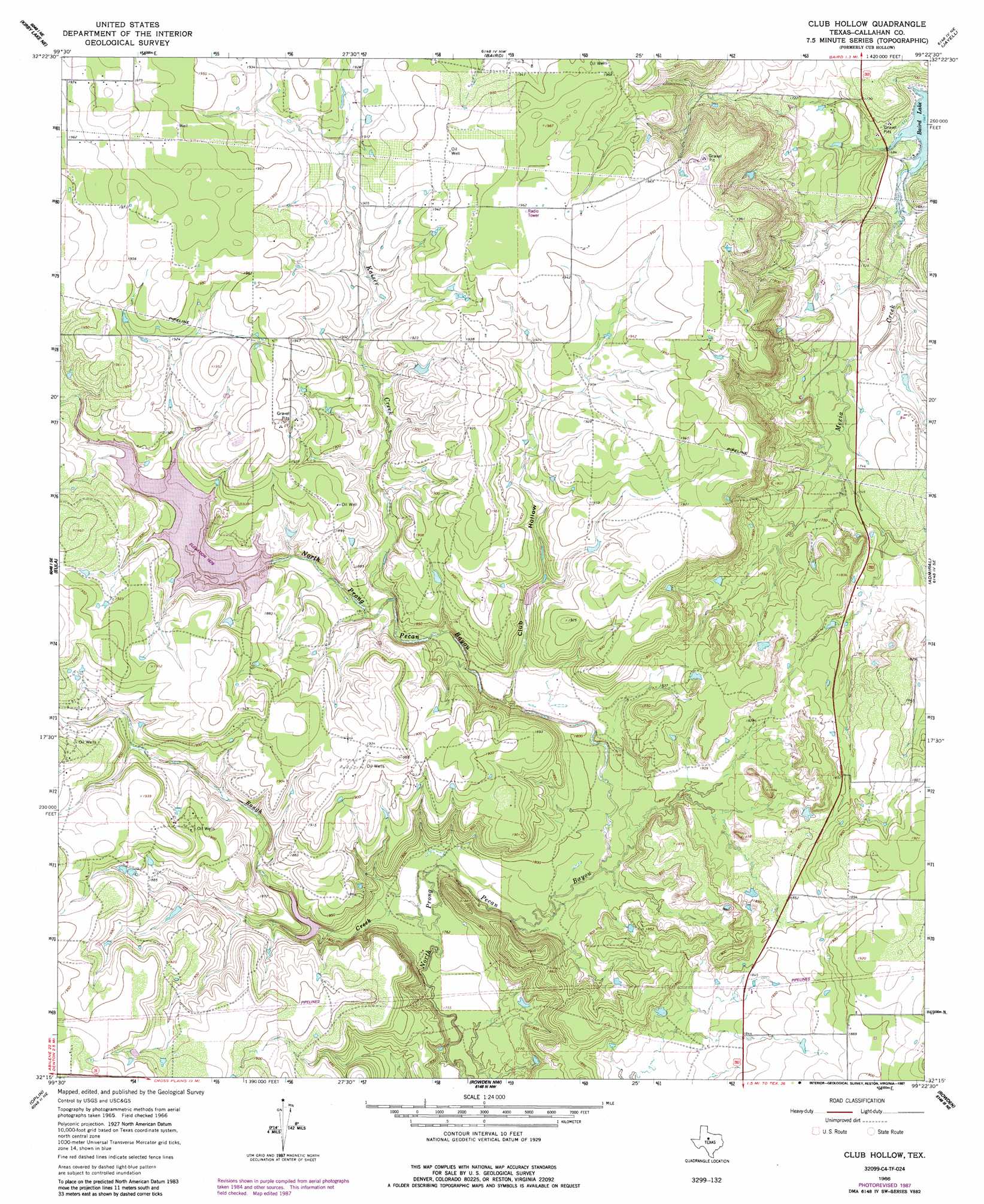
USGS Topo Quad 32099c4 - 1:24,000 scale
| Topo Map Name: | Cub Hollow |
| USGS Topo Quad ID: | 32099c4 |
| Print Size: | ca. 21 1/4" wide x 27" high |
| Southeast Coordinates: | 32.25° N latitude / 99.375° W longitude |
| Map Center Coordinates: | 32.3125° N latitude / 99.4375° W longitude |
| U.S. State: | TX |
| Filename: | o32099c4.jpg |
| Download Map JPG Image: | Cub Hollow topo map 1:24,000 scale |
| Map Type: | Topographic |
| Topo Series: | 7.5´ |
| Map Scale: | 1:24,000 |
| Source of Map Images: | United States Geological Survey (USGS) |
| Alternate Map Versions: |
Cub Hollow TX 1966, updated 1970 Download PDF Buy paper map Club Hollow TX 1966, updated 1984 Download PDF Buy paper map Club Hollow TX 1966, updated 1987 Download PDF Buy paper map Club Hollow TX 2010 Download PDF Buy paper map Club Hollow TX 2012 Download PDF Buy paper map Club Hollow TX 2016 Download PDF Buy paper map |
1:24,000 Topo Quads surrounding Cub Hollow
Hamby |
Flattop |
Leeper Creek |
Snyder Lake |
Moran |
Abilene East |
Kirby Lake Ne |
Baird |
Jayell |
Putnam North |
Potosi |
Eula |
Cub Hollow |
Admiral |
Putnam South |
Lawn |
Oplin |
Rowden Nw |
Rowden |
Cross Plains North |
Goldsboro |
Mcewen Draw |
Crooked Creek |
Webbville |
Cross Cut |
> Back to 32099a1 at 1:100,000 scale
> Back to 32098a1 at 1:250,000 scale
> Back to U.S. Topo Maps home
Cub Hollow topo map: Gazetteer
Cub Hollow: Dams
Soil Conservation Service Site 6 Dam elevation 544m 1784′Soil Conservation Service Site 7 Dam elevation 573m 1879′
Soil Conservation Service Site 9 Dam elevation 559m 1833′
Cub Hollow: Reservoirs
Soil Conservation Service Site 6 Reservoir elevation 544m 1784′Soil Conservation Service Site 7 Reservoir elevation 573m 1879′
Soil Conservation Service Site 9 Reservoir elevation 559m 1833′
Cub Hollow: Streams
Kaiser Creek elevation 552m 1811′Rough Creek elevation 537m 1761′
Cub Hollow: Valleys
Club Hollow elevation 548m 1797′Cub Hollow digital topo map on disk
Buy this Cub Hollow topo map showing relief, roads, GPS coordinates and other geographical features, as a high-resolution digital map file on DVD: