View Topo Map Texas
To zoom in, hover over the map of View
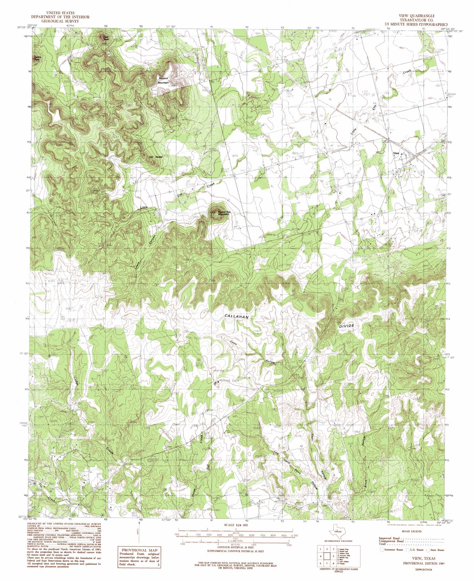
USGS Topo Quad 32099c8 - 1:24,000 scale
| Topo Map Name: | View |
| USGS Topo Quad ID: | 32099c8 |
| Print Size: | ca. 21 1/4" wide x 27" high |
| Southeast Coordinates: | 32.25° N latitude / 99.875° W longitude |
| Map Center Coordinates: | 32.3125° N latitude / 99.9375° W longitude |
| U.S. State: | TX |
| Filename: | o32099c8.jpg |
| Download Map JPG Image: | View topo map 1:24,000 scale |
| Map Type: | Topographic |
| Topo Series: | 7.5´ |
| Map Scale: | 1:24,000 |
| Source of Map Images: | United States Geological Survey (USGS) |
| Alternate Map Versions: |
View TX 1984, updated 1984 Download PDF Buy paper map View TX 1984, updated 1987 Download PDF Buy paper map View TX 2010 Download PDF Buy paper map View TX 2012 Download PDF Buy paper map View TX 2016 Download PDF Buy paper map |
1:24,000 Topo Quads surrounding View
Raven Creek South |
Noodle |
Stith |
Hawley |
Hamby |
Chalk Peak |
Merkel West |
Merkel East |
Abilene West |
Abilene East |
Nolan |
Mountain Pass |
View |
Buffalo Gap |
Potosi |
Hylton |
Shep |
Lake Abilene |
Tuscola |
Lawn |
Church Peak |
Wingate |
Bradshaw |
Bald Knob |
Goldsboro |
> Back to 32099a1 at 1:100,000 scale
> Back to 32098a1 at 1:250,000 scale
> Back to U.S. Topo Maps home
View topo map: Gazetteer
View: Populated Places
View elevation 584m 1916′View: Summits
Buzzard Mountain elevation 721m 2365′Castle Peak elevation 662m 2171′
Cat Heads elevation 686m 2250′
East Peak elevation 699m 2293′
Round Top Mountain elevation 715m 2345′
View: Valleys
Brock Hollow elevation 626m 2053′Coon Hollow elevation 628m 2060′
Left Hand Coon Hollow elevation 624m 2047′
Lewis Canyon elevation 634m 2080′
View digital topo map on disk
Buy this View topo map showing relief, roads, GPS coordinates and other geographical features, as a high-resolution digital map file on DVD: