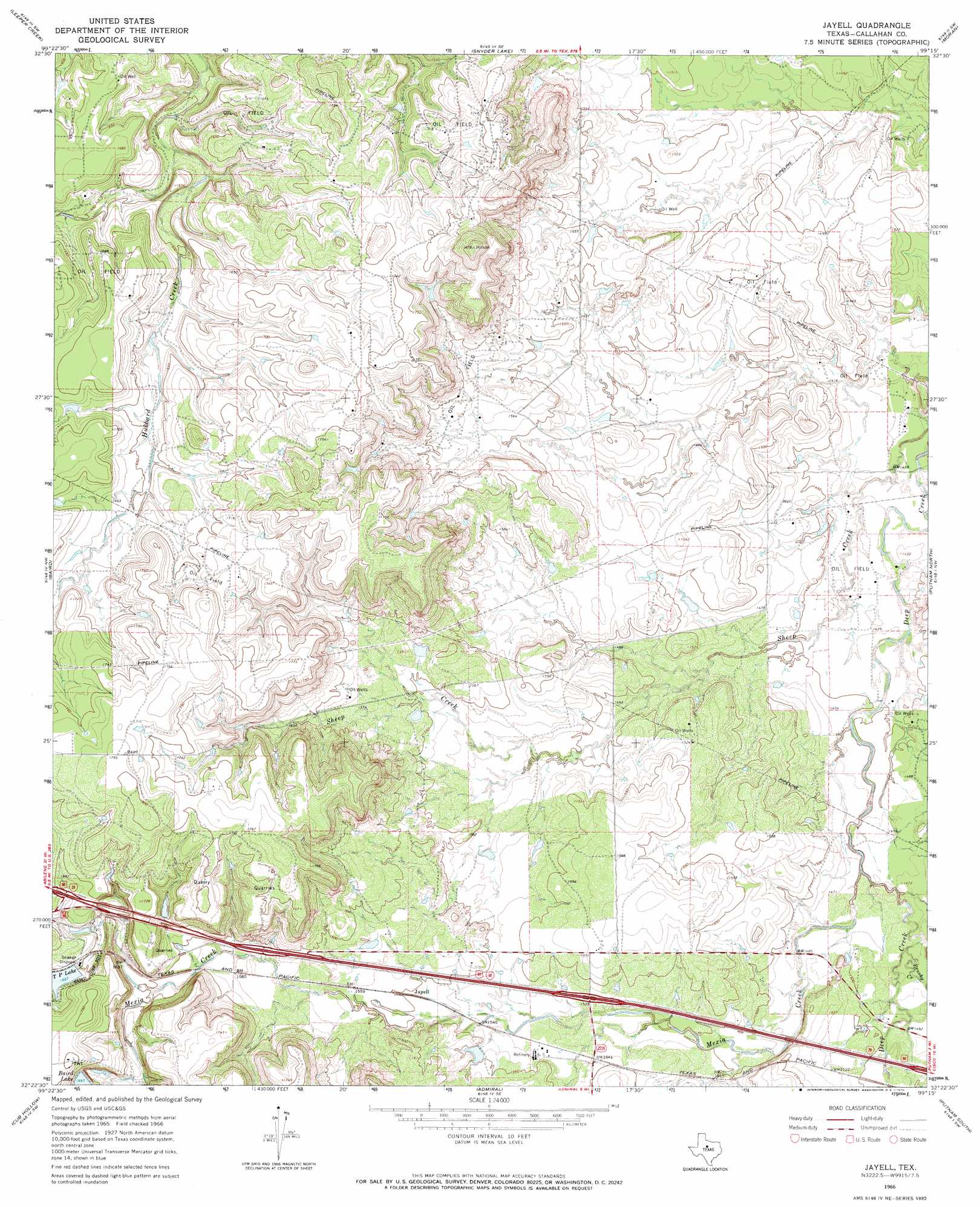
Jayell Topo Map Texas
To zoom in, hover over the map of Jayell
USGS Topo Quad 32099d3 - 1:24,000 scale
| Topo Map Name: | Jayell |
| USGS Topo Quad ID: | 32099d3 |
| Print Size: | ca. 21 1/4" wide x 27" high |
| Southeast Coordinates: | 32.375° N latitude / 99.25° W longitude |
| Map Center Coordinates: | 32.4375° N latitude / 99.3125° W longitude |
| U.S. State: | TX |
| Filename: | o32099d3.jpg |
| Download Map JPG Image: | Jayell topo map 1:24,000 scale |
| Map Type: | Topographic |
| Topo Series: | 7.5´ |
| Map Scale: | 1:24,000 |
| Source of Map Images: | United States Geological Survey (USGS) |
| Alternate Map Versions: |
Jayell TX 1966, updated 1970 Download PDF Buy paper map Jayell TX 2010 Download PDF Buy paper map Jayell TX 2012 Download PDF Buy paper map Jayell TX 2016 Download PDF Buy paper map |
1:24,000 Topo Quads surrounding Jayell
Smokey Draw |
Acampo |
Albany |
Mccathrine Mountain |
Eolian |
Flattop |
Leeper Creek |
Snyder Lake |
Moran |
Indian Knoll |
Kirby Lake Ne |
Baird |
Jayell |
Putnam North |
Bernie Lake |
Eula |
Cub Hollow |
Admiral |
Putnam South |
Scranton |
Oplin |
Rowden Nw |
Rowden |
Cross Plains North |
Sabanno |
> Back to 32099a1 at 1:100,000 scale
> Back to 32098a1 at 1:250,000 scale
> Back to U.S. Topo Maps home
Jayell topo map: Gazetteer
Jayell: Dams
Baird Railroad Lake Dam elevation 502m 1646′Mexia Dam elevation 507m 1663′
Smith Lake Dam elevation 468m 1535′
Jayell: Populated Places
Jayell elevation 473m 1551′Jayell: Reservoirs
Baird Lake elevation 507m 1663′Baird Railroad Lake elevation 502m 1646′
Lake Baird elevation 507m 1663′
Smith Lake elevation 468m 1535′
T P Lake elevation 508m 1666′
Jayell: Streams
Brushy Creek elevation 445m 1459′Mexia Creek elevation 444m 1456′
Jayell digital topo map on disk
Buy this Jayell topo map showing relief, roads, GPS coordinates and other geographical features, as a high-resolution digital map file on DVD: