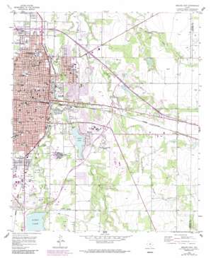
Abilene East Topo Map Texas
To zoom in, hover over the map of Abilene East
USGS Topo Quad 32099d6 - 1:24,000 scale
| Topo Map Name: | Abilene East |
| USGS Topo Quad ID: | 32099d6 |
| Print Size: | ca. 21 1/4" wide x 27" high |
| Southeast Coordinates: | 32.375° N latitude / 99.625° W longitude |
| Map Center Coordinates: | 32.4375° N latitude / 99.6875° W longitude |
| U.S. State: | TX |
| Filename: | o32099d6.jpg |
| Download Map JPG Image: | Abilene East topo map 1:24,000 scale |
| Map Type: | Topographic |
| Topo Series: | 7.5´ |
| Map Scale: | 1:24,000 |
| Source of Map Images: | United States Geological Survey (USGS) |
| Alternate Map Versions: |
Abilene East TX 1957, updated 1958 Download PDF Buy paper map Abilene East TX 1957, updated 1968 Download PDF Buy paper map Abilene East TX 1957, updated 1975 Download PDF Buy paper map Abilene East TX 1957, updated 1987 Download PDF Buy paper map Abilene East TX 2010 Download PDF Buy paper map Abilene East TX 2012 Download PDF Buy paper map Abilene East TX 2016 Download PDF Buy paper map |
1:24,000 Topo Quads surrounding Abilene East
> Back to 32099a1 at 1:100,000 scale
> Back to 32098a1 at 1:250,000 scale
> Back to U.S. Topo Maps home
Abilene East topo map: Gazetteer
Abilene East: Airports
Abilene Regional Airport elevation 545m 1788′Elmdale Airpark elevation 534m 1751′
Hendrick Medical Center Heliport elevation 520m 1706′
Abilene East: Dams
Cameron Dam elevation 517m 1696′Diamond Lake Dam elevation 520m 1706′
Elmer Griffith Lake Dam elevation 536m 1758′
Henninger Lake Dam elevation 546m 1791′
J C Griffith Dam elevation 522m 1712′
Lake Kirby Dam elevation 545m 1788′
Lytle Lake Dam elevation 522m 1712′
R J Griffith Dam elevation 521m 1709′
Woodrow Griffith Lake Dam elevation 515m 1689′
Zoo Lake Number 1 Dam elevation 528m 1732′
Zoo Lake Number 2 Dam elevation 525m 1722′
Abilene East: Oilfields
Box Oil Field elevation 541m 1774′Abilene East: Parks
A C C Stadium elevation 520m 1706′A E 'Poly' and Zieta Wells Field elevation 519m 1702′
Abilene International Soccer Complex elevation 521m 1709′
Arthur Sears Park elevation 519m 1702′
Cal Young Park elevation 518m 1699′
Cobb Park elevation 519m 1702′
Crutcher Scott Field elevation 520m 1706′
Elmer Gray Stadium elevation 520m 1706′
Grover Nelson Park elevation 530m 1738′
Hair Park elevation 510m 1673′
Kirby Park elevation 518m 1699′
Moody Coliseum elevation 523m 1715′
Nelson Wilson Park elevation 521m 1709′
P E Shotwell Center elevation 532m 1745′
Stevenson Park elevation 514m 1686′
Taylor County Expo Center elevation 531m 1742′
Vaughn Camp Park elevation 537m 1761′
Will Hair Park elevation 509m 1669′
Abilene East: Populated Places
Abilene elevation 524m 1719′Elmdale elevation 543m 1781′
Impact elevation 509m 1669′
Abilene East: Reservoirs
Elmer Griffith Lake elevation 536m 1758′Henninger Lake elevation 546m 1791′
J C Griffith Lake elevation 522m 1712′
Kirby Lake elevation 545m 1788′
Lake Kirby elevation 545m 1788′
Lytle Lake elevation 522m 1712′
R J Griffith Lake elevation 521m 1709′
Woodrow Griffith Lake elevation 515m 1689′
Zoo Lake Number 1 elevation 528m 1732′
Zoo Lake Number 2 elevation 525m 1722′
Abilene East: Streams
Buttonwillow Creek elevation 524m 1719′Lytle Creek elevation 515m 1689′
Abilene East digital topo map on disk
Buy this Abilene East topo map showing relief, roads, GPS coordinates and other geographical features, as a high-resolution digital map file on DVD:


