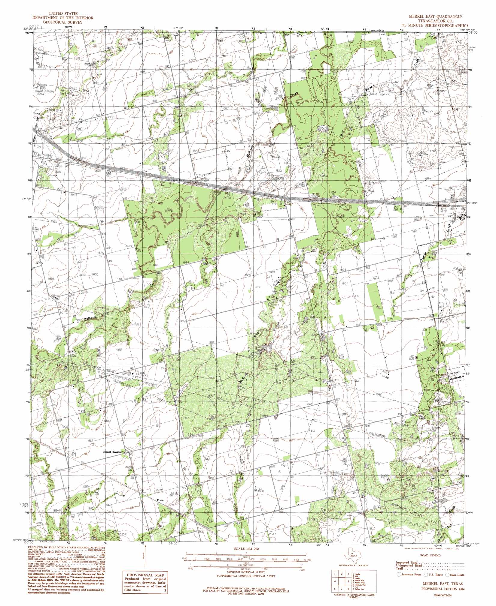
Merkel East Topo Map Texas
To zoom in, hover over the map of Merkel East
USGS Topo Quad 32099d8 - 1:24,000 scale
| Topo Map Name: | Merkel East |
| USGS Topo Quad ID: | 32099d8 |
| Print Size: | ca. 21 1/4" wide x 27" high |
| Southeast Coordinates: | 32.375° N latitude / 99.875° W longitude |
| Map Center Coordinates: | 32.4375° N latitude / 99.9375° W longitude |
| U.S. State: | TX |
| Filename: | o32099d8.jpg |
| Download Map JPG Image: | Merkel East topo map 1:24,000 scale |
| Map Type: | Topographic |
| Topo Series: | 7.5´ |
| Map Scale: | 1:24,000 |
| Source of Map Images: | United States Geological Survey (USGS) |
| Alternate Map Versions: |
Merkel East TX 1984, updated 1984 Download PDF Buy paper map Merkel East TX 1984, updated 1991 Download PDF Buy paper map Merkel East TX 2010 Download PDF Buy paper map Merkel East TX 2012 Download PDF Buy paper map Merkel East TX 2016 Download PDF Buy paper map |
1:24,000 Topo Quads surrounding Merkel East
Raven Creek North |
Noodle Ne |
Truby |
Hawley Ne |
Nugent |
Raven Creek South |
Noodle |
Stith |
Hawley |
Hamby |
Chalk Peak |
Merkel West |
Merkel East |
Abilene West |
Abilene East |
Nolan |
Mountain Pass |
View |
Buffalo Gap |
Potosi |
Hylton |
Shep |
Lake Abilene |
Tuscola |
Lawn |
> Back to 32099a1 at 1:100,000 scale
> Back to 32098a1 at 1:250,000 scale
> Back to U.S. Topo Maps home
Merkel East topo map: Gazetteer
Merkel East: Populated Places
Cozart elevation 590m 1935′Mount Pleasant elevation 583m 1912′
Merkel East digital topo map on disk
Buy this Merkel East topo map showing relief, roads, GPS coordinates and other geographical features, as a high-resolution digital map file on DVD: