Flattop Topo Map Texas
To zoom in, hover over the map of Flattop
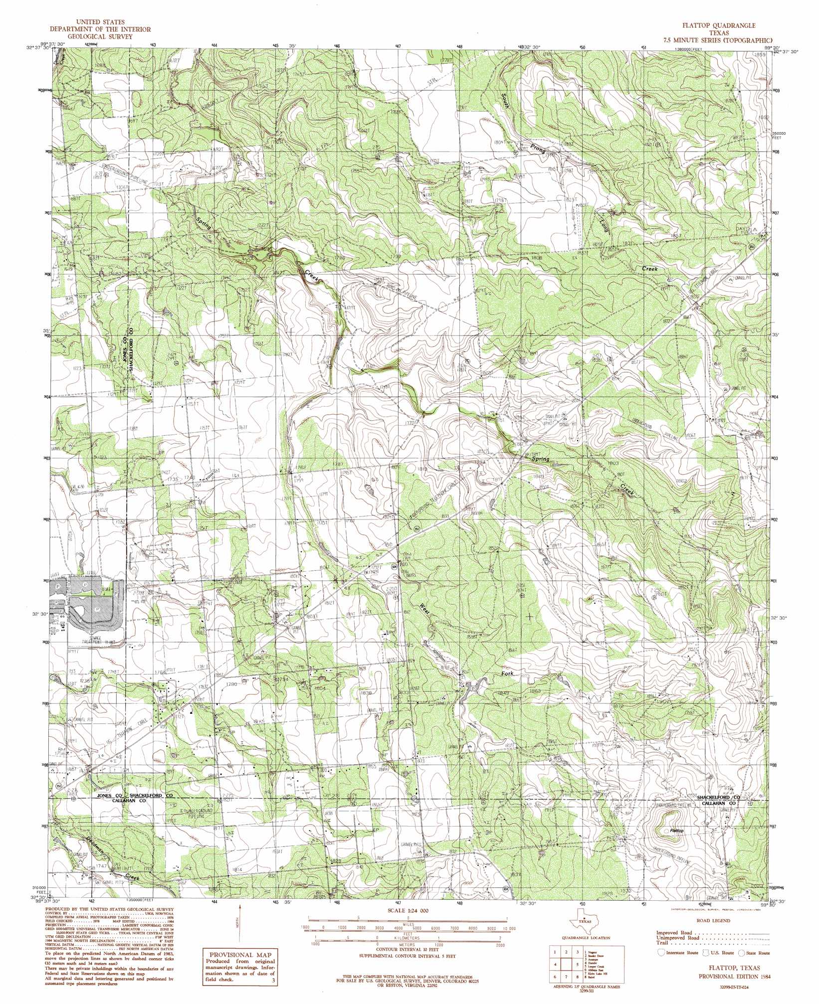
USGS Topo Quad 32099e5 - 1:24,000 scale
| Topo Map Name: | Flattop |
| USGS Topo Quad ID: | 32099e5 |
| Print Size: | ca. 21 1/4" wide x 27" high |
| Southeast Coordinates: | 32.5° N latitude / 99.5° W longitude |
| Map Center Coordinates: | 32.5625° N latitude / 99.5625° W longitude |
| U.S. State: | TX |
| Filename: | o32099e5.jpg |
| Download Map JPG Image: | Flattop topo map 1:24,000 scale |
| Map Type: | Topographic |
| Topo Series: | 7.5´ |
| Map Scale: | 1:24,000 |
| Source of Map Images: | United States Geological Survey (USGS) |
| Alternate Map Versions: |
Flattop TX 1984, updated 1984 Download PDF Buy paper map Flattop TX 2010 Download PDF Buy paper map Flattop TX 2012 Download PDF Buy paper map Flattop TX 2016 Download PDF Buy paper map |
1:24,000 Topo Quads surrounding Flattop
Funston |
Lueders West |
Lueders East |
Collins Creek Sw |
Round Hill |
Hawley Ne |
Nugent |
Smokey Draw |
Acampo |
Albany |
Hawley |
Hamby |
Flattop |
Leeper Creek |
Snyder Lake |
Abilene West |
Abilene East |
Kirby Lake Ne |
Baird |
Jayell |
Buffalo Gap |
Potosi |
Eula |
Cub Hollow |
Admiral |
> Back to 32099e1 at 1:100,000 scale
> Back to 32098a1 at 1:250,000 scale
> Back to U.S. Topo Maps home
Flattop topo map: Gazetteer
Flattop: Airports
Portlock Airfield elevation 536m 1758′Flattop: Oilfields
Morrisett Oil Field elevation 576m 1889′Flattop: Streams
West Fork Spring Creek elevation 527m 1729′Flattop: Summits
Flattop elevation 618m 2027′Flattop digital topo map on disk
Buy this Flattop topo map showing relief, roads, GPS coordinates and other geographical features, as a high-resolution digital map file on DVD: