Smokey Draw Topo Map Texas
To zoom in, hover over the map of Smokey Draw
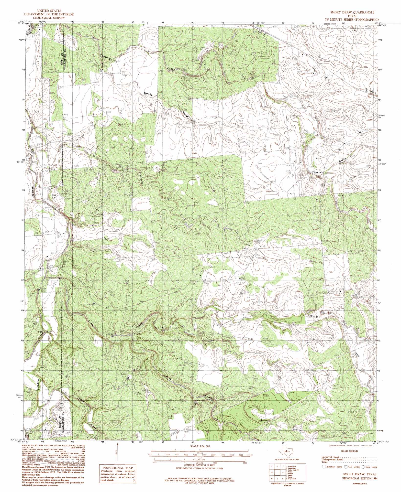
USGS Topo Quad 32099f5 - 1:24,000 scale
| Topo Map Name: | Smokey Draw |
| USGS Topo Quad ID: | 32099f5 |
| Print Size: | ca. 21 1/4" wide x 27" high |
| Southeast Coordinates: | 32.625° N latitude / 99.5° W longitude |
| Map Center Coordinates: | 32.6875° N latitude / 99.5625° W longitude |
| U.S. State: | TX |
| Filename: | o32099f5.jpg |
| Download Map JPG Image: | Smokey Draw topo map 1:24,000 scale |
| Map Type: | Topographic |
| Topo Series: | 7.5´ |
| Map Scale: | 1:24,000 |
| Source of Map Images: | United States Geological Survey (USGS) |
| Alternate Map Versions: |
Smoky Draw TX 1984, updated 1984 Download PDF Buy paper map Smoky Draw TX 1984, updated 1991 Download PDF Buy paper map Smoky Draw TX 2010 Download PDF Buy paper map Smoky Draw TX 2012 Download PDF Buy paper map Smoky Draw TX 2016 Download PDF Buy paper map |
1:24,000 Topo Quads surrounding Smokey Draw
Stamford |
Lueders Nw |
Lueders Ne |
Antelope Hills |
Collins Creek |
Funston |
Lueders West |
Lueders East |
Collins Creek Sw |
Round Hill |
Hawley Ne |
Nugent |
Smokey Draw |
Acampo |
Albany |
Hawley |
Hamby |
Flattop |
Leeper Creek |
Snyder Lake |
Abilene West |
Abilene East |
Kirby Lake Ne |
Baird |
Jayell |
> Back to 32099e1 at 1:100,000 scale
> Back to 32098a1 at 1:250,000 scale
> Back to U.S. Topo Maps home
Smokey Draw topo map: Gazetteer
Smokey Draw: Oilfields
Matilda Perkins Oil Field elevation 497m 1630′Smokey Draw: Streams
Long Creek elevation 479m 1571′South Prong Long Creek elevation 494m 1620′
Spring Creek elevation 490m 1607′
Threemile Creek elevation 470m 1541′
Smokey Draw: Valleys
Smoky Draw elevation 481m 1578′Smokey Draw digital topo map on disk
Buy this Smokey Draw topo map showing relief, roads, GPS coordinates and other geographical features, as a high-resolution digital map file on DVD: