Nugent Topo Map Texas
To zoom in, hover over the map of Nugent
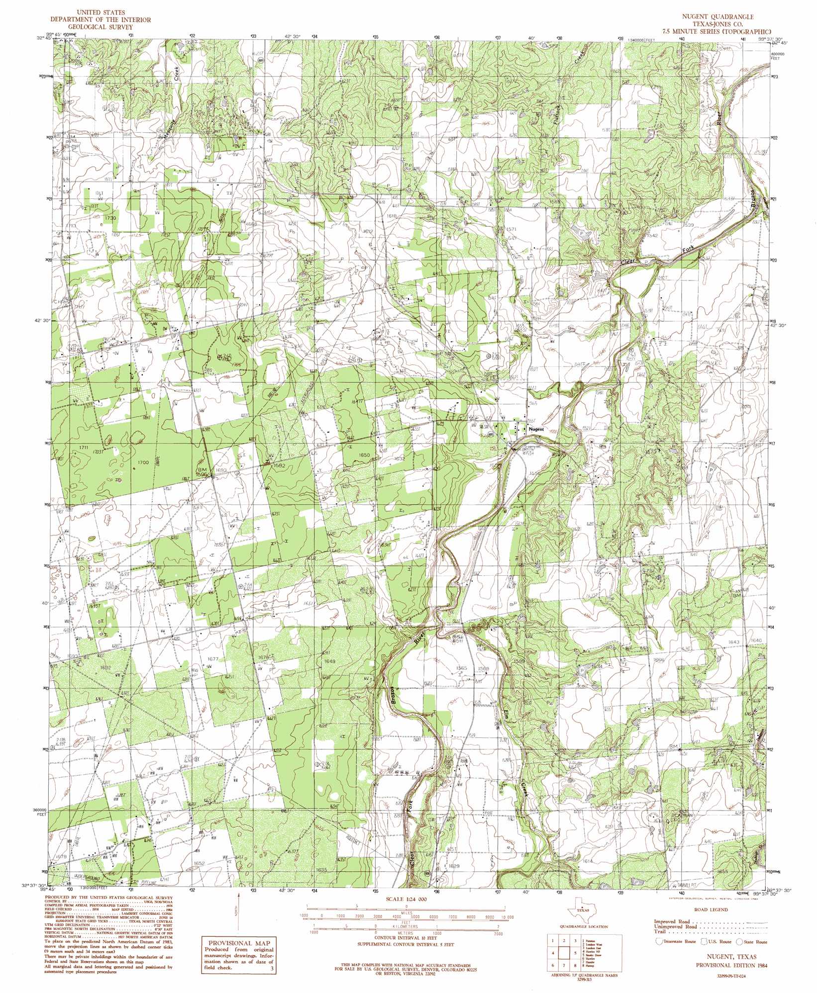
USGS Topo Quad 32099f6 - 1:24,000 scale
| Topo Map Name: | Nugent |
| USGS Topo Quad ID: | 32099f6 |
| Print Size: | ca. 21 1/4" wide x 27" high |
| Southeast Coordinates: | 32.625° N latitude / 99.625° W longitude |
| Map Center Coordinates: | 32.6875° N latitude / 99.6875° W longitude |
| U.S. State: | TX |
| Filename: | o32099f6.jpg |
| Download Map JPG Image: | Nugent topo map 1:24,000 scale |
| Map Type: | Topographic |
| Topo Series: | 7.5´ |
| Map Scale: | 1:24,000 |
| Source of Map Images: | United States Geological Survey (USGS) |
| Alternate Map Versions: |
Nugent TX 1984, updated 1984 Download PDF Buy paper map Nugent TX 2010 Download PDF Buy paper map Nugent TX 2012 Download PDF Buy paper map Nugent TX 2016 Download PDF Buy paper map |
1:24,000 Topo Quads surrounding Nugent
Tuxedo |
Stamford |
Lueders Nw |
Lueders Ne |
Antelope Hills |
Anson |
Funston |
Lueders West |
Lueders East |
Collins Creek Sw |
Truby |
Hawley Ne |
Nugent |
Smokey Draw |
Acampo |
Stith |
Hawley |
Hamby |
Flattop |
Leeper Creek |
Merkel East |
Abilene West |
Abilene East |
Kirby Lake Ne |
Baird |
> Back to 32099e1 at 1:100,000 scale
> Back to 32098a1 at 1:250,000 scale
> Back to U.S. Topo Maps home
Nugent topo map: Gazetteer
Nugent: Oilfields
Doty Oil Field elevation 497m 1630′Lewis Steffens Oil Field elevation 516m 1692′
Nugent: Populated Places
Fort Phantom Hill (historical) elevation 500m 1640′Nugent elevation 474m 1555′
Phantom Hill elevation 489m 1604′
Nugent: Streams
Deadman Creek elevation 462m 1515′Elm Creek elevation 469m 1538′
Nugent digital topo map on disk
Buy this Nugent topo map showing relief, roads, GPS coordinates and other geographical features, as a high-resolution digital map file on DVD: