Stamford Topo Map Texas
To zoom in, hover over the map of Stamford
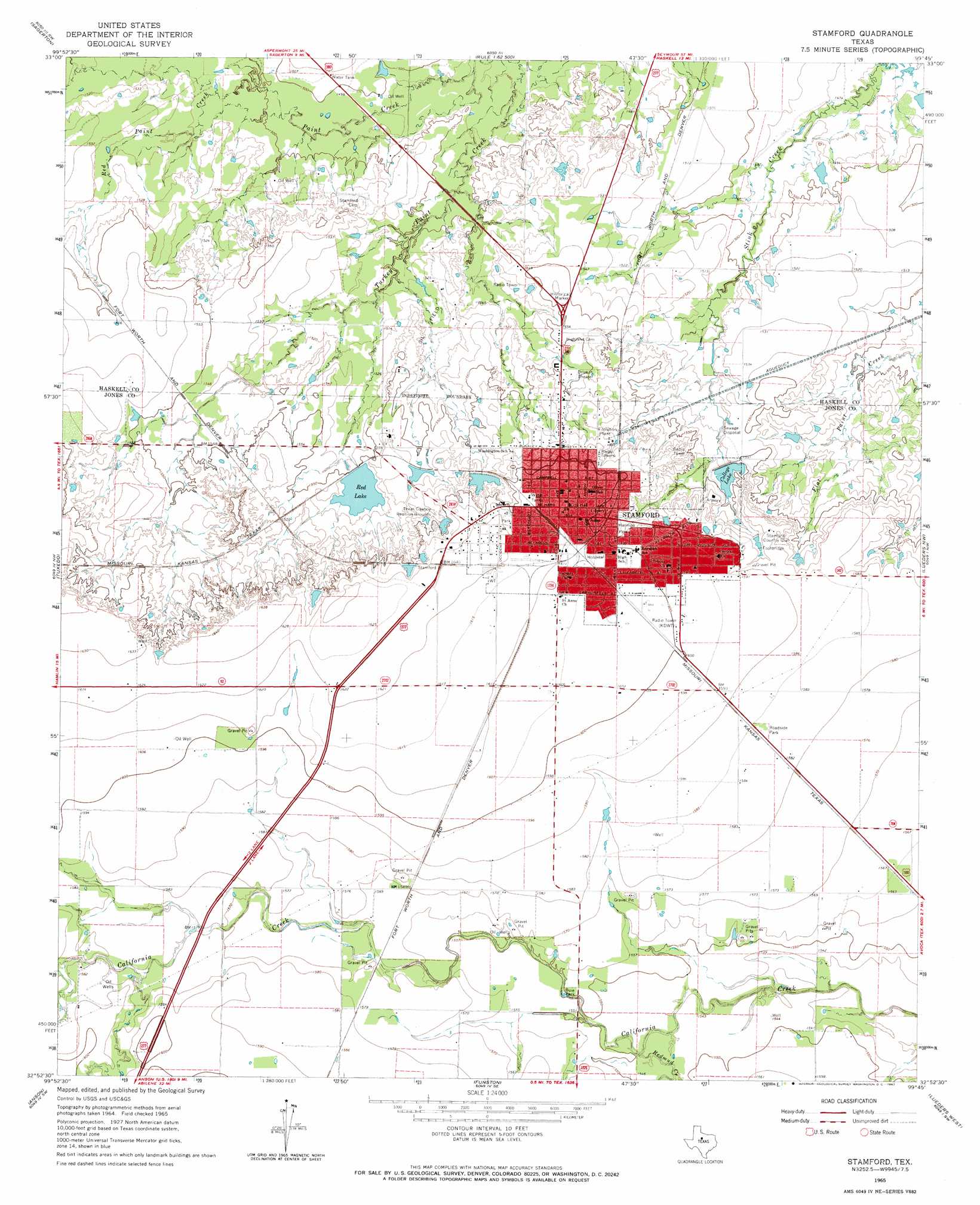
USGS Topo Quad 32099h7 - 1:24,000 scale
| Topo Map Name: | Stamford |
| USGS Topo Quad ID: | 32099h7 |
| Print Size: | ca. 21 1/4" wide x 27" high |
| Southeast Coordinates: | 32.875° N latitude / 99.75° W longitude |
| Map Center Coordinates: | 32.9375° N latitude / 99.8125° W longitude |
| U.S. State: | TX |
| Filename: | o32099h7.jpg |
| Download Map JPG Image: | Stamford topo map 1:24,000 scale |
| Map Type: | Topographic |
| Topo Series: | 7.5´ |
| Map Scale: | 1:24,000 |
| Source of Map Images: | United States Geological Survey (USGS) |
| Alternate Map Versions: |
Stamford TX 1965, updated 1967 Download PDF Buy paper map Stamford TX 2010 Download PDF Buy paper map Stamford TX 2012 Download PDF Buy paper map Stamford TX 2016 Download PDF Buy paper map |
1:24,000 Topo Quads surrounding Stamford
Old Glory |
Rule |
Pinkerton |
Haskell |
Irby |
Frog Mountain |
Sagerton |
Dudleys Creek |
Lake Stamford West |
Lake Stamford East |
Hamlin Ne |
Tuxedo |
Stamford |
Lueders Nw |
Lueders Ne |
Neinda |
Anson |
Funston |
Lueders West |
Lueders East |
Noodle Ne |
Truby |
Hawley Ne |
Nugent |
Smokey Draw |
> Back to 32099e1 at 1:100,000 scale
> Back to 32098a1 at 1:250,000 scale
> Back to U.S. Topo Maps home
Stamford topo map: Gazetteer
Stamford: Dams
Brick Yard Lake Number 2 Dam elevation 473m 1551′College Lake Dam elevation 479m 1571′
Red Lake Dam elevation 476m 1561′
Stamford: Parks
Buie Park elevation 472m 1548′Harmon Park elevation 483m 1584′
Stamford: Populated Places
Stamford elevation 492m 1614′Stamford: Post Offices
United States Post Office elevation 492m 1614′Stamford: Reservoirs
Brick Yard Lake Number 2 elevation 473m 1551′College Lake elevation 470m 1541′
Red Lake elevation 473m 1551′
Stamford: Streams
Red Paint Creek elevation 457m 1499′Redmud Creek elevation 470m 1541′
Stamford digital topo map on disk
Buy this Stamford topo map showing relief, roads, GPS coordinates and other geographical features, as a high-resolution digital map file on DVD: