Wingate Topo Map Texas
To zoom in, hover over the map of Wingate
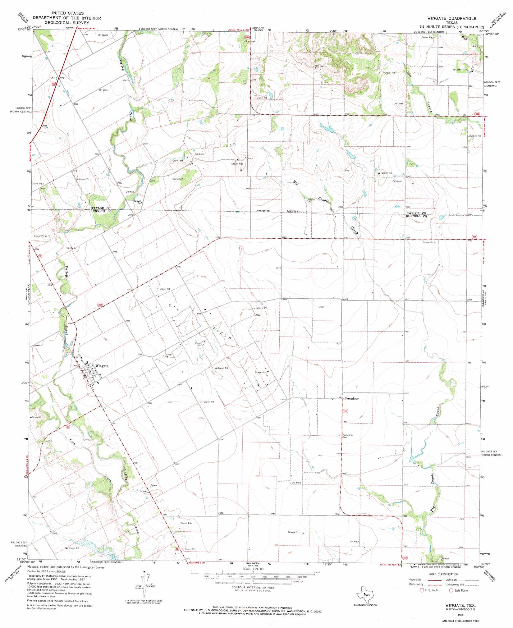
USGS Topo Quad 32100a1 - 1:24,000 scale
| Topo Map Name: | Wingate |
| USGS Topo Quad ID: | 32100a1 |
| Print Size: | ca. 21 1/4" wide x 27" high |
| Southeast Coordinates: | 32° N latitude / 100° W longitude |
| Map Center Coordinates: | 32.0625° N latitude / 100.0625° W longitude |
| U.S. State: | TX |
| Filename: | o32100a1.jpg |
| Download Map JPG Image: | Wingate topo map 1:24,000 scale |
| Map Type: | Topographic |
| Topo Series: | 7.5´ |
| Map Scale: | 1:24,000 |
| Source of Map Images: | United States Geological Survey (USGS) |
| Alternate Map Versions: |
Wingate TX 1967, updated 1969 Download PDF Buy paper map Wingate TX 2010 Download PDF Buy paper map Wingate TX 2012 Download PDF Buy paper map Wingate TX 2016 Download PDF Buy paper map |
1:24,000 Topo Quads surrounding Wingate
Holder Creek |
Nolan |
Mountain Pass |
View |
Buffalo Gap |
Blackwell Ne |
Hylton |
Shep |
Lake Abilene |
Tuscola |
Blackwell |
Church Peak |
Wingate |
Bradshaw |
Bald Knob |
Bronte |
Hog Mountain |
Wilmeth |
Winters |
Crews |
Shawville |
Maverick |
Herring Ranch |
Hatchel |
Benoit |
> Back to 32100a1 at 1:100,000 scale
> Back to 32100a1 at 1:250,000 scale
> Back to U.S. Topo Maps home
Wingate topo map: Gazetteer
Wingate: Dams
Mitchell Dam elevation 590m 1935′Soil Conservation Service Site 16 Dam elevation 650m 2132′
Soil Conservation Service Site 17 Dam elevation 625m 2050′
Wingate: Populated Places
Pumphrey elevation 606m 1988′Wingate elevation 610m 2001′
Wingate: Reservoirs
Mitchell Lake elevation 590m 1935′Soil Conservation Service Site 16 Reservoir elevation 650m 2132′
Soil Conservation Service Site 17 Reservoir elevation 625m 2050′
Wingate: Streams
Fish Creek elevation 591m 1938′Wingate digital topo map on disk
Buy this Wingate topo map showing relief, roads, GPS coordinates and other geographical features, as a high-resolution digital map file on DVD: