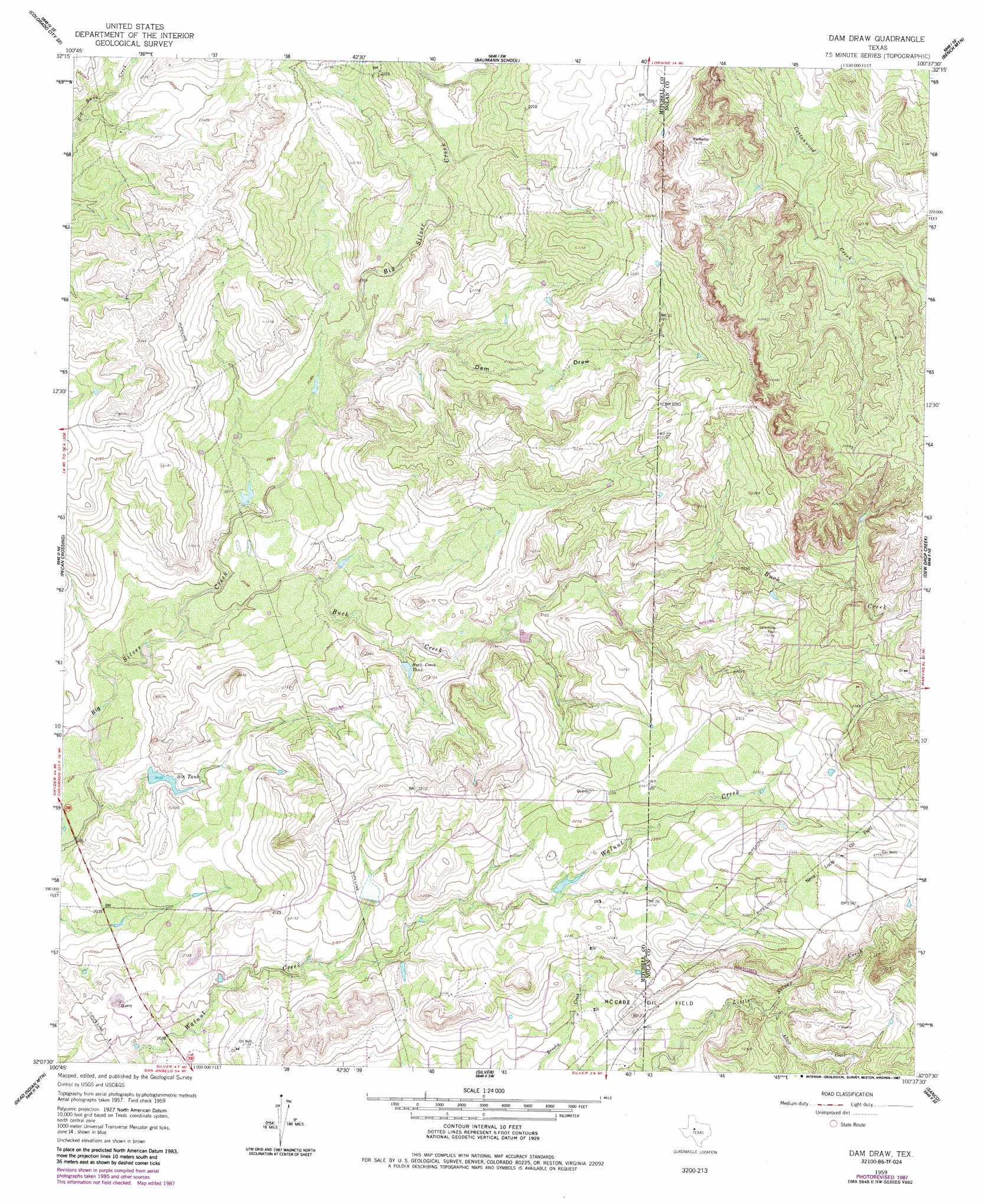
Dam Draw Topo Map Texas
To zoom in, hover over the map of Dam Draw
USGS Topo Quad 32100b6 - 1:24,000 scale
| Topo Map Name: | Dam Draw |
| USGS Topo Quad ID: | 32100b6 |
| Print Size: | ca. 21 1/4" wide x 27" high |
| Southeast Coordinates: | 32.125° N latitude / 100.625° W longitude |
| Map Center Coordinates: | 32.1875° N latitude / 100.6875° W longitude |
| U.S. State: | TX |
| Filename: | o32100b6.jpg |
| Download Map JPG Image: | Dam Draw topo map 1:24,000 scale |
| Map Type: | Topographic |
| Topo Series: | 7.5´ |
| Map Scale: | 1:24,000 |
| Source of Map Images: | United States Geological Survey (USGS) |
| Alternate Map Versions: |
Dam Draw TX 1959, updated 1960 Download PDF Buy paper map Dam Draw TX 1959, updated 1985 Download PDF Buy paper map Dam Draw TX 1959, updated 1987 Download PDF Buy paper map Dam Draw TX 2010 Download PDF Buy paper map Dam Draw TX 2012 Download PDF Buy paper map Dam Draw TX 2016 Download PDF Buy paper map |
1:24,000 Topo Quads surrounding Dam Draw
Cedar Bend |
Colorado City |
Loraine |
Roscoe |
Sweetwater |
Lake Colorado City |
Colorado City Se |
Baumann School |
Bench Mountain |
Lake Trammell |
Spade Ranch |
Pecan Crossing |
Dam Draw |
Dew Drop Creek |
Maryneal |
Mcwhorter Mountain |
Dead Indian Mountain |
Silver |
Sanco |
Blackwell Sw |
Sterling City Nw |
Crawford Slide |
Green Mountain |
Edith |
Robert Lee |
> Back to 32100a1 at 1:100,000 scale
> Back to 32100a1 at 1:250,000 scale
> Back to U.S. Topo Maps home
Dam Draw topo map: Gazetteer
Dam Draw: Reservoirs
Buck Creek Tank elevation 641m 2103′Six Tank elevation 618m 2027′
Dam Draw: Streams
Adair Creek elevation 670m 2198′Buck Creek elevation 618m 2027′
Dam Draw: Valleys
Dam Draw elevation 636m 2086′Dam Draw digital topo map on disk
Buy this Dam Draw topo map showing relief, roads, GPS coordinates and other geographical features, as a high-resolution digital map file on DVD: