Bench Mountain Topo Map Texas
To zoom in, hover over the map of Bench Mountain
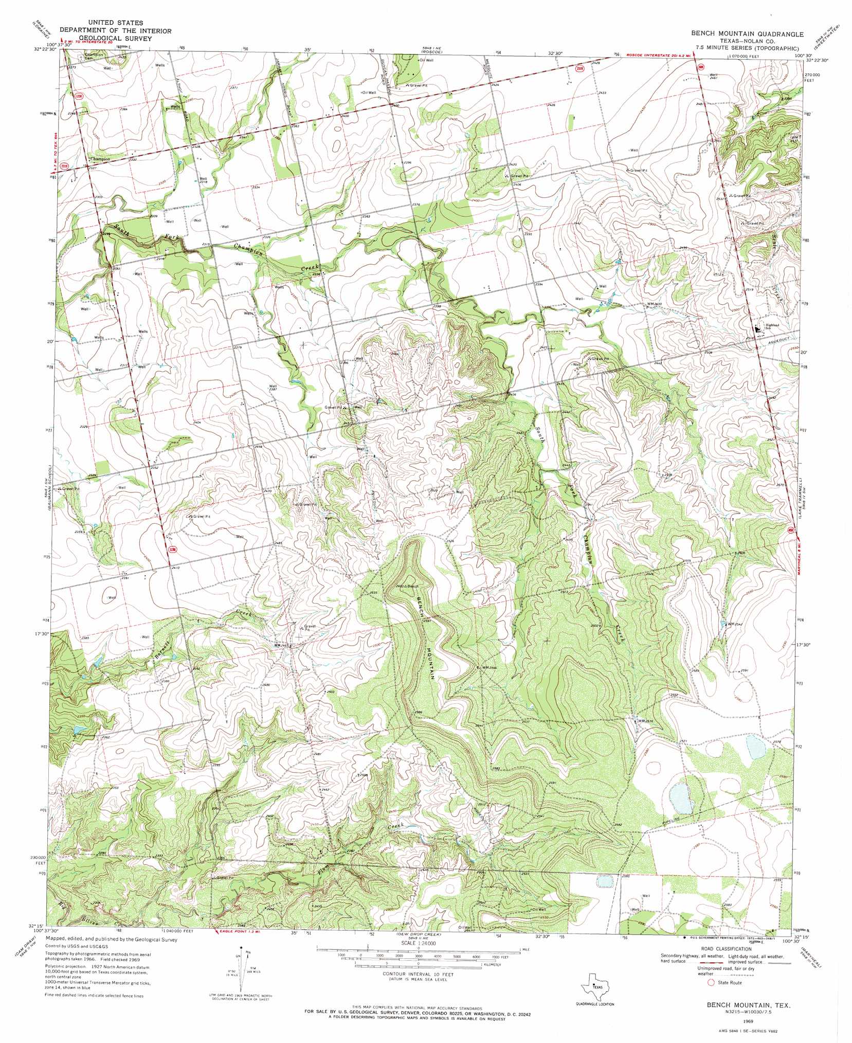
USGS Topo Quad 32100c5 - 1:24,000 scale
| Topo Map Name: | Bench Mountain |
| USGS Topo Quad ID: | 32100c5 |
| Print Size: | ca. 21 1/4" wide x 27" high |
| Southeast Coordinates: | 32.25° N latitude / 100.5° W longitude |
| Map Center Coordinates: | 32.3125° N latitude / 100.5625° W longitude |
| U.S. State: | TX |
| Filename: | o32100c5.jpg |
| Download Map JPG Image: | Bench Mountain topo map 1:24,000 scale |
| Map Type: | Topographic |
| Topo Series: | 7.5´ |
| Map Scale: | 1:24,000 |
| Source of Map Images: | United States Geological Survey (USGS) |
| Alternate Map Versions: |
Bench Mountain TX 1969, updated 1972 Download PDF Buy paper map Bench Mountain TX 2010 Download PDF Buy paper map Bench Mountain TX 2012 Download PDF Buy paper map Bench Mountain TX 2016 Download PDF Buy paper map |
1:24,000 Topo Quads surrounding Bench Mountain
China Grove |
Inadale |
Bernecker |
Busby |
Eskota |
Colorado City |
Loraine |
Roscoe |
Sweetwater |
Lake Sweetwater |
Colorado City Se |
Baumann School |
Bench Mountain |
Lake Trammell |
Holder Creek |
Pecan Crossing |
Dam Draw |
Dew Drop Creek |
Maryneal |
Blackwell Ne |
Dead Indian Mountain |
Silver |
Sanco |
Blackwell Sw |
Blackwell |
> Back to 32100a1 at 1:100,000 scale
> Back to 32100a1 at 1:250,000 scale
> Back to U.S. Topo Maps home
Bench Mountain topo map: Gazetteer
Bench Mountain: Populated Places
Champion elevation 709m 2326′Bench Mountain: Streams
Plum Creek elevation 691m 2267′Bench Mountain: Summits
Bench Mountain elevation 794m 2604′Bench Mountain digital topo map on disk
Buy this Bench Mountain topo map showing relief, roads, GPS coordinates and other geographical features, as a high-resolution digital map file on DVD: