Noodle Topo Map Texas
To zoom in, hover over the map of Noodle
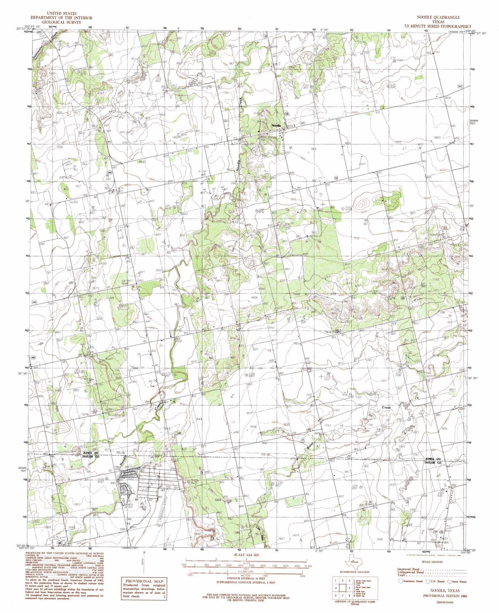
USGS Topo Quad 32100e1 - 1:24,000 scale
| Topo Map Name: | Noodle |
| USGS Topo Quad ID: | 32100e1 |
| Print Size: | ca. 21 1/4" wide x 27" high |
| Southeast Coordinates: | 32.5° N latitude / 100° W longitude |
| Map Center Coordinates: | 32.5625° N latitude / 100.0625° W longitude |
| U.S. State: | TX |
| Filename: | o32100e1.jpg |
| Download Map JPG Image: | Noodle topo map 1:24,000 scale |
| Map Type: | Topographic |
| Topo Series: | 7.5´ |
| Map Scale: | 1:24,000 |
| Source of Map Images: | United States Geological Survey (USGS) |
| Alternate Map Versions: |
Noodle TX 1984, updated 1984 Download PDF Buy paper map Noodle TX 2010 Download PDF Buy paper map Noodle TX 2012 Download PDF Buy paper map Noodle TX 2016 Download PDF Buy paper map |
1:24,000 Topo Quads surrounding Noodle
Royston |
Mccaulley |
Neinda |
Anson |
Funston |
Longworth |
Raven Creek North |
Noodle Ne |
Truby |
Hawley Ne |
Eskota |
Raven Creek South |
Noodle |
Stith |
Hawley |
Lake Sweetwater |
Chalk Peak |
Merkel West |
Merkel East |
Abilene West |
Holder Creek |
Nolan |
Mountain Pass |
View |
Buffalo Gap |
> Back to 32100e1 at 1:100,000 scale
> Back to 32100a1 at 1:250,000 scale
> Back to U.S. Topo Maps home
Noodle topo map: Gazetteer
Noodle: Oilfields
Ball Kuehn Oil Field elevation 540m 1771′Noodle Oil Field elevation 557m 1827′
Pitzer Oil Field elevation 554m 1817′
Noodle: Populated Places
Noodle elevation 556m 1824′Noodle: Streams
Little Bitter Creek elevation 553m 1814′Noodle digital topo map on disk
Buy this Noodle topo map showing relief, roads, GPS coordinates and other geographical features, as a high-resolution digital map file on DVD: