Dunn Topo Map Texas
To zoom in, hover over the map of Dunn
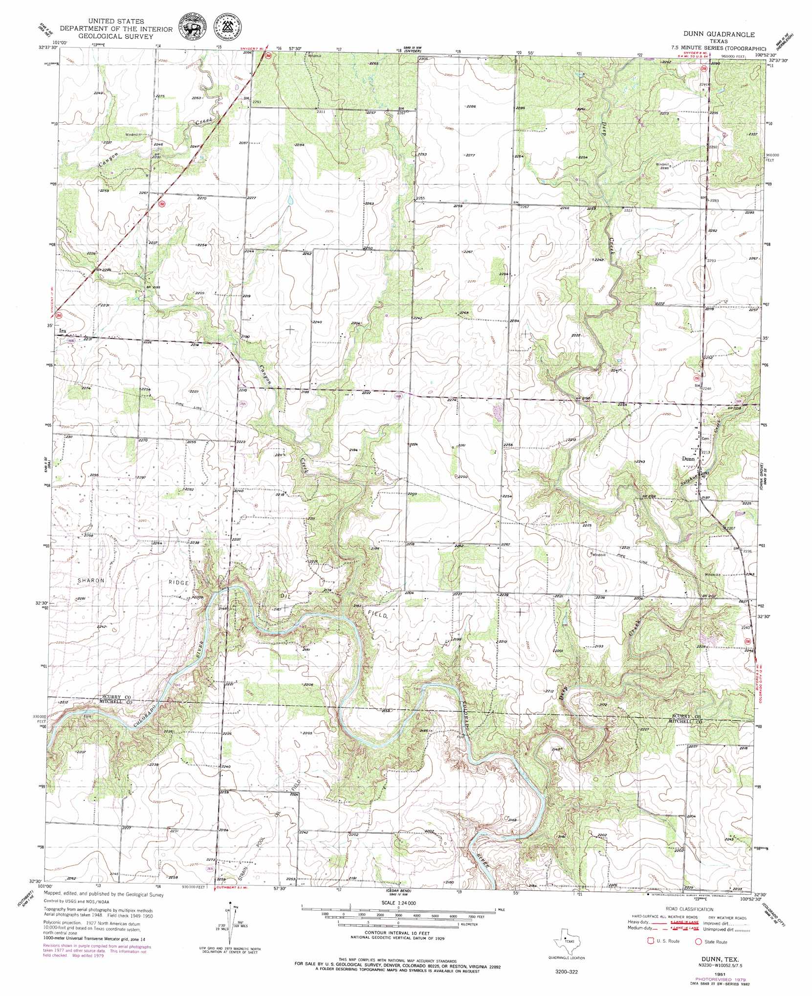
USGS Topo Quad 32100e8 - 1:24,000 scale
| Topo Map Name: | Dunn |
| USGS Topo Quad ID: | 32100e8 |
| Print Size: | ca. 21 1/4" wide x 27" high |
| Southeast Coordinates: | 32.5° N latitude / 100.875° W longitude |
| Map Center Coordinates: | 32.5625° N latitude / 100.9375° W longitude |
| U.S. State: | TX |
| Filename: | o32100e8.jpg |
| Download Map JPG Image: | Dunn topo map 1:24,000 scale |
| Map Type: | Topographic |
| Topo Series: | 7.5´ |
| Map Scale: | 1:24,000 |
| Source of Map Images: | United States Geological Survey (USGS) |
| Alternate Map Versions: |
Dunn TX 1951 Download PDF Buy paper map Dunn TX 1951, updated 1980 Download PDF Buy paper map Dunn TX 2010 Download PDF Buy paper map Dunn TX 2012 Download PDF Buy paper map Dunn TX 2016 Download PDF Buy paper map |
1:24,000 Topo Quads surrounding Dunn
Arah |
Dermott |
Brand |
Lloyd Mountain |
Camp Springs |
Ira Nw |
Ira Ne |
Snyder |
Hermleigh |
Inadale Nw |
Ira Sw |
Ira |
Dunn |
China Grove |
Inadale |
Vincent |
Cuthbert |
Cedar Bend |
Colorado City |
Loraine |
Iatan |
Westbrook |
Lake Colorado City |
Colorado City Se |
Baumann School |
> Back to 32100e1 at 1:100,000 scale
> Back to 32100a1 at 1:250,000 scale
> Back to U.S. Topo Maps home
Dunn topo map: Gazetteer
Dunn: Oilfields
Sharon Ridge Oil Field elevation 698m 2290′Dunn: Populated Places
Dunn elevation 676m 2217′Dunn: Streams
Canyon Creek elevation 652m 2139′Deep Creek elevation 638m 2093′
Little Sulphur Creek elevation 651m 2135′
Sulphur Creek elevation 662m 2171′
Dunn digital topo map on disk
Buy this Dunn topo map showing relief, roads, GPS coordinates and other geographical features, as a high-resolution digital map file on DVD: