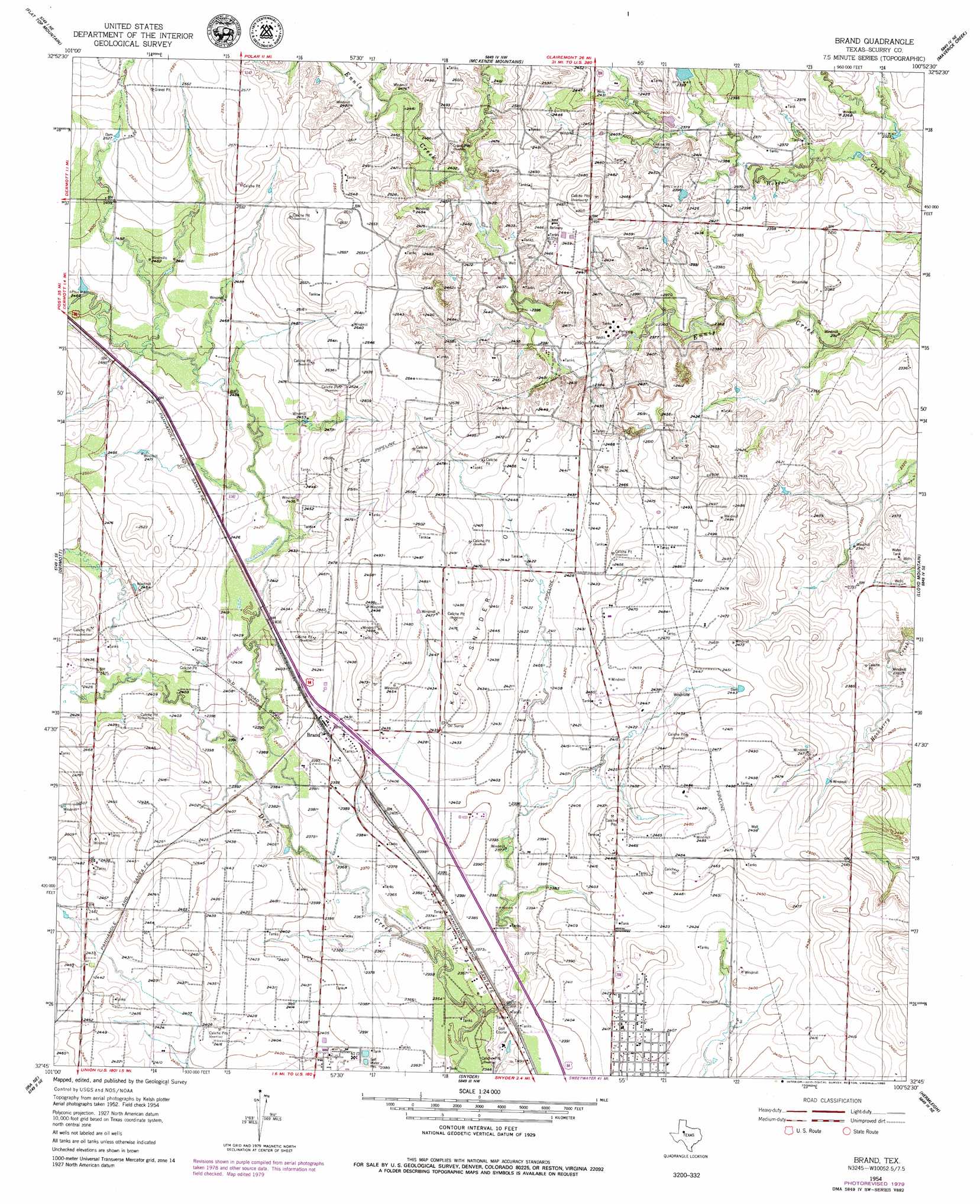
Brand Topo Map Texas
To zoom in, hover over the map of Brand
USGS Topo Quad 32100g8 - 1:24,000 scale
| Topo Map Name: | Brand |
| USGS Topo Quad ID: | 32100g8 |
| Print Size: | ca. 21 1/4" wide x 27" high |
| Southeast Coordinates: | 32.75° N latitude / 100.875° W longitude |
| Map Center Coordinates: | 32.8125° N latitude / 100.9375° W longitude |
| U.S. State: | TX |
| Filename: | o32100g8.jpg |
| Download Map JPG Image: | Brand topo map 1:24,000 scale |
| Map Type: | Topographic |
| Topo Series: | 7.5´ |
| Map Scale: | 1:24,000 |
| Source of Map Images: | United States Geological Survey (USGS) |
| Alternate Map Versions: |
Brand TX 1954, updated 1956 Download PDF Buy paper map Brand TX 1954, updated 1980 Download PDF Buy paper map Brand TX 2010 Download PDF Buy paper map Brand TX 2012 Download PDF Buy paper map Brand TX 2016 Download PDF Buy paper map |
1:24,000 Topo Quads surrounding Brand
Justiceburg |
Justiceburg Se |
Polar |
Cooper Mountain |
Gant Hills |
Fluvanna |
Flat Top Mountain |
Mckenzie Mountains |
Maverick Creek |
Hudd |
Arah |
Dermott |
Brand |
Lloyd Mountain |
Camp Springs |
Ira Nw |
Ira Ne |
Snyder |
Hermleigh |
Inadale Nw |
Ira Sw |
Ira |
Dunn |
China Grove |
Inadale |
> Back to 32100e1 at 1:100,000 scale
> Back to 32100a1 at 1:250,000 scale
> Back to U.S. Topo Maps home
Brand topo map: Gazetteer
Brand: Oilfields
Kelly Snyder Oil Field elevation 737m 2417′Brand: Populated Places
Brand elevation 738m 2421′Brand digital topo map on disk
Buy this Brand topo map showing relief, roads, GPS coordinates and other geographical features, as a high-resolution digital map file on DVD: