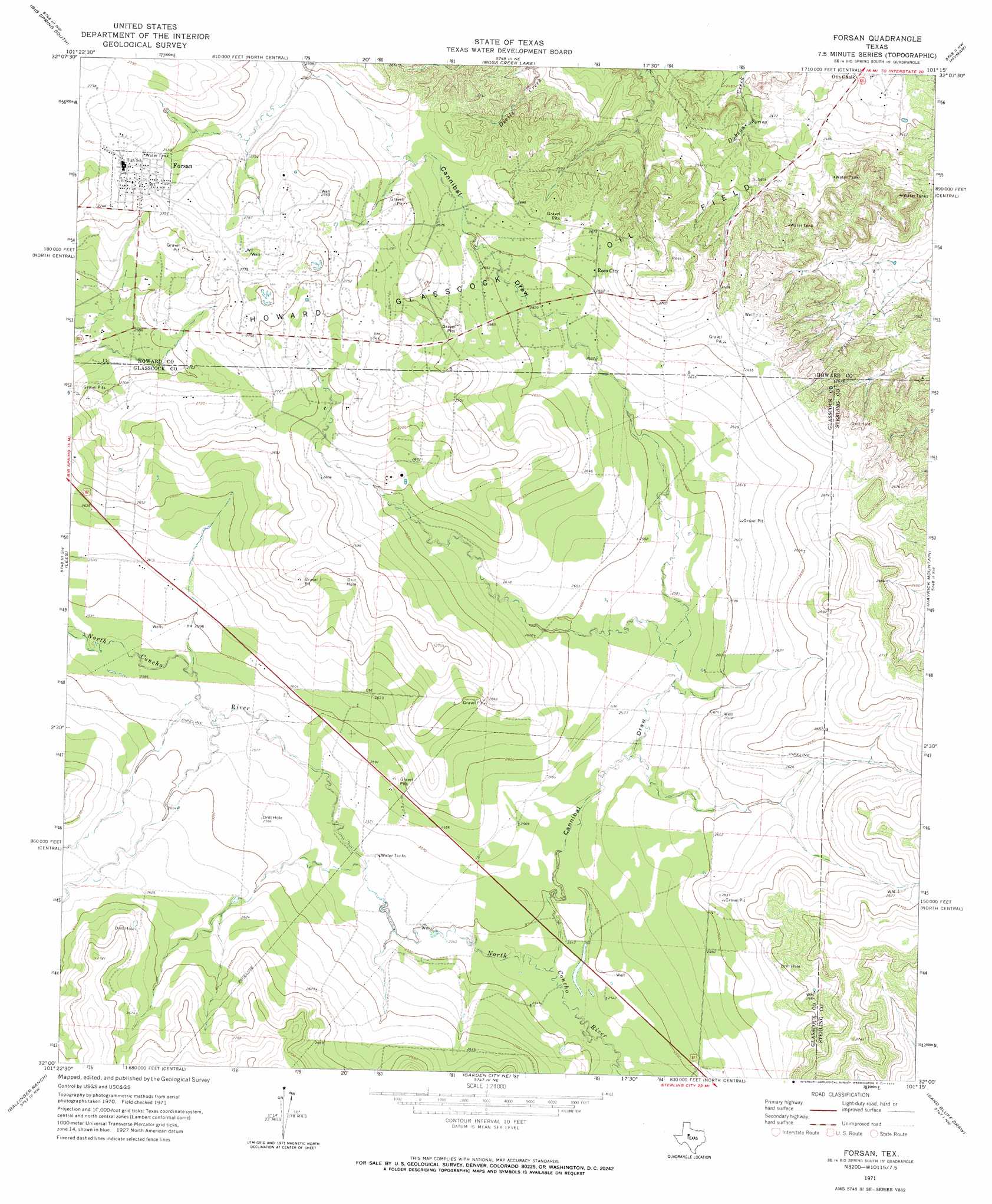
Forsan Topo Map Texas
To zoom in, hover over the map of Forsan
USGS Topo Quad 32101a3 - 1:24,000 scale
| Topo Map Name: | Forsan |
| USGS Topo Quad ID: | 32101a3 |
| Print Size: | ca. 21 1/4" wide x 27" high |
| Southeast Coordinates: | 32° N latitude / 101.25° W longitude |
| Map Center Coordinates: | 32.0625° N latitude / 101.3125° W longitude |
| U.S. State: | TX |
| Filename: | o32101a3.jpg |
| Download Map JPG Image: | Forsan topo map 1:24,000 scale |
| Map Type: | Topographic |
| Topo Series: | 7.5´ |
| Map Scale: | 1:24,000 |
| Source of Map Images: | United States Geological Survey (USGS) |
| Alternate Map Versions: |
Forsan TX 1971, updated 1974 Download PDF Buy paper map Forsan TX 2010 Download PDF Buy paper map Forsan TX 2012 Download PDF Buy paper map Forsan TX 2016 Download PDF Buy paper map |
1:24,000 Topo Quads surrounding Forsan
Knott Se |
Big Spring North |
Coahoma |
Iatan |
Westbrook |
Elbow |
Big Spring South |
Moss Creek Lake |
Hyman |
Hyman Ne |
Lucian Wells Ranch |
Lees |
Forsan |
Hayrick Mountain |
Buffalo Draw |
Dewey Lake Ne |
Ballinger Ranch |
Garden City Ne |
Sand Bluff Draw |
Cumbie Draw Ne |
Dewey Lake Se |
Garden City |
Currie Reservoir |
Glass Ranch |
Cumbie Draw |
> Back to 32101a1 at 1:100,000 scale
> Back to 32100a1 at 1:250,000 scale
> Back to U.S. Topo Maps home
Forsan topo map: Gazetteer
Forsan: Oilfields
Howard Glasscock Oil Field elevation 812m 2664′Forsan: Populated Places
Forsan elevation 850m 2788′Ross City elevation 803m 2634′
Forsan: Valleys
Cannibal Draw elevation 774m 2539′Forsan digital topo map on disk
Buy this Forsan topo map showing relief, roads, GPS coordinates and other geographical features, as a high-resolution digital map file on DVD: