Iatan Topo Map Texas
To zoom in, hover over the map of Iatan
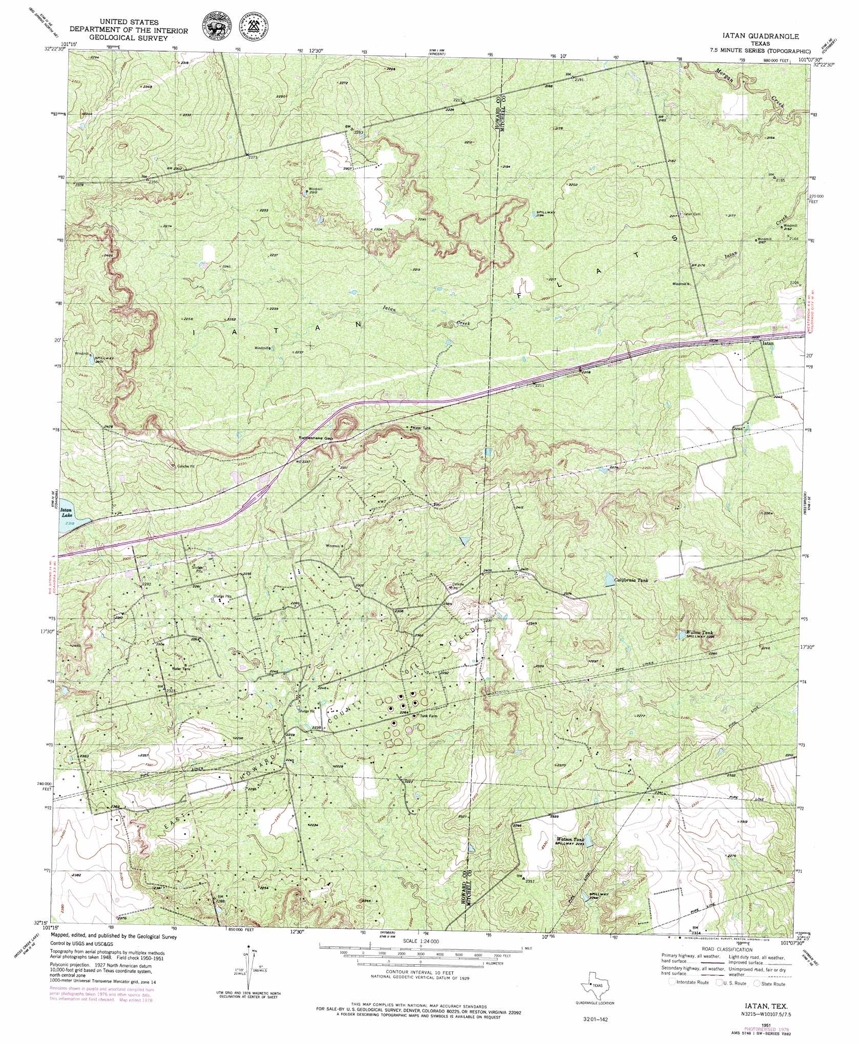
USGS Topo Quad 32101c2 - 1:24,000 scale
| Topo Map Name: | Iatan |
| USGS Topo Quad ID: | 32101c2 |
| Print Size: | ca. 21 1/4" wide x 27" high |
| Southeast Coordinates: | 32.25° N latitude / 101.125° W longitude |
| Map Center Coordinates: | 32.3125° N latitude / 101.1875° W longitude |
| U.S. State: | TX |
| Filename: | o32101c2.jpg |
| Download Map JPG Image: | Iatan topo map 1:24,000 scale |
| Map Type: | Topographic |
| Topo Series: | 7.5´ |
| Map Scale: | 1:24,000 |
| Source of Map Images: | United States Geological Survey (USGS) |
| Alternate Map Versions: |
Iatan TX 1951, updated 1979 Download PDF Buy paper map Iatan TX 1952 Download PDF Buy paper map Iatan TX 2010 Download PDF Buy paper map Iatan TX 2012 Download PDF Buy paper map Iatan TX 2016 Download PDF Buy paper map |
1:24,000 Topo Quads surrounding Iatan
Gunsight Draw |
Gunsight Draw Se |
Ira Sw |
Ira |
Dunn |
Luther |
Big Spring North Ne |
Vincent |
Cuthbert |
Cedar Bend |
Big Spring North |
Coahoma |
Iatan |
Westbrook |
Lake Colorado City |
Big Spring South |
Moss Creek Lake |
Hyman |
Hyman Ne |
Spade Ranch |
Lees |
Forsan |
Hayrick Mountain |
Buffalo Draw |
Mcwhorter Mountain |
> Back to 32101a1 at 1:100,000 scale
> Back to 32100a1 at 1:250,000 scale
> Back to U.S. Topo Maps home
Iatan topo map: Gazetteer
Iatan: Flats
Iatan Flats elevation 671m 2201′Iatan: Gaps
Rattlesnake Gap elevation 701m 2299′Iatan: Oilfields
East Howard County Oil Field elevation 687m 2253′Iatan: Populated Places
Iatan elevation 680m 2230′Iatan: Reservoirs
California Tank elevation 702m 2303′Iatan Lake elevation 707m 2319′
Watson Tank elevation 694m 2276′
Willow Tank elevation 700m 2296′
Iatan digital topo map on disk
Buy this Iatan topo map showing relief, roads, GPS coordinates and other geographical features, as a high-resolution digital map file on DVD: