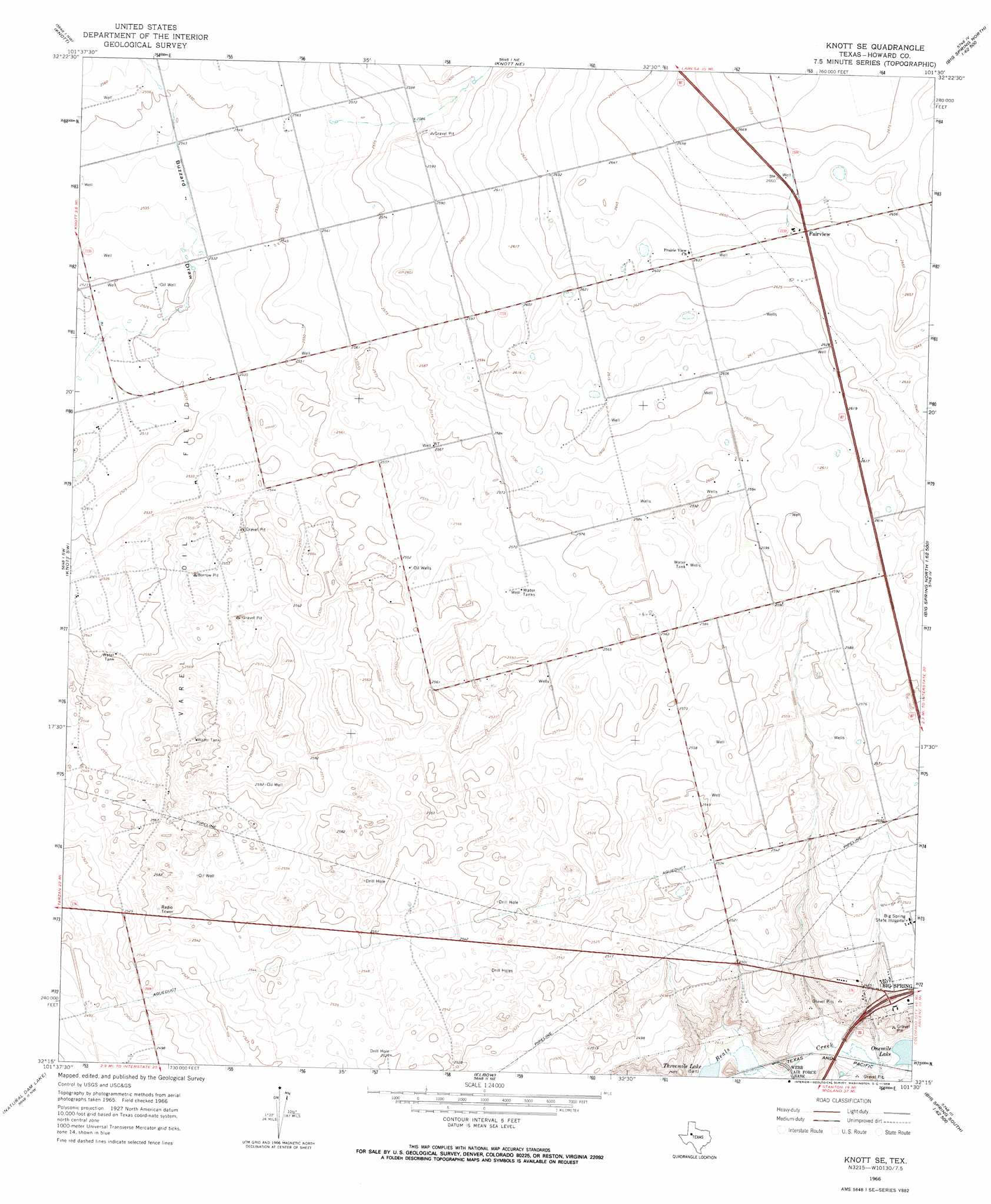
Knott Se Topo Map Texas
To zoom in, hover over the map of Knott Se
USGS Topo Quad 32101c5 - 1:24,000 scale
| Topo Map Name: | Knott Se |
| USGS Topo Quad ID: | 32101c5 |
| Print Size: | ca. 21 1/4" wide x 27" high |
| Southeast Coordinates: | 32.25° N latitude / 101.5° W longitude |
| Map Center Coordinates: | 32.3125° N latitude / 101.5625° W longitude |
| U.S. State: | TX |
| Filename: | o32101c5.jpg |
| Download Map JPG Image: | Knott Se topo map 1:24,000 scale |
| Map Type: | Topographic |
| Topo Series: | 7.5´ |
| Map Scale: | 1:24,000 |
| Source of Map Images: | United States Geological Survey (USGS) |
| Alternate Map Versions: |
Knott SE TX 1966, updated 1968 Download PDF Buy paper map Knott SE TX 1966, updated 1968 Download PDF Buy paper map Knott SE TX 2010 Download PDF Buy paper map Knott SE TX 2012 Download PDF Buy paper map Knott SE TX 2016 Download PDF Buy paper map |
1:24,000 Topo Quads surrounding Knott Se
Sparenberg |
Ackerly |
Vealmoor |
Gunsight Draw |
Gunsight Draw Se |
Merrick |
Knott |
Knott Ne |
Luther |
Big Spring North Ne |
Lenorah East |
Knott Sw |
Knott Se |
Big Spring North |
Coahoma |
Stanton |
Natural Dam Lake |
Elbow |
Big Spring South |
Moss Creek Lake |
Stanton Se |
Houston Ranch |
Lucian Wells Ranch |
Lees |
Forsan |
> Back to 32101a1 at 1:100,000 scale
> Back to 32100a1 at 1:250,000 scale
> Back to U.S. Topo Maps home
Knott Se topo map: Gazetteer
Knott Se: Oilfields
Varel Oil Field elevation 779m 2555′Knott Se: Parks
Roy Andrews Park elevation 761m 2496′Knott Se: Populated Places
Fairview elevation 806m 2644′Knott Se digital topo map on disk
Buy this Knott Se topo map showing relief, roads, GPS coordinates and other geographical features, as a high-resolution digital map file on DVD: