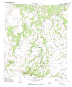
Gunsight Draw Topo Map Texas
To zoom in, hover over the map of Gunsight Draw
USGS Topo Quad 32101e4 - 1:24,000 scale
| Topo Map Name: | Gunsight Draw |
| USGS Topo Quad ID: | 32101e4 |
| Print Size: | ca. 21 1/4" wide x 27" high |
| Southeast Coordinates: | 32.5° N latitude / 101.375° W longitude |
| Map Center Coordinates: | 32.5625° N latitude / 101.4375° W longitude |
| U.S. State: | TX |
| Filename: | o32101e4.jpg |
| Download Map JPG Image: | Gunsight Draw topo map 1:24,000 scale |
| Map Type: | Topographic |
| Topo Series: | 7.5´ |
| Map Scale: | 1:24,000 |
| Source of Map Images: | United States Geological Survey (USGS) |
| Alternate Map Versions: |
Gunsight Draw TX 1970, updated 1973 Download PDF Buy paper map Gunsight Draw TX 2010 Download PDF Buy paper map Gunsight Draw TX 2012 Download PDF Buy paper map Gunsight Draw TX 2016 Download PDF Buy paper map |
1:24,000 Topo Quads surrounding Gunsight Draw
> Back to 32101e1 at 1:100,000 scale
> Back to 32100a1 at 1:250,000 scale
> Back to U.S. Topo Maps home
Gunsight Draw topo map: Gazetteer
Gunsight Draw: Reservoirs
Bombsight Tank elevation 756m 2480′Catfish Tank elevation 734m 2408′
Clear Tank elevation 747m 2450′
Deep Tank elevation 738m 2421′
Diamond Tank elevation 756m 2480′
Double Tanks elevation 741m 2431′
Dugout Tank elevation 755m 2477′
Fish Tank elevation 750m 2460′
House Tank elevation 763m 2503′
House Tanks elevation 771m 2529′
Lost Tank elevation 741m 2431′
Munger Tank elevation 729m 2391′
North Pasture Tank elevation 751m 2463′
Pipeline Tank elevation 723m 2372′
Rock Tank elevation 721m 2365′
Root Plow Tank elevation 756m 2480′
Shady Tank elevation 738m 2421′
South Tank elevation 764m 2506′
Southwest Tank elevation 735m 2411′
Triple Tanks elevation 760m 2493′
White Tank elevation 734m 2408′
Gunsight Draw: Streams
Plum Creek elevation 708m 2322′Rattlesnake Creek elevation 717m 2352′
Gunsight Draw: Summits
East Gunsight Mountain elevation 812m 2664′West Gunsight Mountain elevation 819m 2687′
Gunsight Draw: Valleys
German Hollow elevation 723m 2372′Gunsight Draw elevation 707m 2319′
Gunsight Draw digital topo map on disk
Buy this Gunsight Draw topo map showing relief, roads, GPS coordinates and other geographical features, as a high-resolution digital map file on DVD:


