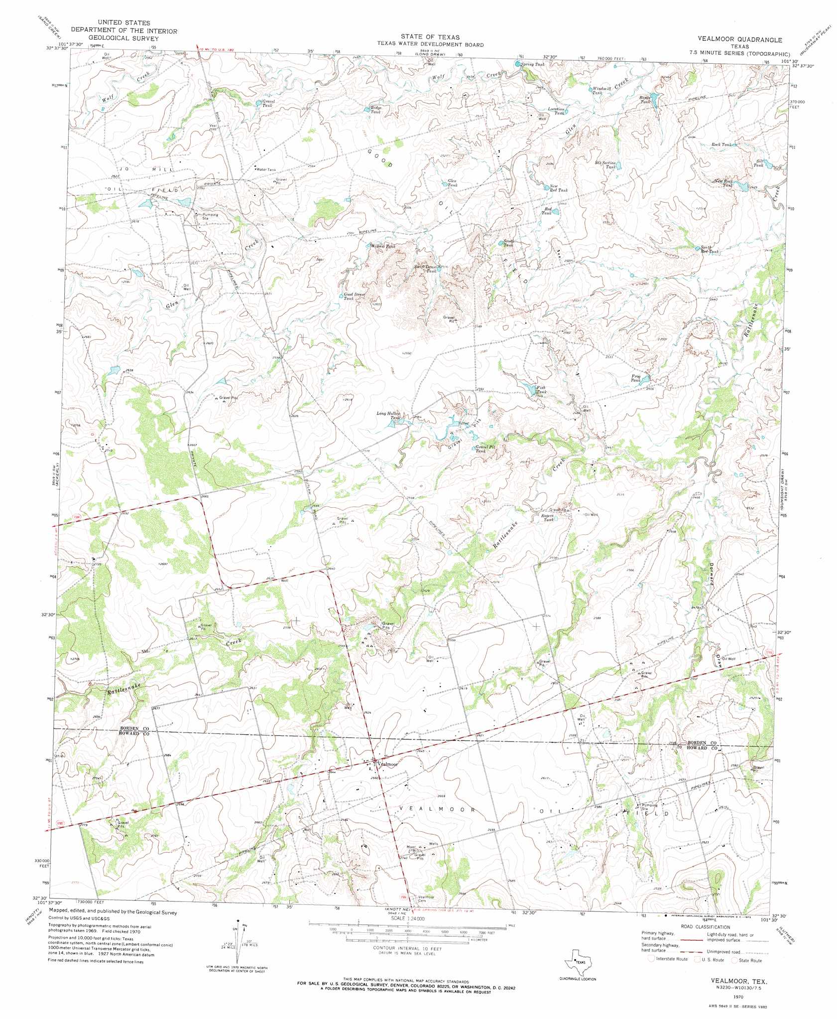
Vealmoor Topo Map Texas
To zoom in, hover over the map of Vealmoor
USGS Topo Quad 32101e5 - 1:24,000 scale
| Topo Map Name: | Vealmoor |
| USGS Topo Quad ID: | 32101e5 |
| Print Size: | ca. 21 1/4" wide x 27" high |
| Southeast Coordinates: | 32.5° N latitude / 101.5° W longitude |
| Map Center Coordinates: | 32.5625° N latitude / 101.5625° W longitude |
| U.S. State: | TX |
| Filename: | o32101e5.jpg |
| Download Map JPG Image: | Vealmoor topo map 1:24,000 scale |
| Map Type: | Topographic |
| Topo Series: | 7.5´ |
| Map Scale: | 1:24,000 |
| Source of Map Images: | United States Geological Survey (USGS) |
| Alternate Map Versions: |
Vealmoor TX 1970, updated 1973 Download PDF Buy paper map Vealmoor TX 2010 Download PDF Buy paper map Vealmoor TX 2012 Download PDF Buy paper map Vealmoor TX 2016 Download PDF Buy paper map |
1:24,000 Topo Quads surrounding Vealmoor
Hancock |
Indian Canyon |
Holloway Canyon |
Gail |
Fivemile Creek |
Key |
Sand Creek |
Long Draw |
Mushaway Peak |
Gunsight Draw Ne |
Sparenberg |
Ackerly |
Vealmoor |
Gunsight Draw |
Gunsight Draw Se |
Merrick |
Knott |
Knott Ne |
Luther |
Big Spring North Ne |
Lenorah East |
Knott Sw |
Knott Se |
Big Spring North |
Coahoma |
> Back to 32101e1 at 1:100,000 scale
> Back to 32100a1 at 1:250,000 scale
> Back to U.S. Topo Maps home
Vealmoor topo map: Gazetteer
Vealmoor: Oilfields
Jo Mill Oil Field elevation 800m 2624′Vealmoor Oil Field elevation 807m 2647′
Vealmoor: Populated Places
Vealmoor elevation 811m 2660′Vealmoor: Reservoirs
Bones Tank elevation 748m 2454′Fish Tank elevation 775m 2542′
Frog Tank elevation 763m 2503′
Glen Tank elevation 755m 2477′
Good Draw Tank elevation 767m 2516′
Gravel Pit Tank elevation 774m 2539′
Gravel Tank elevation 771m 2529′
Location Tank elevation 745m 2444′
Long Hollow Tank elevation 782m 2565′
New Red Tank elevation 751m 2463′
New Rock Tank elevation 739m 2424′
Red Tank elevation 754m 2473′
Ridge Tank elevation 766m 2513′
Rock Tank elevation 750m 2460′
Rogers Tank elevation 768m 2519′
Silt Tank elevation 734m 2408′
Six Section Tank elevation 755m 2477′
South Red Tank elevation 749m 2457′
South Tank elevation 775m 2542′
Spring Tank elevation 749m 2457′
Swift Draw Tank elevation 767m 2516′
Willow Tank elevation 761m 2496′
Windmill Tank elevation 741m 2431′
Vealmoor: Streams
Wolf Creek elevation 740m 2427′Vealmoor: Valleys
Dorward Draw elevation 750m 2460′Vealmoor digital topo map on disk
Buy this Vealmoor topo map showing relief, roads, GPS coordinates and other geographical features, as a high-resolution digital map file on DVD: