Ira Nw Topo Map Texas
To zoom in, hover over the map of Ira Nw
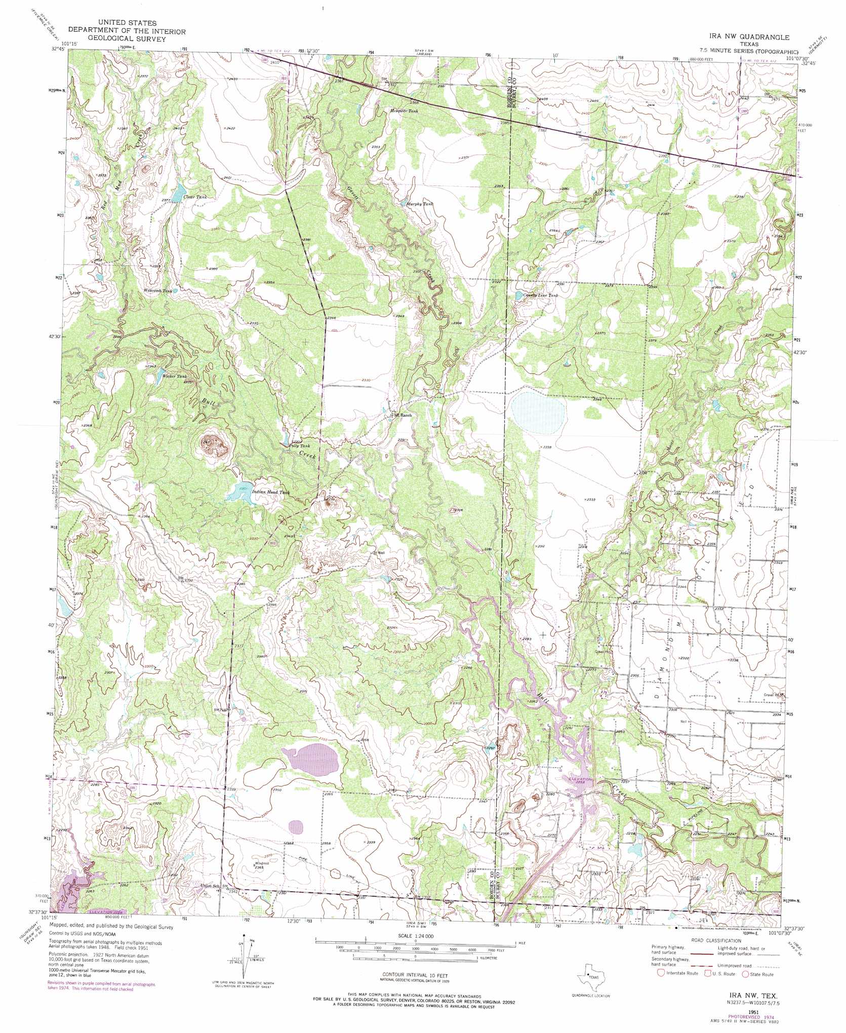
USGS Topo Quad 32101f2 - 1:24,000 scale
| Topo Map Name: | Ira Nw |
| USGS Topo Quad ID: | 32101f2 |
| Print Size: | ca. 21 1/4" wide x 27" high |
| Southeast Coordinates: | 32.625° N latitude / 101.125° W longitude |
| Map Center Coordinates: | 32.6875° N latitude / 101.1875° W longitude |
| U.S. State: | TX |
| Filename: | o32101f2.jpg |
| Download Map JPG Image: | Ira Nw topo map 1:24,000 scale |
| Map Type: | Topographic |
| Topo Series: | 7.5´ |
| Map Scale: | 1:24,000 |
| Source of Map Images: | United States Geological Survey (USGS) |
| Alternate Map Versions: |
Ira NW TX 1951, updated 1953 Download PDF Buy paper map Ira NW TX 1951, updated 1976 Download PDF Buy paper map Ira NW TX 2010 Download PDF Buy paper map Ira NW TX 2012 Download PDF Buy paper map Ira NW TX 2016 Download PDF Buy paper map |
1:24,000 Topo Quads surrounding Ira Nw
Beal Hollow |
Gail Ne |
Fluvanna |
Flat Top Mountain |
Mckenzie Mountains |
Gail |
Fivemile Creek |
Arah |
Dermott |
Brand |
Mushaway Peak |
Gunsight Draw Ne |
Ira Nw |
Ira Ne |
Snyder |
Gunsight Draw |
Gunsight Draw Se |
Ira Sw |
Ira |
Dunn |
Luther |
Big Spring North Ne |
Vincent |
Cuthbert |
Cedar Bend |
> Back to 32101e1 at 1:100,000 scale
> Back to 32100a1 at 1:250,000 scale
> Back to U.S. Topo Maps home
Ira Nw topo map: Gazetteer
Ira Nw: Dams
Indian Head Tank Dam elevation 702m 2303′Ira Nw: Lakes
Divesion Lake elevation 689m 2260′Ira Nw: Reservoirs
Clear Tank elevation 724m 2375′County Line Tank elevation 715m 2345′
Indian Head Tank elevation 702m 2303′
Mesquite Tank elevation 720m 2362′
Murphy Tank elevation 717m 2352′
Polly Tank elevation 701m 2299′
Wascomb Tank elevation 714m 2342′
Wicker Tank elevation 706m 2316′
Ira Nw: Streams
Gavett Creek elevation 695m 2280′Mooar Creek elevation 689m 2260′
Red Mud Creek elevation 701m 2299′
Ira Nw digital topo map on disk
Buy this Ira Nw topo map showing relief, roads, GPS coordinates and other geographical features, as a high-resolution digital map file on DVD: