North Cowden Topo Map Texas
To zoom in, hover over the map of North Cowden
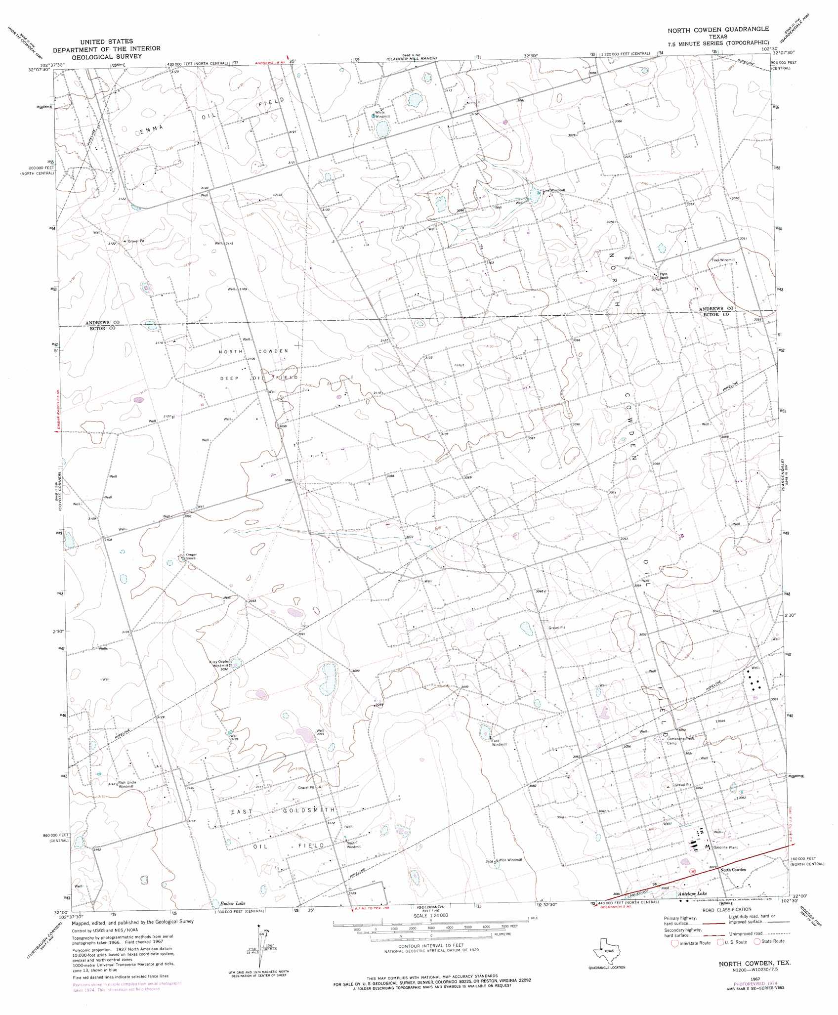
USGS Topo Quad 32102a5 - 1:24,000 scale
| Topo Map Name: | North Cowden |
| USGS Topo Quad ID: | 32102a5 |
| Print Size: | ca. 21 1/4" wide x 27" high |
| Southeast Coordinates: | 32° N latitude / 102.5° W longitude |
| Map Center Coordinates: | 32.0625° N latitude / 102.5625° W longitude |
| U.S. State: | TX |
| Filename: | o32102a5.jpg |
| Download Map JPG Image: | North Cowden topo map 1:24,000 scale |
| Map Type: | Topographic |
| Topo Series: | 7.5´ |
| Map Scale: | 1:24,000 |
| Source of Map Images: | United States Geological Survey (USGS) |
| Alternate Map Versions: |
North Cowden TX 1967, updated 1970 Download PDF Buy paper map North Cowden TX 1967, updated 1975 Download PDF Buy paper map North Cowden TX 2010 Download PDF Buy paper map North Cowden TX 2012 Download PDF Buy paper map North Cowden TX 2016 Download PDF Buy paper map |
1:24,000 Topo Quads surrounding North Cowden
Whalen Lake |
Lazy X Ranch |
Andrews |
Five Wells Ranch Sw |
Five Wells Ranch Se |
Sand Ranch |
North Cowden Nw |
Clabber Hill Ranch |
Gardendale Nw |
Baird Lake |
Bedford Ranch |
Coyote Corner |
North Cowden |
Gardendale |
Hackberry Lake |
Notrees |
Turnbaugh Corner |
Goldsmith |
Odessa Nw |
Odessa Ne |
Amburgey Ranch |
Red Lakes |
Douro |
Odessa Sw |
Odessa Se |
> Back to 32102a1 at 1:100,000 scale
> Back to 32102a1 at 1:250,000 scale
> Back to U.S. Topo Maps home
North Cowden topo map: Gazetteer
North Cowden: Lakes
Embar Lake elevation 957m 3139′North Cowden: Oilfields
East Goldsmith Oil Field elevation 954m 3129′North Cowden Deep Oil Field elevation 946m 3103′
North Cowden Oil Field elevation 933m 3061′
North Cowden: Populated Places
North Cowden elevation 937m 3074′North Cowden digital topo map on disk
Buy this North Cowden topo map showing relief, roads, GPS coordinates and other geographical features, as a high-resolution digital map file on DVD: