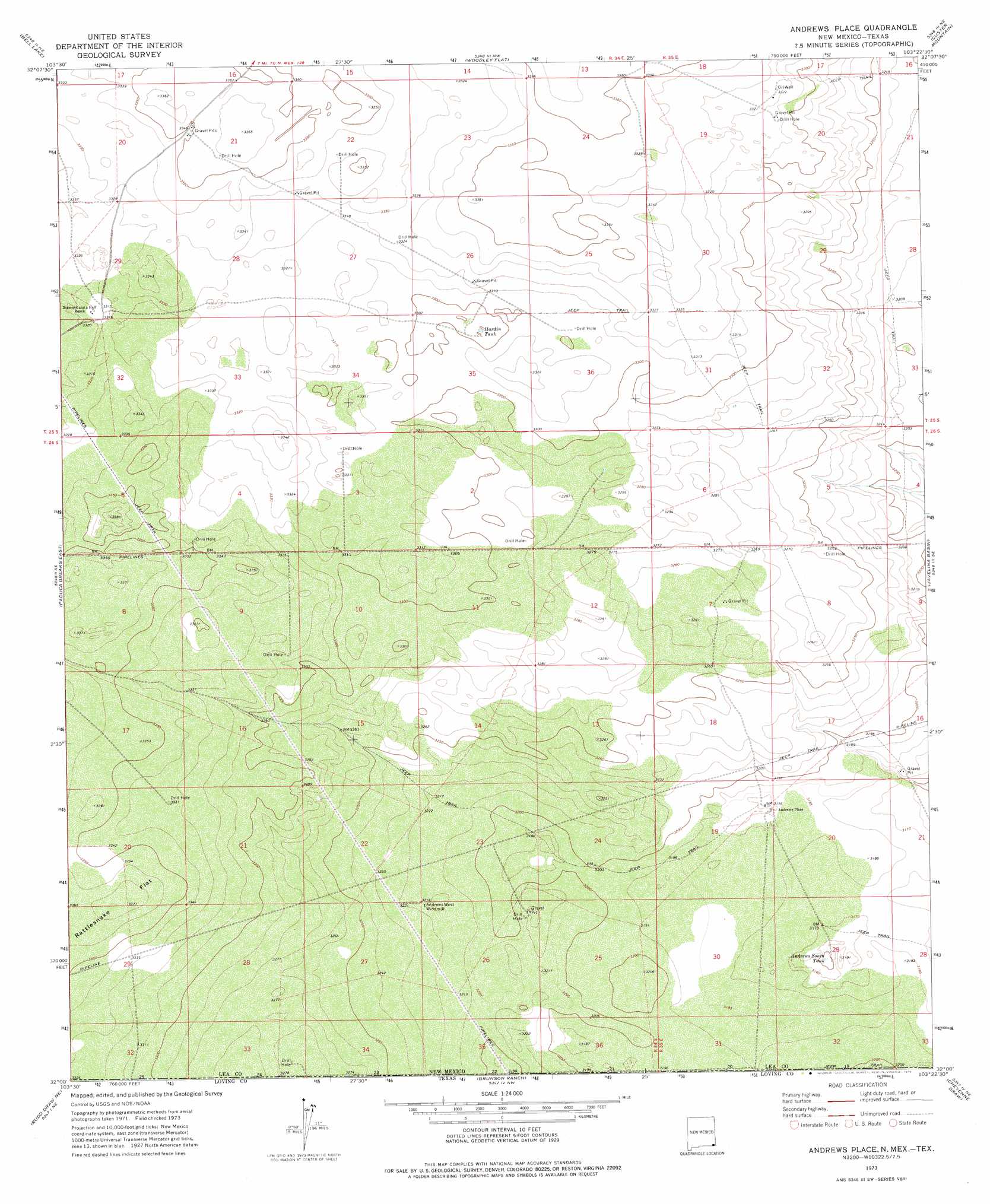
Andrews Place Topo Map New Mexico
To zoom in, hover over the map of Andrews Place
USGS Topo Quad 32103a4 - 1:24,000 scale
| Topo Map Name: | Andrews Place |
| USGS Topo Quad ID: | 32103a4 |
| Print Size: | ca. 21 1/4" wide x 27" high |
| Southeast Coordinates: | 32° N latitude / 103.375° W longitude |
| Map Center Coordinates: | 32.0625° N latitude / 103.4375° W longitude |
| U.S. States: | NM, TX |
| Filename: | o32103a4.jpg |
| Download Map JPG Image: | Andrews Place topo map 1:24,000 scale |
| Map Type: | Topographic |
| Topo Series: | 7.5´ |
| Map Scale: | 1:24,000 |
| Source of Map Images: | United States Geological Survey (USGS) |
| Alternate Map Versions: |
Andrews Place NM 1973, updated 1976 Download PDF Buy paper map Andrews Place NM 2010 Download PDF Buy paper map Andrews Place NM 2013 Download PDF Buy paper map Andrews Place NM 2017 Download PDF Buy paper map |
1:24,000 Topo Quads surrounding Andrews Place
Bootleg Ridge |
Tip Top Wells |
San Simon Sink |
East Lake |
Rattlesnake Canyon |
Paduca Breaks Nw |
Bell Lake |
Woodley Flat |
Custer Mountain |
Jal Nw |
Paduca Breaks West |
Paduca Breaks East |
Andrews Place |
Javelina Basin |
Jal |
Kyle Ranch |
Rudd Draw Ne |
Brunson Ranch |
Cheyenne Draw |
Kermit Nw |
Lindley Ranch |
Rudd Draw |
Cheyenne Draw Sw |
Cheyenne Draw Se |
Wink North |
> Back to 32103a1 at 1:100,000 scale
> Back to 32102a1 at 1:250,000 scale
> Back to U.S. Topo Maps home
Andrews Place topo map: Gazetteer
Andrews Place: Populated Places
Andrews Place elevation 969m 3179′Andrews Place: Reservoirs
Andrews South Tank elevation 960m 3149′Andrews West Tank elevation 982m 3221′
Hardin Tank elevation 1006m 3300′
Andrews Place digital topo map on disk
Buy this Andrews Place topo map showing relief, roads, GPS coordinates and other geographical features, as a high-resolution digital map file on DVD: