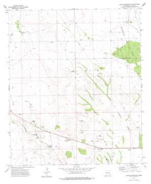
Custer Mountain Topo Map New Mexico
To zoom in, hover over the map of Custer Mountain
USGS Topo Quad 32103b3 - 1:24,000 scale
| Topo Map Name: | Custer Mountain |
| USGS Topo Quad ID: | 32103b3 |
| Print Size: | ca. 21 1/4" wide x 27" high |
| Southeast Coordinates: | 32.125° N latitude / 103.25° W longitude |
| Map Center Coordinates: | 32.1875° N latitude / 103.3125° W longitude |
| U.S. State: | NM |
| Filename: | o32103b3.jpg |
| Download Map JPG Image: | Custer Mountain topo map 1:24,000 scale |
| Map Type: | Topographic |
| Topo Series: | 7.5´ |
| Map Scale: | 1:24,000 |
| Source of Map Images: | United States Geological Survey (USGS) |
| Alternate Map Versions: |
Custer Mountain NM 1973, updated 1976 Download PDF Buy paper map Custer Mountain NM 2010 Download PDF Buy paper map Custer Mountain NM 2013 Download PDF Buy paper map Custer Mountain NM 2017 Download PDF Buy paper map |
1:24,000 Topo Quads surrounding Custer Mountain
> Back to 32103a1 at 1:100,000 scale
> Back to 32102a1 at 1:250,000 scale
> Back to U.S. Topo Maps home
Custer Mountain topo map: Gazetteer
Custer Mountain: Lakes
Old Lake elevation 1021m 3349′Custer Mountain: Ranges
Jal Rifle Range elevation 965m 3166′Custer Mountain: Reservoirs
Dinwiddie Tanks elevation 960m 3149′Sewell Tank elevation 964m 3162′
Custer Mountain: Summits
Custer Mountain elevation 985m 3231′Old Baldy elevation 988m 3241′
Custer Mountain: Wells
10580 Water Well elevation 1040m 3412′10581 Water Well elevation 1038m 3405′
10582 Water Well elevation 1036m 3398′
10583 Water Well elevation 1034m 3392′
10584 Water Well elevation 1034m 3392′
10585 Water Well elevation 1034m 3392′
10586 Water Well elevation 1033m 3389′
North Well elevation 994m 3261′
Custer Mountain digital topo map on disk
Buy this Custer Mountain topo map showing relief, roads, GPS coordinates and other geographical features, as a high-resolution digital map file on DVD:


