Bell Lake Topo Map New Mexico
To zoom in, hover over the map of Bell Lake
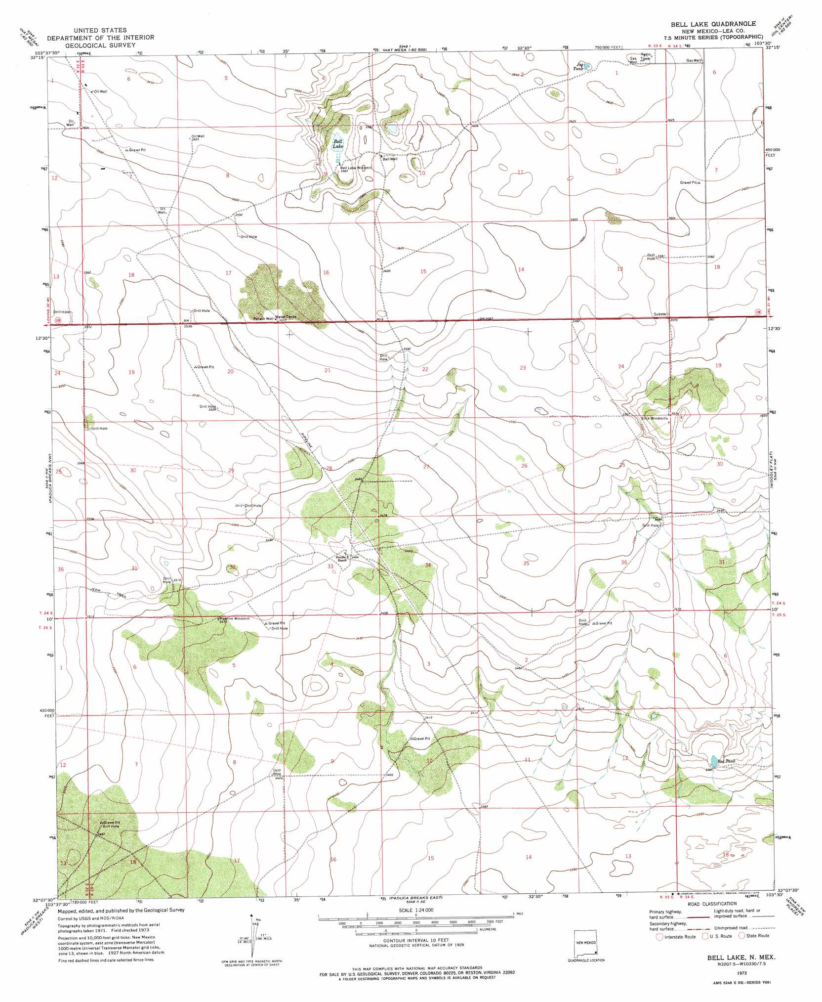
USGS Topo Quad 32103b5 - 1:24,000 scale
| Topo Map Name: | Bell Lake |
| USGS Topo Quad ID: | 32103b5 |
| Print Size: | ca. 21 1/4" wide x 27" high |
| Southeast Coordinates: | 32.125° N latitude / 103.5° W longitude |
| Map Center Coordinates: | 32.1875° N latitude / 103.5625° W longitude |
| U.S. State: | NM |
| Filename: | o32103b5.jpg |
| Download Map JPG Image: | Bell Lake topo map 1:24,000 scale |
| Map Type: | Topographic |
| Topo Series: | 7.5´ |
| Map Scale: | 1:24,000 |
| Source of Map Images: | United States Geological Survey (USGS) |
| Alternate Map Versions: |
Bell Lake NM 1973, updated 1975 Download PDF Buy paper map Bell Lake NM 2010 Download PDF Buy paper map Bell Lake NM 2013 Download PDF Buy paper map Bell Lake NM 2017 Download PDF Buy paper map |
1:24,000 Topo Quads surrounding Bell Lake
Livingston Ridge |
The Divide |
Grama Ridge |
San Simon Ranch |
Oil Center |
Los Medanos |
Bootleg Ridge |
Tip Top Wells |
San Simon Sink |
East Lake |
Big Sinks |
Paduca Breaks Nw |
Bell Lake |
Woodley Flat |
Custer Mountain |
Phatom Banks |
Paduca Breaks West |
Paduca Breaks East |
Andrews Place |
Javelina Basin |
Orla Ne |
Kyle Ranch |
Rudd Draw Ne |
Brunson Ranch |
Cheyenne Draw |
> Back to 32103a1 at 1:100,000 scale
> Back to 32102a1 at 1:250,000 scale
> Back to U.S. Topo Maps home
Bell Lake topo map: Gazetteer
Bell Lake: Lakes
Bell Lake elevation 1088m 3569′Bell Lake: Reservoirs
Jog Tank elevation 1107m 3631′Red Tank elevation 1031m 3382′
Bell Lake: Wells
05059 Water Well elevation 1089m 3572′12714 Water Well elevation 1097m 3599′
12715 Water Well elevation 1081m 3546′
12716 Water Well elevation 1079m 3540′
12717 Water Well elevation 1059m 3474′
13631 Water Well elevation 1057m 3467′
Big Well elevation 1095m 3592′
Bell Lake digital topo map on disk
Buy this Bell Lake topo map showing relief, roads, GPS coordinates and other geographical features, as a high-resolution digital map file on DVD: