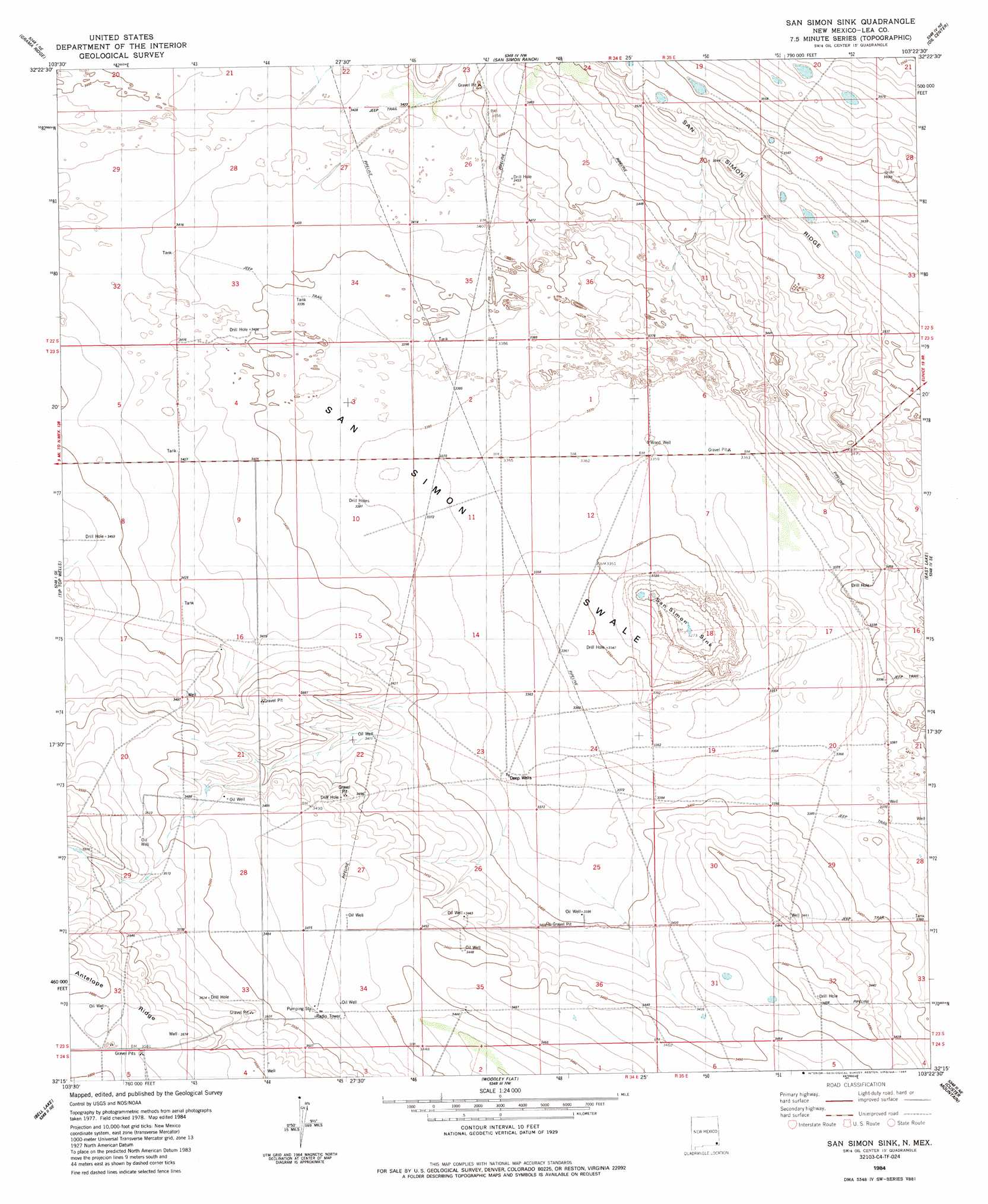
San Simon Sink Topo Map New Mexico
To zoom in, hover over the map of San Simon Sink
USGS Topo Quad 32103c4 - 1:24,000 scale
| Topo Map Name: | San Simon Sink |
| USGS Topo Quad ID: | 32103c4 |
| Print Size: | ca. 21 1/4" wide x 27" high |
| Southeast Coordinates: | 32.25° N latitude / 103.375° W longitude |
| Map Center Coordinates: | 32.3125° N latitude / 103.4375° W longitude |
| U.S. State: | NM |
| Filename: | o32103c4.jpg |
| Download Map JPG Image: | San Simon Sink topo map 1:24,000 scale |
| Map Type: | Topographic |
| Topo Series: | 7.5´ |
| Map Scale: | 1:24,000 |
| Source of Map Images: | United States Geological Survey (USGS) |
| Alternate Map Versions: |
San Simon Sink NM 1984, updated 1984 Download PDF Buy paper map San Simon Sink NM 2010 Download PDF Buy paper map San Simon Sink NM 2013 Download PDF Buy paper map San Simon Sink NM 2017 Download PDF Buy paper map |
1:24,000 Topo Quads surrounding San Simon Sink
Laguna Gatuna |
Lea |
Monument Sw |
Monument South |
Hobbs Sw |
The Divide |
Grama Ridge |
San Simon Ranch |
Oil Center |
Eunice |
Bootleg Ridge |
Tip Top Wells |
San Simon Sink |
East Lake |
Rattlesnake Canyon |
Paduca Breaks Nw |
Bell Lake |
Woodley Flat |
Custer Mountain |
Jal Nw |
Paduca Breaks West |
Paduca Breaks East |
Andrews Place |
Javelina Basin |
Jal |
> Back to 32103a1 at 1:100,000 scale
> Back to 32102a1 at 1:250,000 scale
> Back to U.S. Topo Maps home
San Simon Sink topo map: Gazetteer
San Simon Sink: Basins
San Simon Sink elevation 999m 3277′San Simon Sink: Ridges
San Simon Ridge elevation 1086m 3562′San Simon Sink: Wells
Deep Wells elevation 1029m 3375′Wood Well elevation 1025m 3362′
San Simon Sink digital topo map on disk
Buy this San Simon Sink topo map showing relief, roads, GPS coordinates and other geographical features, as a high-resolution digital map file on DVD: