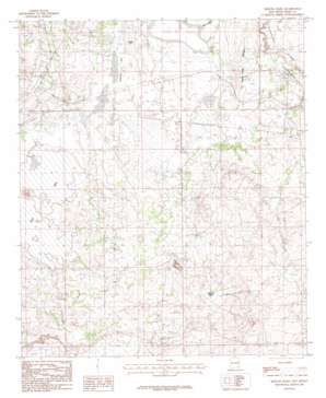
Remuda Basin Topo Map New Mexico
To zoom in, hover over the map of Remuda Basin
USGS Topo Quad 32103c8 - 1:24,000 scale
| Topo Map Name: | Remuda Basin |
| USGS Topo Quad ID: | 32103c8 |
| Print Size: | ca. 21 1/4" wide x 27" high |
| Southeast Coordinates: | 32.25° N latitude / 103.875° W longitude |
| Map Center Coordinates: | 32.3125° N latitude / 103.9375° W longitude |
| U.S. State: | NM |
| Filename: | o32103c8.jpg |
| Download Map JPG Image: | Remuda Basin topo map 1:24,000 scale |
| Map Type: | Topographic |
| Topo Series: | 7.5´ |
| Map Scale: | 1:24,000 |
| Source of Map Images: | United States Geological Survey (USGS) |
| Alternate Map Versions: |
Remuda Basin NM 1985, updated 1985 Download PDF Buy paper map Remuda Basin NM 2010 Download PDF Buy paper map Remuda Basin NM 2013 Download PDF Buy paper map Remuda Basin NM 2017 Download PDF Buy paper map |
1:24,000 Topo Quads surrounding Remuda Basin
> Back to 32103a1 at 1:100,000 scale
> Back to 32102a1 at 1:250,000 scale
> Back to U.S. Topo Maps home
Remuda Basin topo map: Gazetteer
Remuda Basin: Basins
Remuda Basin elevation 937m 3074′Remuda Basin: Flats
Tamarisk Flat elevation 906m 2972′Remuda Basin: Lakes
Lindsey Lake elevation 908m 2979′Salt Lake elevation 899m 2949′
Remuda Basin: Mines
Duval Mine elevation 964m 3162′Hodges Potash Property elevation 909m 2982′
Nash Draw elevation 954m 3129′
Nash Draw Mine elevation 964m 3162′
Salt Lake Mine elevation 900m 2952′
Remuda Basin: Ridges
Forty Niner Ridge elevation 948m 3110′Forty-Niner Ridge elevation 945m 3100′
Remuda Basin: Wells
05116 Water Well elevation 925m 3034′05123 Water Well elevation 921m 3021′
06669 Water Well elevation 921m 3021′
06680 Water Well elevation 921m 3021′
06681 Water Well elevation 921m 3021′
06682 Water Well elevation 964m 3162′
07036 Water Well elevation 1043m 3421′
08607 Water Well elevation 925m 3034′
20002 Water Well elevation 912m 2992′
20003 Water Well elevation 966m 3169′
Indian Well elevation 966m 3169′
J Bar F Well elevation 917m 3008′
Nash Well elevation 909m 2982′
West Well elevation 910m 2985′
Remuda Basin digital topo map on disk
Buy this Remuda Basin topo map showing relief, roads, GPS coordinates and other geographical features, as a high-resolution digital map file on DVD:


