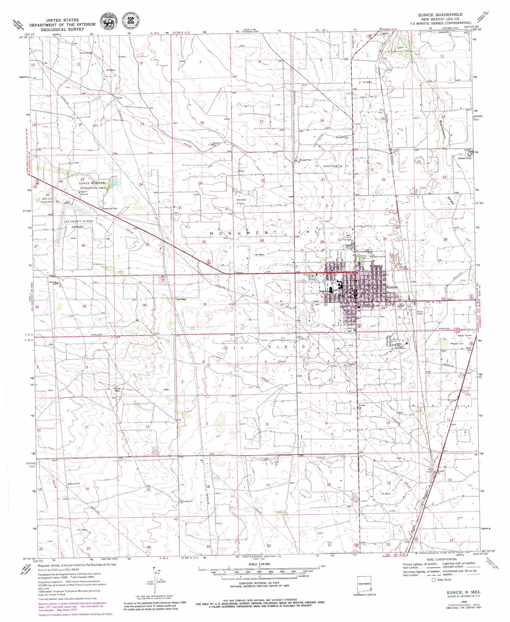
Eunice Topo Map New Mexico
To zoom in, hover over the map of Eunice
USGS Topo Quad 32103d2 - 1:24,000 scale
| Topo Map Name: | Eunice |
| USGS Topo Quad ID: | 32103d2 |
| Print Size: | ca. 21 1/4" wide x 27" high |
| Southeast Coordinates: | 32.375° N latitude / 103.125° W longitude |
| Map Center Coordinates: | 32.4375° N latitude / 103.1875° W longitude |
| U.S. State: | NM |
| Filename: | o32103d2.jpg |
| Download Map JPG Image: | Eunice topo map 1:24,000 scale |
| Map Type: | Topographic |
| Topo Series: | 7.5´ |
| Map Scale: | 1:24,000 |
| Source of Map Images: | United States Geological Survey (USGS) |
| Alternate Map Versions: |
Eunice NM 1969, updated 1972 Download PDF Buy paper map Eunice NM 1969, updated 1980 Download PDF Buy paper map Eunice NM 2010 Download PDF Buy paper map Eunice NM 2013 Download PDF Buy paper map Eunice NM 2017 Download PDF Buy paper map |
1:24,000 Topo Quads surrounding Eunice
Ironhouse Draw |
Monument North |
Hobbs West |
Hobbs East |
Paynes Corner Nw |
Monument Sw |
Monument South |
Hobbs Sw |
Hobbs Se |
Brinson Ranch |
San Simon Ranch |
Oil Center |
Eunice |
Eunice Ne |
Jumbo Hill |
San Simon Sink |
East Lake |
Rattlesnake Canyon |
Eunice Se |
Frankel City Sw |
Woodley Flat |
Custer Mountain |
Jal Nw |
Jal Ne |
Figure Seven Ranch |
> Back to 32103a1 at 1:100,000 scale
> Back to 32102a1 at 1:250,000 scale
> Back to U.S. Topo Maps home
Eunice topo map: Gazetteer
Eunice: Airports
Eunice Airport elevation 1085m 3559′Eunice: Flats
Hardy Flats elevation 1064m 3490′Eunice: Mines
Armstrong and Armstrong elevation 1090m 3576′Eunice: Parks
Eunice Municipal Recreation Area elevation 1077m 3533′Eunice: Populated Places
Eunice elevation 1051m 3448′Jones City elevation 1040m 3412′
Eunice: Post Offices
Eunice Post Office (historical) elevation 1051m 3448′Eunice: Wells
Cobb Well elevation 1066m 3497′Eunice digital topo map on disk
Buy this Eunice topo map showing relief, roads, GPS coordinates and other geographical features, as a high-resolution digital map file on DVD: