San Simon Ranch Topo Map New Mexico
To zoom in, hover over the map of San Simon Ranch
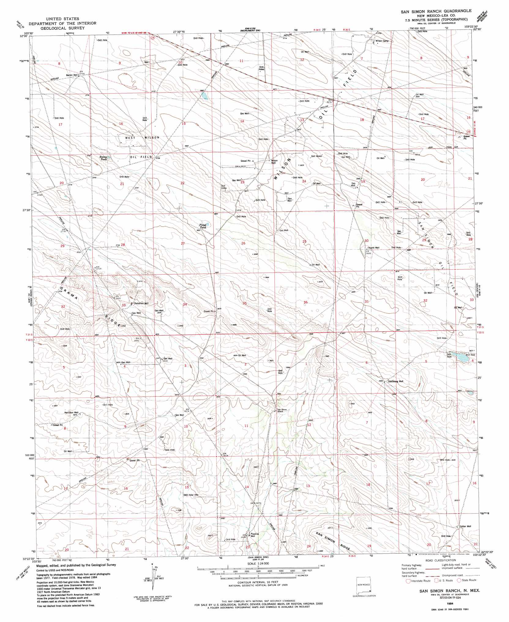
USGS Topo Quad 32103d4 - 1:24,000 scale
| Topo Map Name: | San Simon Ranch |
| USGS Topo Quad ID: | 32103d4 |
| Print Size: | ca. 21 1/4" wide x 27" high |
| Southeast Coordinates: | 32.375° N latitude / 103.375° W longitude |
| Map Center Coordinates: | 32.4375° N latitude / 103.4375° W longitude |
| U.S. State: | NM |
| Filename: | o32103d4.jpg |
| Download Map JPG Image: | San Simon Ranch topo map 1:24,000 scale |
| Map Type: | Topographic |
| Topo Series: | 7.5´ |
| Map Scale: | 1:24,000 |
| Source of Map Images: | United States Geological Survey (USGS) |
| Alternate Map Versions: |
San Simon Ranch NM 1984, updated 1984 Download PDF Buy paper map San Simon Ranch NM 2010 Download PDF Buy paper map San Simon Ranch NM 2013 Download PDF Buy paper map San Simon Ranch NM 2017 Download PDF Buy paper map |
1:24,000 Topo Quads surrounding San Simon Ranch
Laguna Gatuna Nw |
Ironhouse Well |
Ironhouse Draw |
Monument North |
Hobbs West |
Laguna Gatuna |
Lea |
Monument Sw |
Monument South |
Hobbs Sw |
The Divide |
Grama Ridge |
San Simon Ranch |
Oil Center |
Eunice |
Bootleg Ridge |
Tip Top Wells |
San Simon Sink |
East Lake |
Rattlesnake Canyon |
Paduca Breaks Nw |
Bell Lake |
Woodley Flat |
Custer Mountain |
Jal Nw |
> Back to 32103a1 at 1:100,000 scale
> Back to 32102a1 at 1:250,000 scale
> Back to U.S. Topo Maps home
San Simon Ranch topo map: Gazetteer
San Simon Ranch: Lakes
Floyd Lake elevation 1122m 3681′Rainy Lake elevation 1131m 3710′
San Simon Ranch: Oilfields
San Simon Oil Field elevation 1107m 3631′West Wilson Oil Field elevation 1141m 3743′
Wilson Oil Field elevation 1119m 3671′
San Simon Ranch: Wells
Barren Well elevation 1131m 3710′Christmas Well elevation 1111m 3645′
Cotton Well elevation 1072m 3517′
Doodlebug Well elevation 1097m 3599′
Hamilton Well elevation 1090m 3576′
North Well elevation 1101m 3612′
Pipeline Well elevation 1051m 3448′
San Simon Ranch digital topo map on disk
Buy this San Simon Ranch topo map showing relief, roads, GPS coordinates and other geographical features, as a high-resolution digital map file on DVD: