The Divide Topo Map New Mexico
To zoom in, hover over the map of The Divide
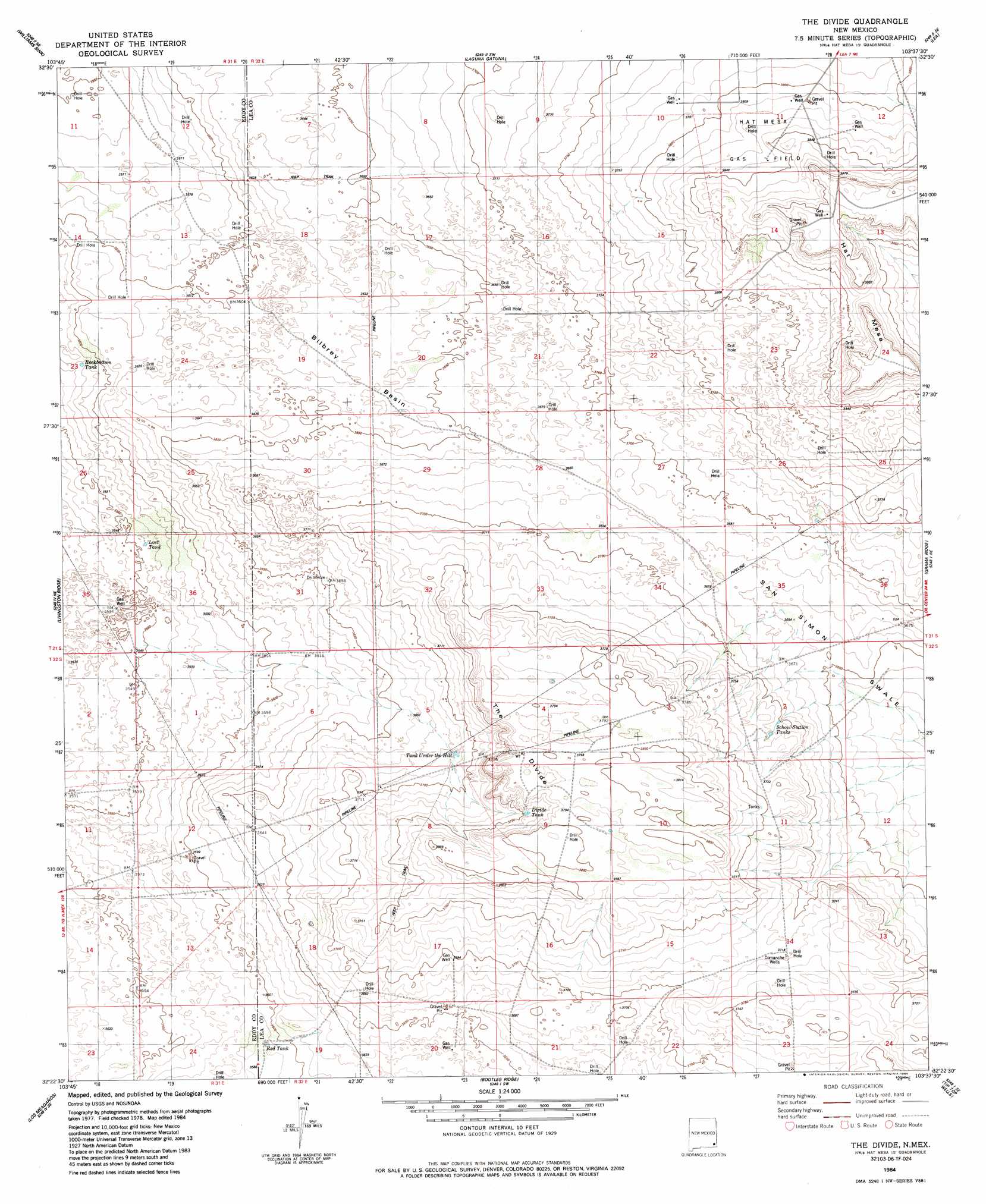
USGS Topo Quad 32103d6 - 1:24,000 scale
| Topo Map Name: | The Divide |
| USGS Topo Quad ID: | 32103d6 |
| Print Size: | ca. 21 1/4" wide x 27" high |
| Southeast Coordinates: | 32.375° N latitude / 103.625° W longitude |
| Map Center Coordinates: | 32.4375° N latitude / 103.6875° W longitude |
| U.S. State: | NM |
| Filename: | o32103d6.jpg |
| Download Map JPG Image: | The Divide topo map 1:24,000 scale |
| Map Type: | Topographic |
| Topo Series: | 7.5´ |
| Map Scale: | 1:24,000 |
| Source of Map Images: | United States Geological Survey (USGS) |
| Alternate Map Versions: |
The Divide NM 1984, updated 1984 Download PDF Buy paper map The Divide NM 2010 Download PDF Buy paper map The Divide NM 2013 Download PDF Buy paper map The Divide NM 2017 Download PDF Buy paper map |
1:24,000 Topo Quads surrounding The Divide
Hackberry Lake |
Greenwood Lake |
Laguna Gatuna Nw |
Ironhouse Well |
Ironhouse Draw |
Tower Hill North |
Williams Sink |
Laguna Gatuna |
Lea |
Monument Sw |
Tower Hill South |
Livingston Ridge |
The Divide |
Grama Ridge |
San Simon Ranch |
Remuda Basin |
Los Medanos |
Bootleg Ridge |
Tip Top Wells |
San Simon Sink |
Pierce Canyon |
Big Sinks |
Paduca Breaks Nw |
Bell Lake |
Woodley Flat |
> Back to 32103a1 at 1:100,000 scale
> Back to 32102a1 at 1:250,000 scale
> Back to U.S. Topo Maps home
The Divide topo map: Gazetteer
The Divide: Basins
Bilbrey Basin elevation 1110m 3641′The Divide: Oilfields
Hat Mesa Gas Field elevation 1174m 3851′The Divide: Reservoirs
Divide Tank elevation 1146m 3759′Lost Tank elevation 1085m 3559′
Red Tank elevation 1093m 3585′
Rockbottom Tank elevation 1091m 3579′
School Section Tanks elevation 1131m 3710′
Under the Hill Tank elevation 1125m 3690′
The Divide: Ridges
The Divide elevation 1156m 3792′The Divide: Summits
Hat Mesa elevation 1194m 3917′The Divide: Wells
Comanche Wells elevation 1134m 3720′The Divide digital topo map on disk
Buy this The Divide topo map showing relief, roads, GPS coordinates and other geographical features, as a high-resolution digital map file on DVD: