Lea Topo Map New Mexico
To zoom in, hover over the map of Lea
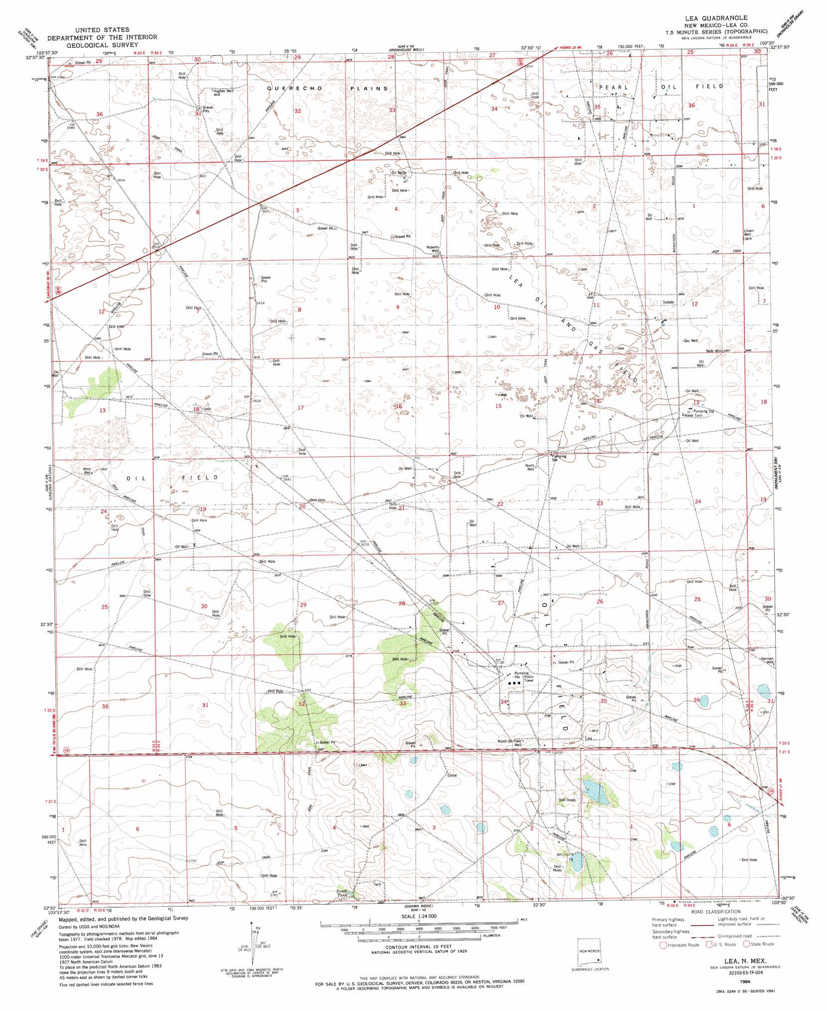
USGS Topo Quad 32103e5 - 1:24,000 scale
| Topo Map Name: | Lea |
| USGS Topo Quad ID: | 32103e5 |
| Print Size: | ca. 21 1/4" wide x 27" high |
| Southeast Coordinates: | 32.5° N latitude / 103.5° W longitude |
| Map Center Coordinates: | 32.5625° N latitude / 103.5625° W longitude |
| U.S. State: | NM |
| Filename: | o32103e5.jpg |
| Download Map JPG Image: | Lea topo map 1:24,000 scale |
| Map Type: | Topographic |
| Topo Series: | 7.5´ |
| Map Scale: | 1:24,000 |
| Source of Map Images: | United States Geological Survey (USGS) |
| Alternate Map Versions: |
Lea NM 1984, updated 1984 Download PDF Buy paper map Lea NM 2010 Download PDF Buy paper map Lea NM 2013 Download PDF Buy paper map Lea NM 2017 Download PDF Buy paper map |
1:24,000 Topo Quads surrounding Lea
Maljamar |
Dog Lake |
Buckeye |
Lovington Sw |
Lovington Se |
Greenwood Lake |
Laguna Gatuna Nw |
Ironhouse Well |
Ironhouse Draw |
Monument North |
Williams Sink |
Laguna Gatuna |
Lea |
Monument Sw |
Monument South |
Livingston Ridge |
The Divide |
Grama Ridge |
San Simon Ranch |
Oil Center |
Los Medanos |
Bootleg Ridge |
Tip Top Wells |
San Simon Sink |
East Lake |
> Back to 32103e1 at 1:100,000 scale
> Back to 32102a1 at 1:250,000 scale
> Back to U.S. Topo Maps home
Lea topo map: Gazetteer
Lea: Oilfields
Lea Oil and Gas Field elevation 1114m 3654′Middle Lynch Oil Field elevation 1128m 3700′
North Lynch Oil Field elevation 1110m 3641′
Lea: Populated Places
Lea elevation 1158m 3799′Lea: Post Offices
Lea Post Office (historical) elevation 1158m 3799′Lea: Reservoirs
South Tank elevation 1156m 3792′Lea: Wells
China Knob Well elevation 1157m 3795′City Service Well elevation 1109m 3638′
Herman Well elevation 1137m 3730′
Hughes Well elevation 1108m 3635′
Linam Well elevation 1122m 3681′
Nate Well elevation 1116m 3661′
North Oil Field Well elevation 1152m 3779′
North Well elevation 1114m 3654′
Roberts Well elevation 1107m 3631′
West Well elevation 1107m 3631′
Lea digital topo map on disk
Buy this Lea topo map showing relief, roads, GPS coordinates and other geographical features, as a high-resolution digital map file on DVD: