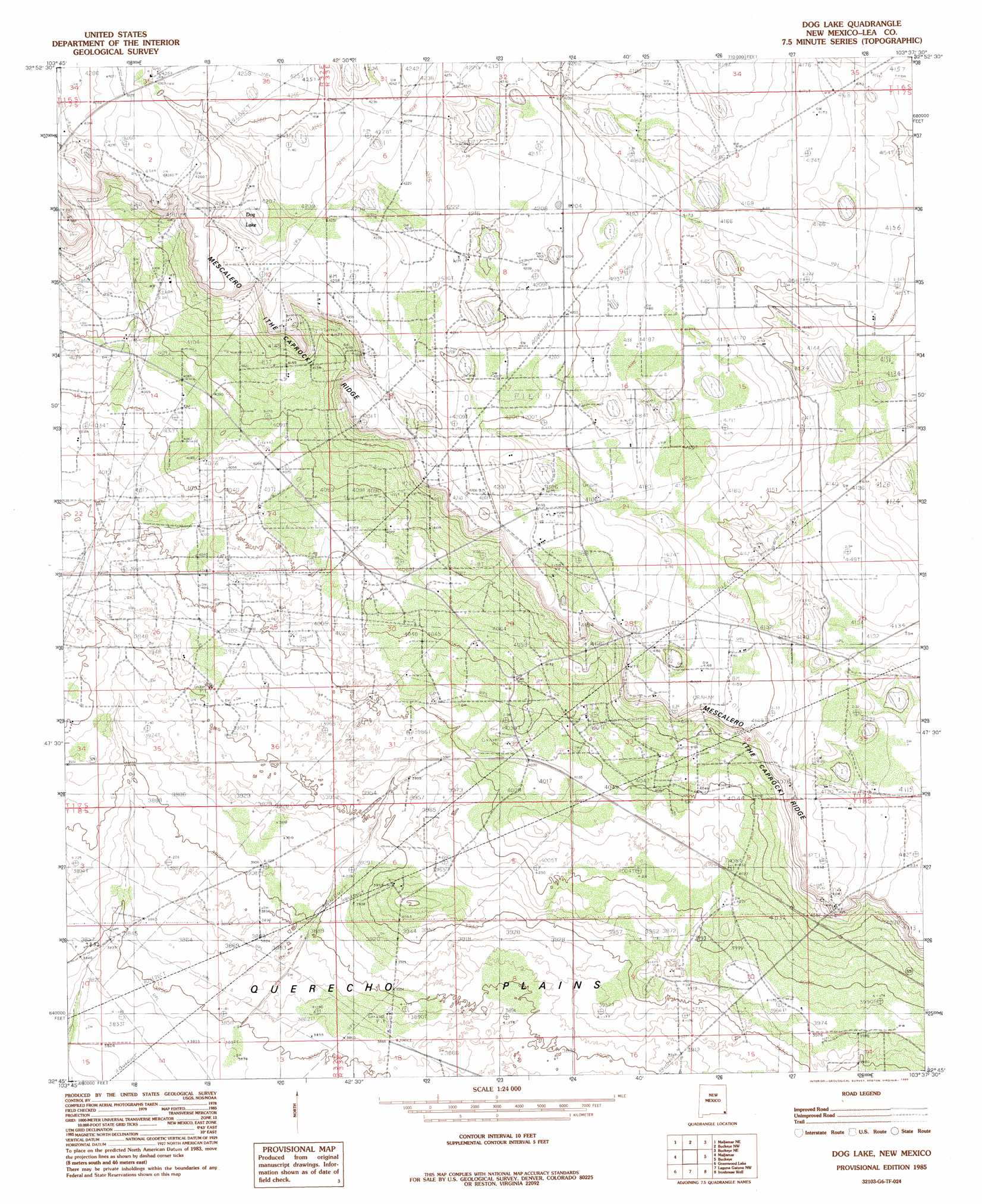
Dog Lake Topo Map New Mexico
To zoom in, hover over the map of Dog Lake
USGS Topo Quad 32103g6 - 1:24,000 scale
| Topo Map Name: | Dog Lake |
| USGS Topo Quad ID: | 32103g6 |
| Print Size: | ca. 21 1/4" wide x 27" high |
| Southeast Coordinates: | 32.75° N latitude / 103.625° W longitude |
| Map Center Coordinates: | 32.8125° N latitude / 103.6875° W longitude |
| U.S. State: | NM |
| Filename: | o32103g6.jpg |
| Download Map JPG Image: | Dog Lake topo map 1:24,000 scale |
| Map Type: | Topographic |
| Topo Series: | 7.5´ |
| Map Scale: | 1:24,000 |
| Source of Map Images: | United States Geological Survey (USGS) |
| Alternate Map Versions: |
Dog Lake NM 1985, updated 1985 Download PDF Buy paper map Dog Lake NM 2010 Download PDF Buy paper map Dog Lake NM 2013 Download PDF Buy paper map Dog Lake NM 2017 Download PDF Buy paper map |
1:24,000 Topo Quads surrounding Dog Lake
Cedar Point |
Cedar Point Se |
Dean Ranch |
Fort Ranch |
Hillburn City Sw |
Henshaw Tank |
Maljamar Ne |
Buckeye Nw |
Buckeye Ne |
Lovington Nw |
Loco Hills |
Maljamar |
Dog Lake |
Buckeye |
Lovington Sw |
Hackberry Lake |
Greenwood Lake |
Laguna Gatuna Nw |
Ironhouse Well |
Ironhouse Draw |
Tower Hill North |
Williams Sink |
Laguna Gatuna |
Lea |
Monument Sw |
> Back to 32103e1 at 1:100,000 scale
> Back to 32102a1 at 1:250,000 scale
> Back to U.S. Topo Maps home
Dog Lake topo map: Gazetteer
Dog Lake: Lakes
White Lake elevation 1254m 4114′Dog Lake: Mines
Caprock Sand and Gravel elevation 1210m 3969′Dog Lake: Oilfields
East Maljamar Oil Field elevation 1275m 4183′Leamex Oil Field elevation 1263m 4143′
Maljamar Oil Field elevation 1242m 4074′
Roberts Oil Field elevation 1291m 4235′
Sannel Oil Field elevation 1276m 4186′
Dog Lake digital topo map on disk
Buy this Dog Lake topo map showing relief, roads, GPS coordinates and other geographical features, as a high-resolution digital map file on DVD: