Cottonwood Hills Topo Map New Mexico
To zoom in, hover over the map of Cottonwood Hills
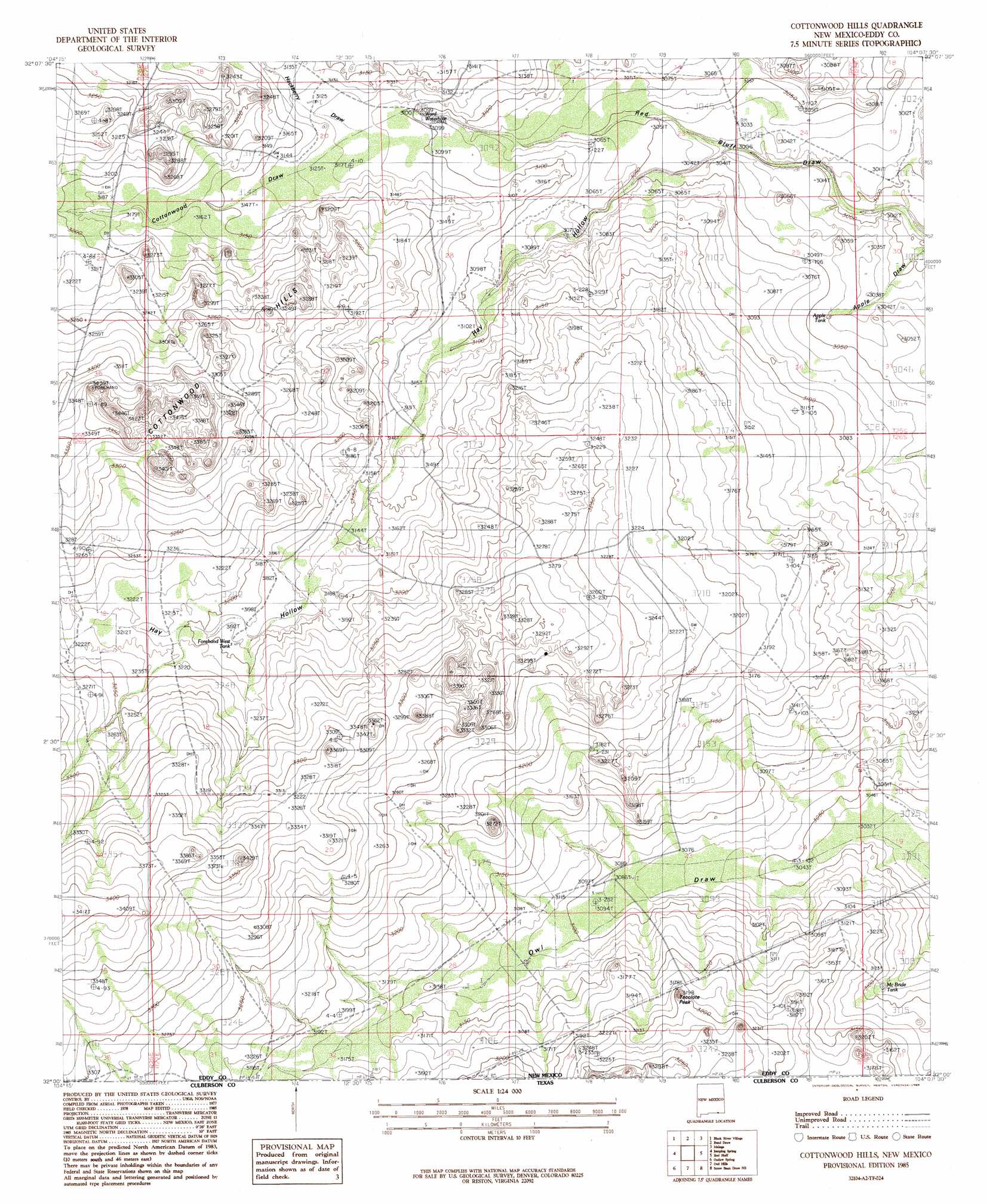
USGS Topo Quad 32104a2 - 1:24,000 scale
| Topo Map Name: | Cottonwood Hills |
| USGS Topo Quad ID: | 32104a2 |
| Print Size: | ca. 21 1/4" wide x 27" high |
| Southeast Coordinates: | 32° N latitude / 104.125° W longitude |
| Map Center Coordinates: | 32.0625° N latitude / 104.1875° W longitude |
| U.S. State: | NM |
| Filename: | o32104a2.jpg |
| Download Map JPG Image: | Cottonwood Hills topo map 1:24,000 scale |
| Map Type: | Topographic |
| Topo Series: | 7.5´ |
| Map Scale: | 1:24,000 |
| Source of Map Images: | United States Geological Survey (USGS) |
| Alternate Map Versions: |
Cottonwood Hills NM 1985, updated 1985 Download PDF Buy paper map Cottonwood Hills NM 2010 Download PDF Buy paper map Cottonwood Hills NM 2013 Download PDF Buy paper map Cottonwood Hills NM 2017 Download PDF Buy paper map |
1:24,000 Topo Quads surrounding Cottonwood Hills
Carnero Peak |
Kitchen Cove |
Otis |
Loving |
Remuda Basin |
Carlsbad Caverns |
Black River Village |
Bond Draw |
Malaga |
Pierce Canyon |
Rattlesnake Spring |
Jumping Spring |
Cottonwood Hills |
Red Bluff |
Ross Ranch |
Alligator Draw |
Outlaw Spring |
Owl Hills |
Screw Bean Draw Ne |
Red Bluff |
Delaware Spring |
Castile Hill |
Screw Bean Draw West |
Screw Bean Draw East |
Orla |
> Back to 32104a1 at 1:100,000 scale
> Back to 32104a1 at 1:250,000 scale
> Back to U.S. Topo Maps home
Cottonwood Hills topo map: Gazetteer
Cottonwood Hills: Ranges
Cottonwood Hills elevation 1034m 3392′Cottonwood Hills: Reservoirs
Apple Tank elevation 927m 3041′McBride Tank elevation 943m 3093′
Ward Waterhole elevation 944m 3097′
Cottonwood Hills: Summits
Tecolote Peak elevation 979m 3211′Cottonwood Hills: Valleys
Apple Draw elevation 912m 2992′Cottonwood Draw elevation 950m 3116′
Hackberry Draw elevation 950m 3116′
Hay Hollow elevation 918m 3011′
Cottonwood Hills: Wells
Forehand West Well elevation 974m 3195′Hobbs Well elevation 935m 3067′
Kelly Polk Well elevation 978m 3208′
Lower Reed Well elevation 933m 3061′
Parisher Well elevation 961m 3152′
Cottonwood Hills digital topo map on disk
Buy this Cottonwood Hills topo map showing relief, roads, GPS coordinates and other geographical features, as a high-resolution digital map file on DVD: